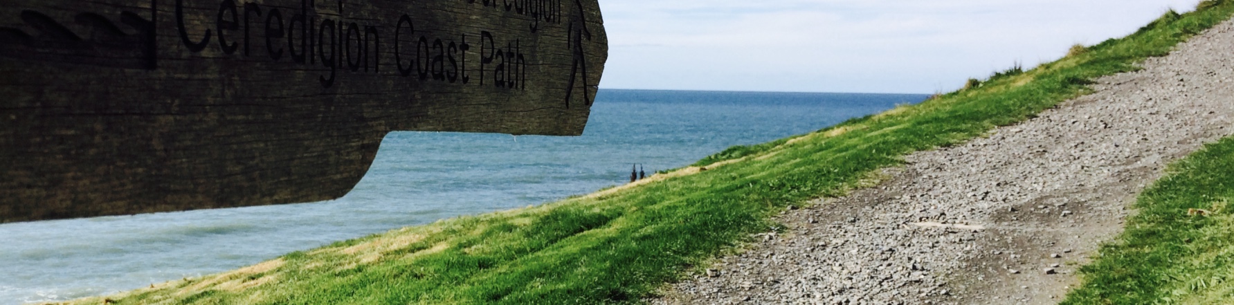
Trees, Waterfalls, Trees, Waterfalls, more Trees, and Skyrim - this walk has it all
March 1, 2017
Happy St. David's Day! For anyone not aware, St. David is the patron Saint of Wales, and so his Saint's Day - March 1st - is basically the day Wales celebrates its national day. That said, although I asked around Aberdyfi, no one seemed to be able to point me in the direction of a celebration.
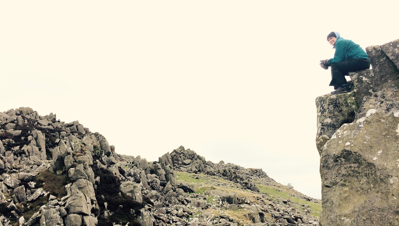
Argionian blood-wine, please
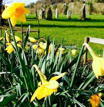
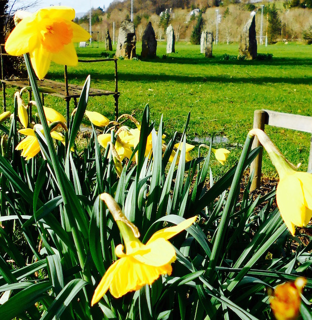
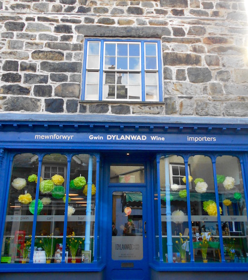
Although fairly certain there was a parade at some point in Aberystwyth, I instead wheedled P to stop studying and to take me back to Dolgellau. Now, there were definitely going to be small shop windows decorated with the Welsh dragon and the symbol of Wales - the daffodil - but I have to admit that some part of me really wanted to go to Dolgellau because the town reminds me of Skyrim. I doubt there's a whole lot of overlap between the outdoorsy—type-people who might read this and people who would be able to tell you where Winterhold is in Skyrim - so if my saying that there's nothing I'd like more than to be made a Thane in Dolgellau and allowed to buy a house there, so that I can build an Alchemy table and chop up some Luna Moths Wings while enjoying views over the Mawddach estuary and Cadair Idris, just feel free to ignore me. (hint: it's a video game that used to be the only reason I even owned a television)
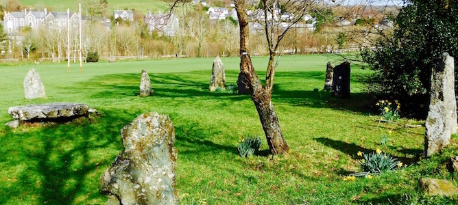
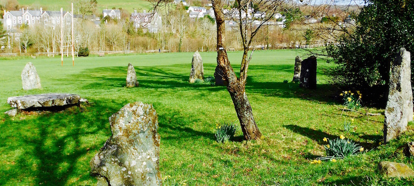
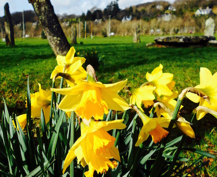
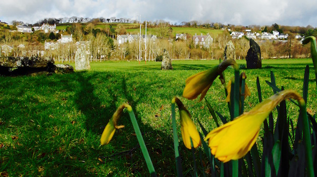
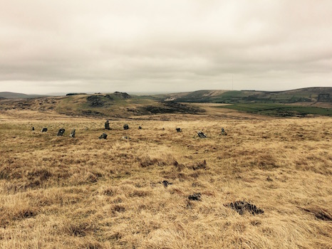
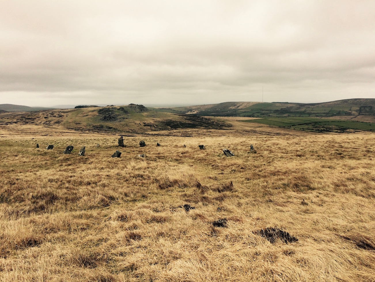
Also, I'm sorry, but in Dolgellau there's also the stone circle that's practically set in the middle of a rugby pitch that we found when we came to hike the Mawddach Trail. And I couldn't think of anything more Welsh than stone circles and rugby. Until we got there - and the stone circle was itself encircled by daffodils.
Daffodils? Check. Ancient stone circle? Check. Rugby Pitch? Check. Dragon? Probably. Leeks? Umm. . .
If only there'd been a dragon and a leek (did I mention the other symbol of Wales is a leek? You know where else there are lots of leeks and dragons? That's right, Skyrim.) we would have had everything.
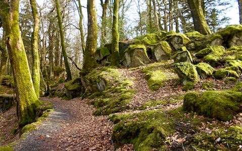
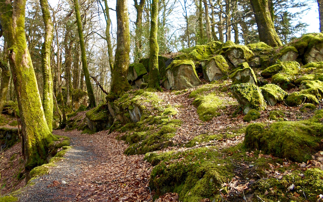
Off to the Torrent Walk
After wandering aimlessly through the streets of Winterhold for a little while, and seeing some cutely decorated shops and lots and lots of daffodils, we decided it was time for a walk, since it was lovely out.
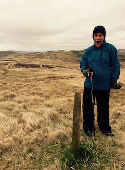
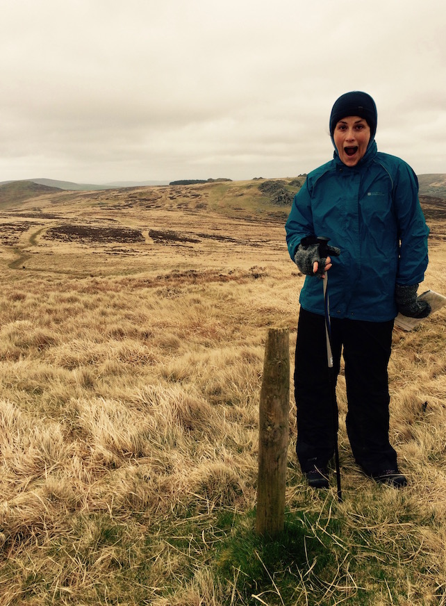
Oh you meant that signpost. Ok.
Did I say Winterhold? Of course I mean Dolgellau.
It occurred to me that my Rough Guide had suggested several walks in the area - we'd already done the Panorama Walk and the Mawddach Trail (even if it had been largely in the dark) and that there was a third it suggested - the Torrent Walk.
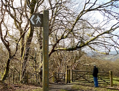
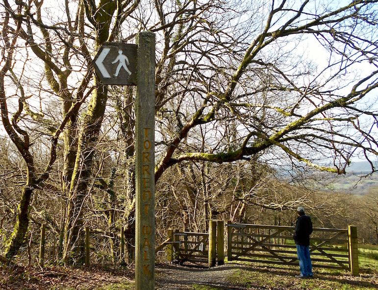
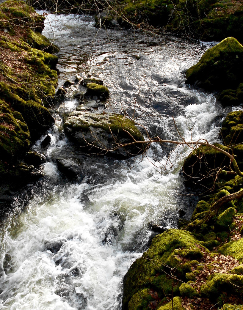
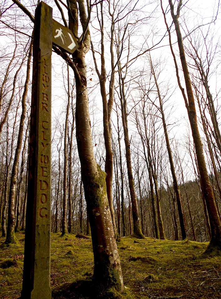
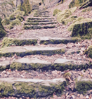
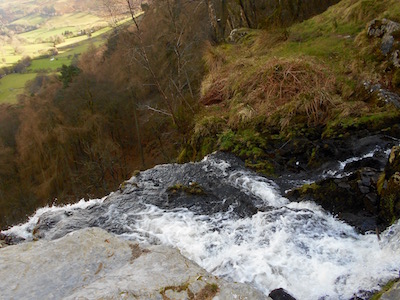
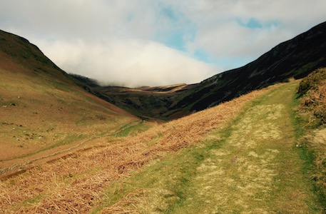
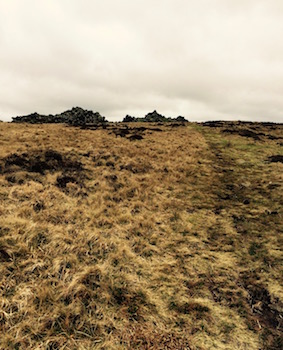
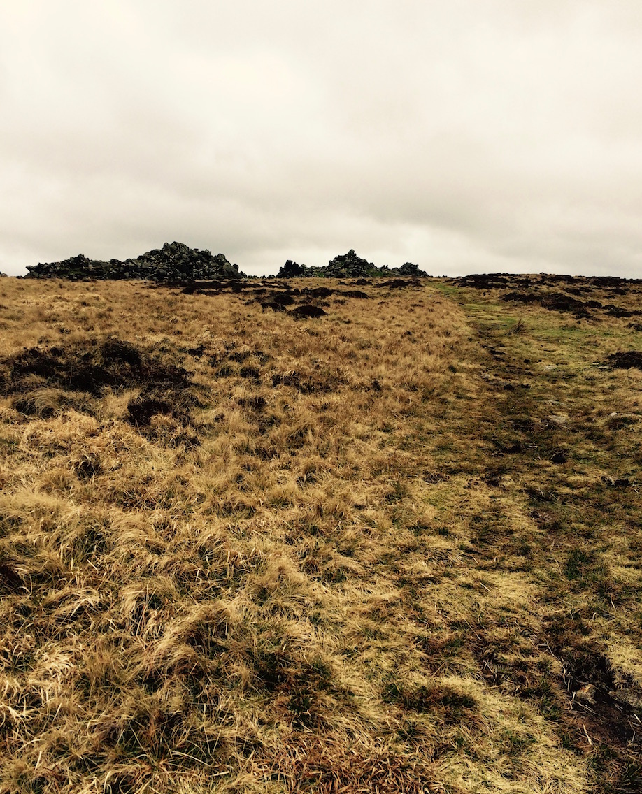
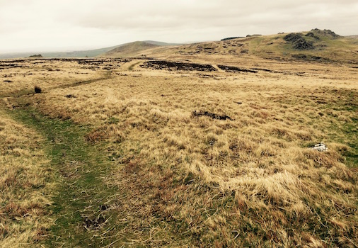
Torrent 1 of 50
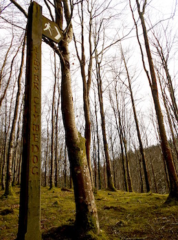
As per usual, it was difficult to tell where, exactly, the Rough Guide meant to say the walk started - as the directions it gave said 'three miles east' in a way that could have meant three miles east of Dolgellau, or else three miles east on the B4416 that the walk was on. So, of course we drove right past the entrance trying to go three miles on the B4416 - a road that is much less than 3 miles long. It turns out there's a great big signpost - but driving by it's hard to see the vertical lettering on it. Regardless, the area was so lovely neither P nor I were terribly concerned that we had to drive aimlessly through it and then back again. I once again started asking if this was really too far from Aberystwyth for us to commute from.
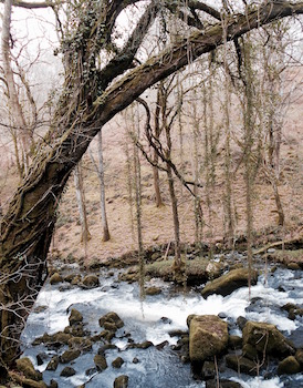
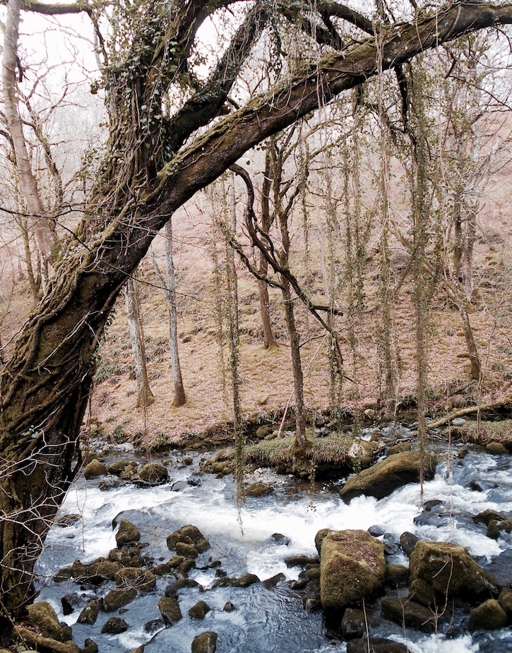
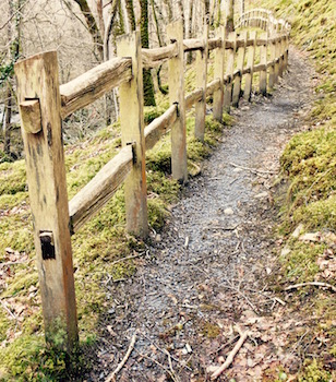
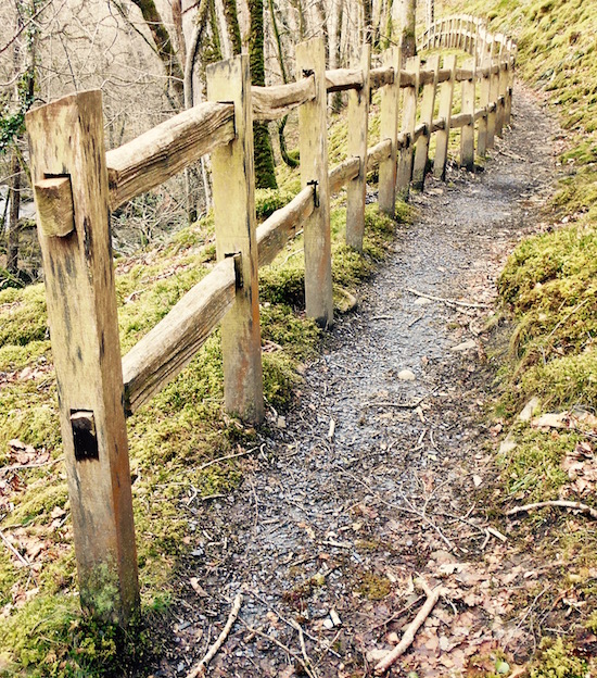
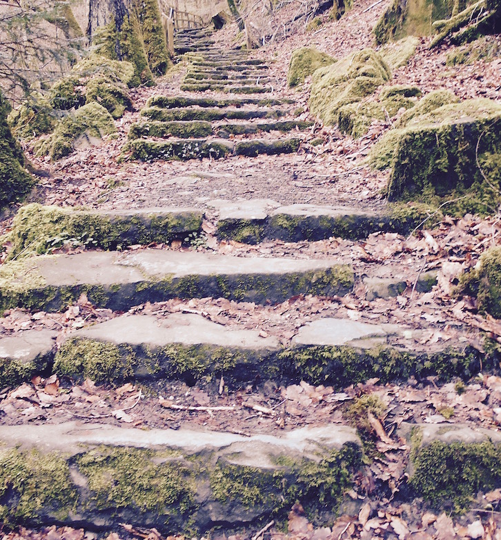
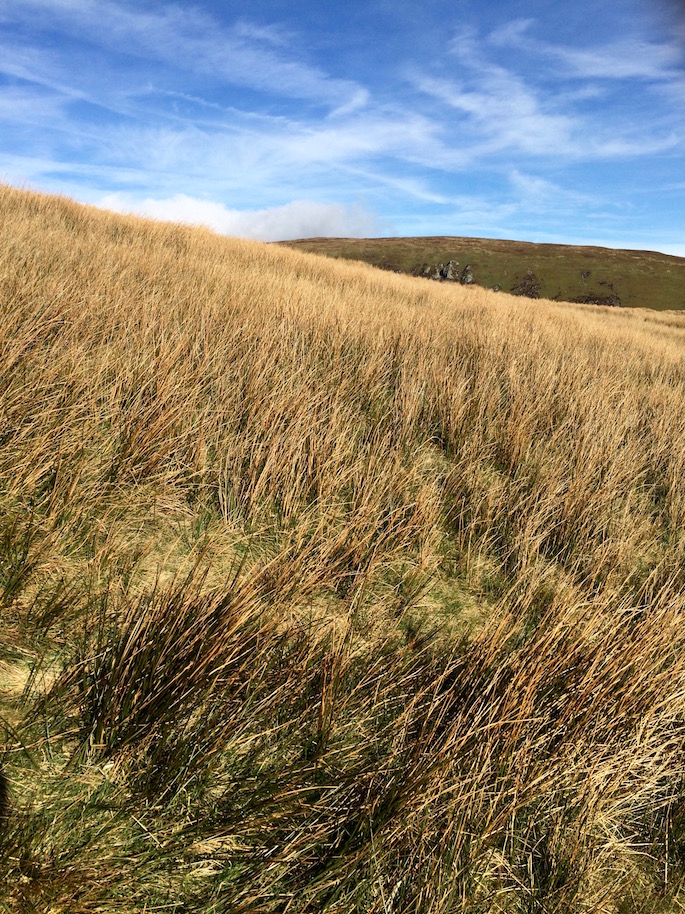
Anyway, after a bit of meandering driving, we pulled off and parked along the side of the road - far closer to the A470 than we'd realized. The trail basically goes down one side of the Clywedog river and then back up the other. As we started out, it soon became obvious that everything was a bit squishy from all the recent rain, but the trail was actually pretty well maintained.
Torrent 26
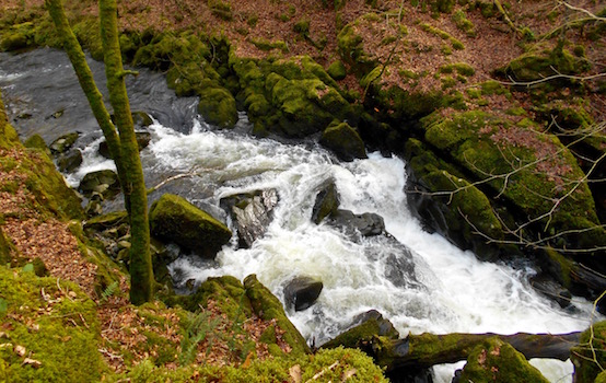
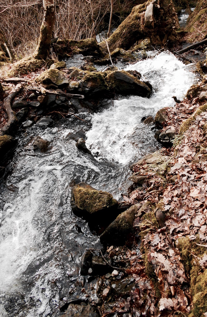
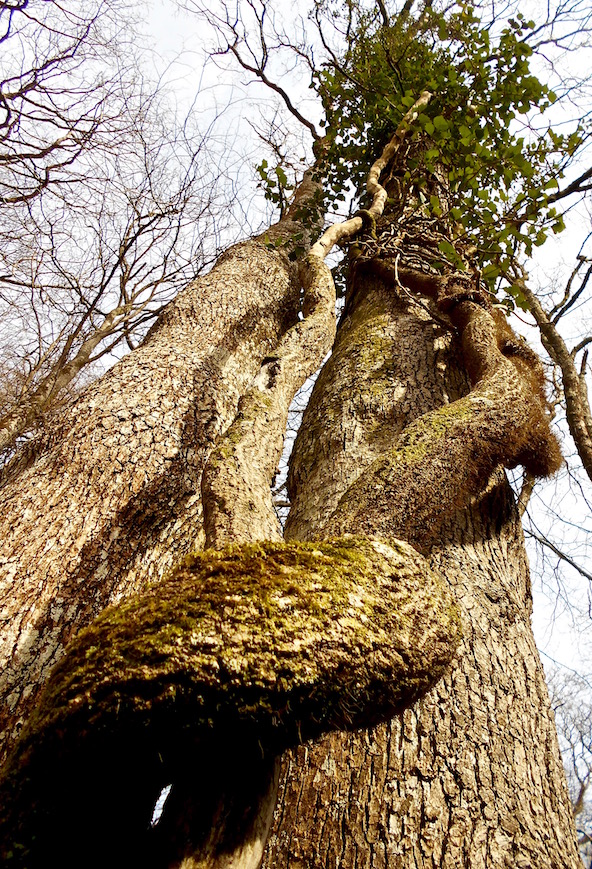
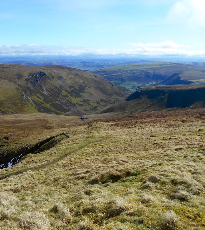
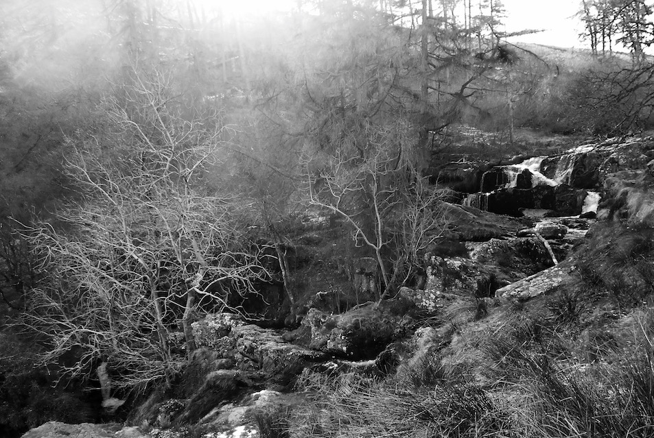
That said, when I say the trail goes down the Clywedog - that actually doesn't mean you walk close to the river - you're really walking tens of meters higher than the river - along either a cliff or at times a very steep embankment. That can make slippery conditions a bit nerve-wracking if you have a fear of heights, but all in all it's a perfectly pleasant walk.
Like my recent trip to the Dyfi Forest at Tan-y-Coed, the floor of the forest was covered in new green leaves. Also like Tan-y-Coed whatever the plant was hadn't flowered yet - but when it does it will definitely be beautiful (which reminded me that I need to make sure I go see the bluebells!).
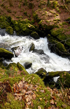
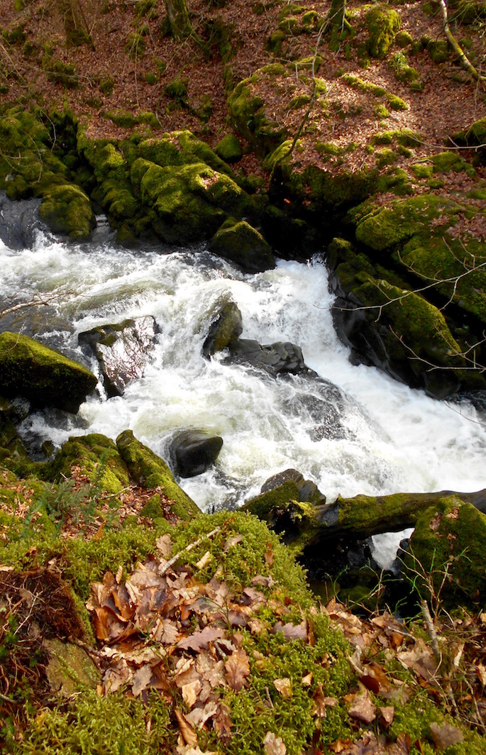
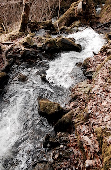
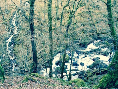
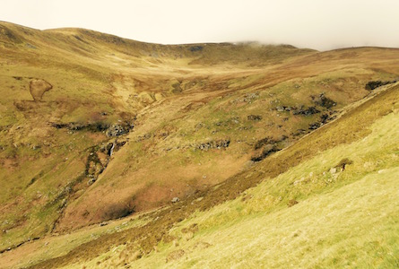
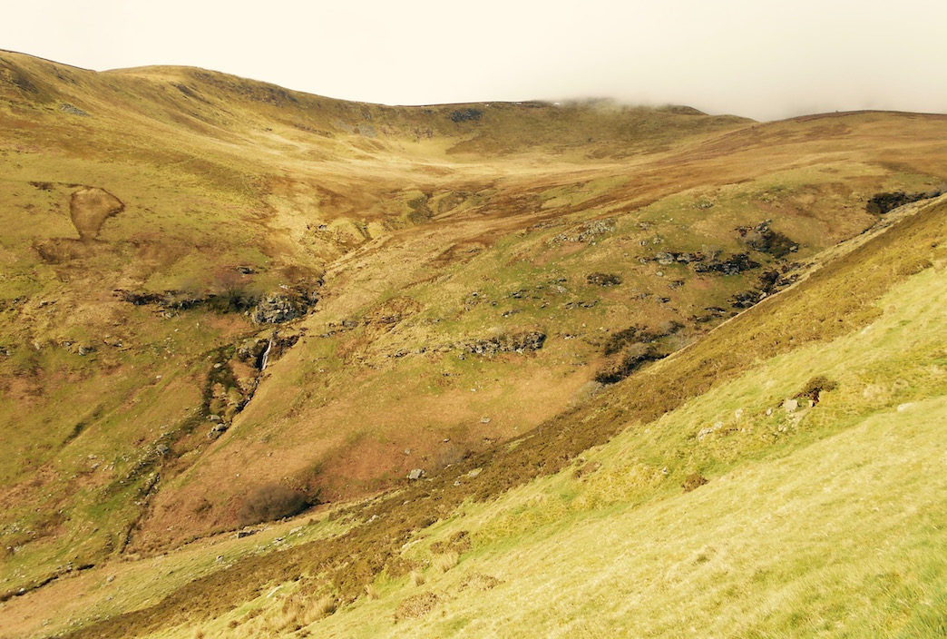
So many torrents
Back in the bayou
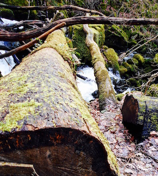
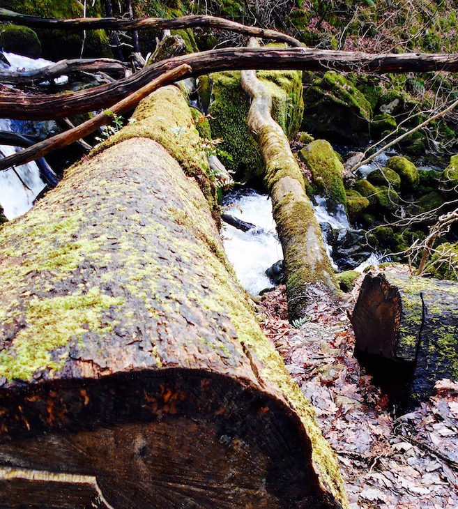
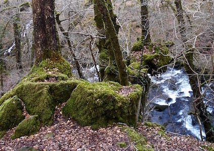
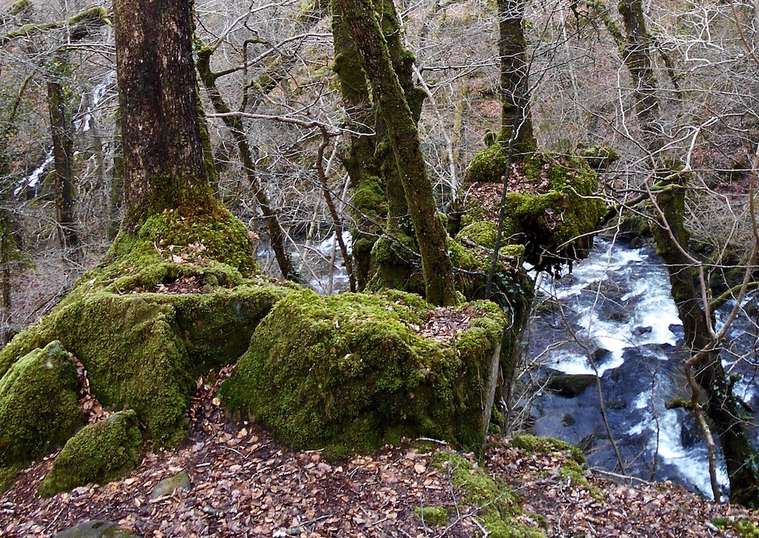
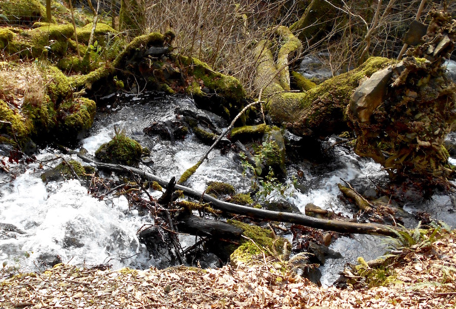
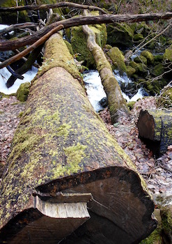
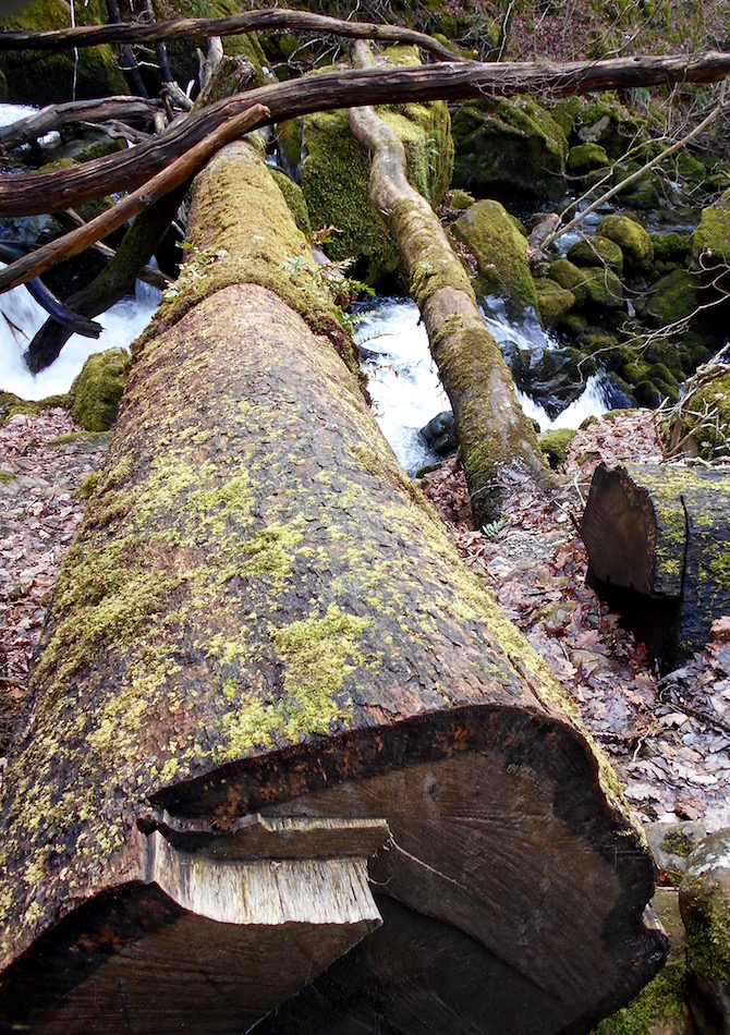
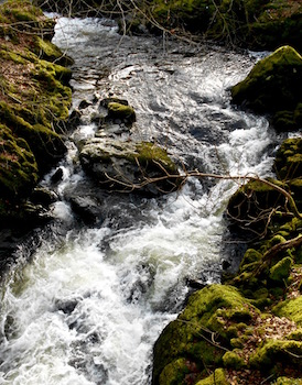
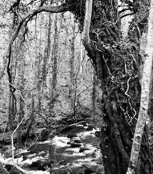
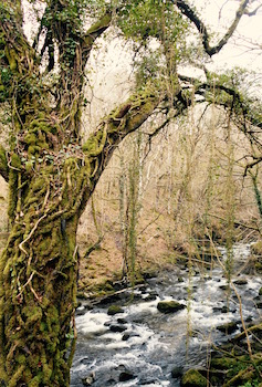
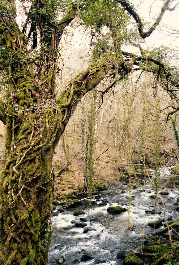
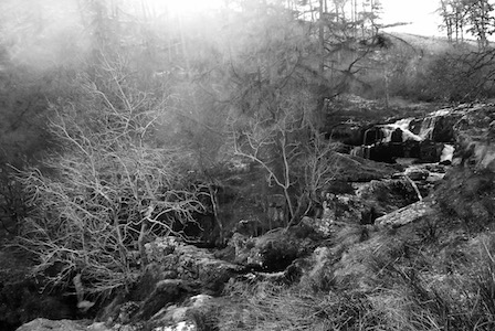
But mostly the walk taught me that the Torrent Walk is aptly named. Along the walk the Clywedog twists and turns and crashes over various waterfalls and rapids, and is fed by minor tributaries all along the steep valley it cuts through. In places giant trees that have been pulled up by the roots came to a rest across the river and the water crashes through them, in others there are clear pools of water emptying serenely into wide slow flows.
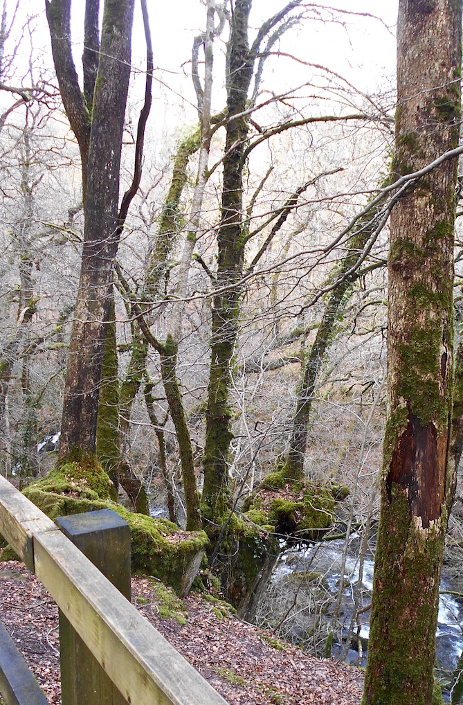
When you get to the bottom of the trail it hits a road that passes between two old stone buildings. One was an old mill that sits serenely next to the river, with lovely north-eastern hill views towards Bala. Both were very charming.
Crossing the bridge between them, and over the river, we made our way back up the east side of the river - where P noted that the ferns looked like Nirnroot. But of course this isn't Skyrim, and they weren't ringing. They were ferns.
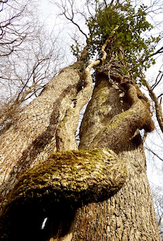
Maybe it hasn't noticed there's nothing below it yet
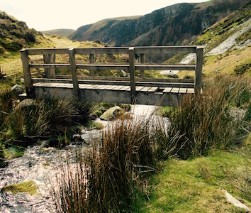
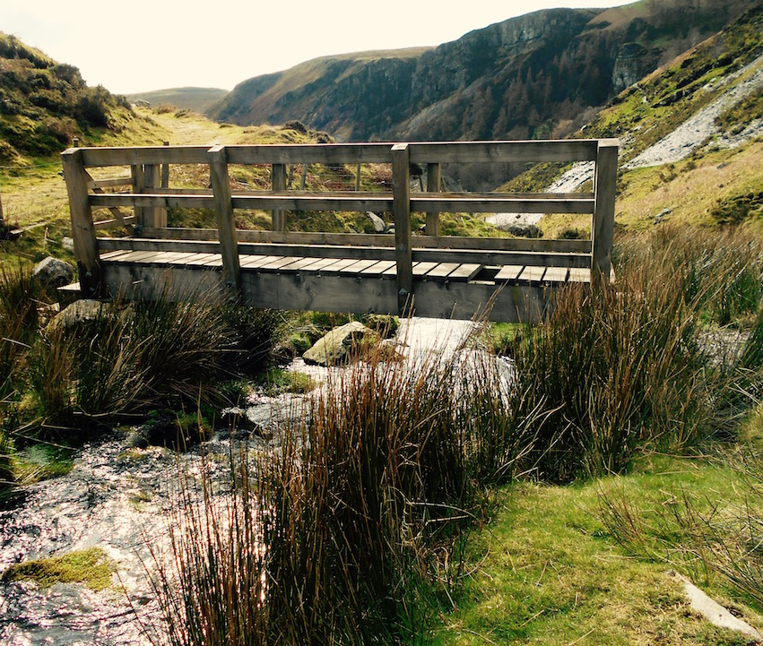
The walk back was inclined but not dramatically, and the path was interspersed with bridges, wooden steps and fallen trees here and there. At a particularly precipitous point, there was one tree that seemed to have a particular problem - it's existence as a tree was rather confusing, as it appeared to be growing out of nothing and floating a hundred feet over the river with nothing but air below it.
Sure, this might not be Skyrim - but I can assure you there was actually a magical floating tree on the Torrent Walk. Even without it, however, this was a completely charming hour long hike, and I'm sure will be only made more beautiful once spring comes and the trees and flowers are in bloom.
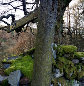
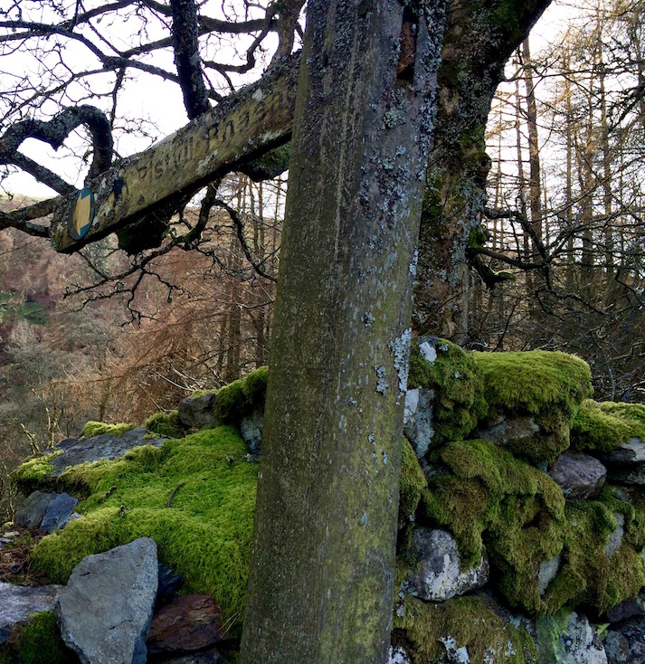
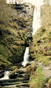
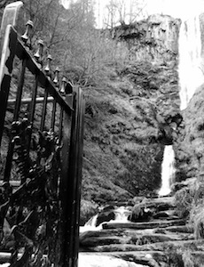
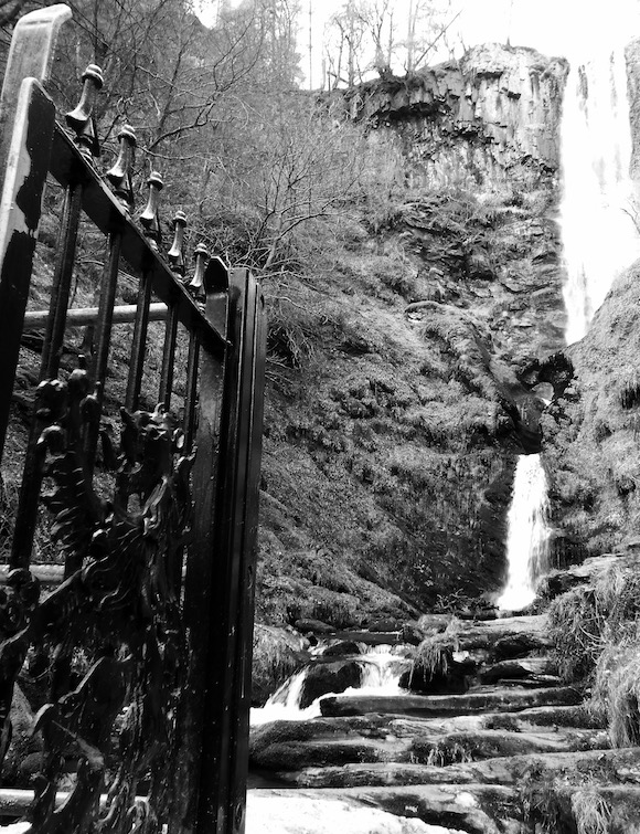
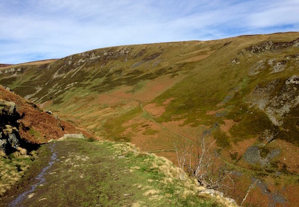
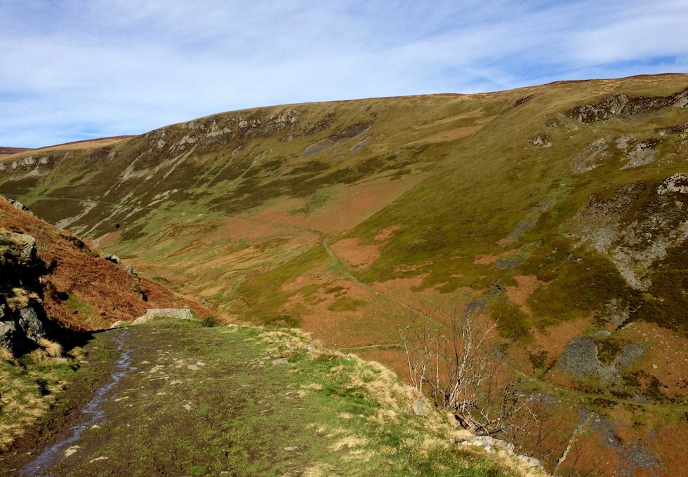
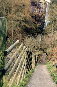
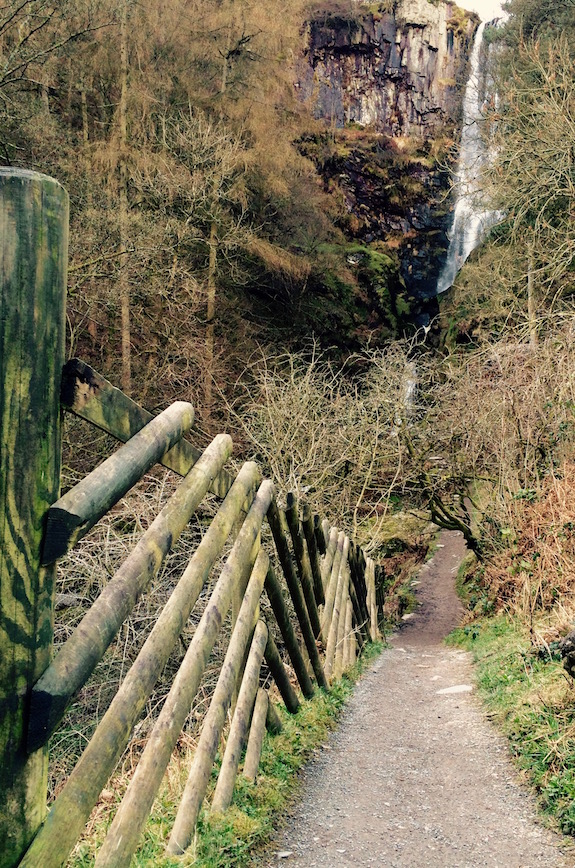
I'd been wanting to get to Pistyll Rhaedr (Rhaeder Falls) for a while. Having been in the general area on our less than satisfactory trip to Bala in January, I'd run across an entry in my Hay-on-Wye 1938 guidebook describing them not only as the highest falls in Wales, but also one of the best settings in North Wales as well.
Rhaeder Falls, slowly I turn
Testament to how much things have changed since 1938 - I didn't have to hire a guide from a town 5 miles away in order to get to the falls. Although set in what's considered the 'remote' Berwyn mountains in eastern Wales, enough people have apparently driven to the falls in the last 80 years that there's a road, albeit one way, and even camping and a lovely old tea room right at the base of the falls.
The Berwyn Mountains
I put remote in quotes above because every guidebook and signpost in the area describe the Berwyn's as 'little explored' or 'oft-neglected' or 'remote'. I'm sorry, but I'm really having a hard time understanding how this comes about when (as this is an hour and a half east of Aberdyfi), this mountain range can't be more than 2 hours drive outside of major urban areas.
Nonetheless, remote they were. The falls themselves, which you practically can drive up to at this point, have a steady stream of tourists, even in early March - although it was admittedly a beautiful day. High as Niagara Falls, and in a lovely setting, I could see why.
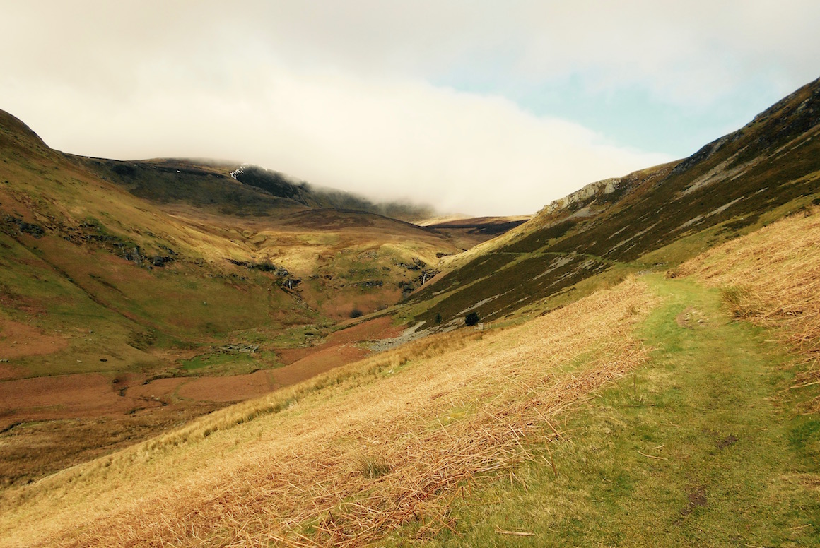
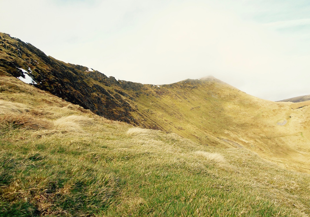
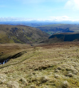
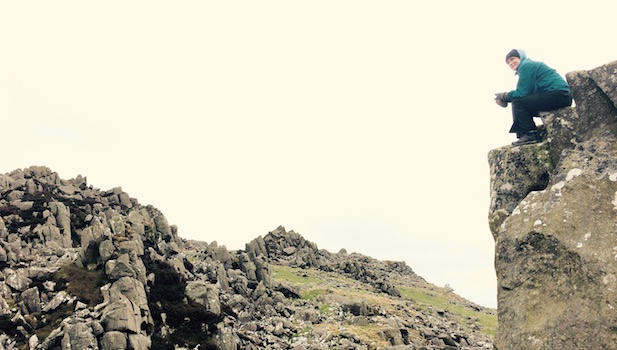
However, within five minutes of having set off on the path that wasn't used to get to the falls - but rather would take more toward the top of twin peaks 827m Moel Sych and 830m Cadair Berwyn - I stopped seeing any other people. In fact, the next people I ran into were four hours later, when I returned via the route that passes the top of the falls.
Well that looks like a giant fog cloud
In the intervening period, of course, I had come close enough to falling off a cliff that I had almost kind of wished there had been someone around.
Sun, fog, mist, rain and wind, all in one
Since my border hike is planned to start in mid-May, I thought it would behoove me to actually start hiking with my camping gear, or at least my larger pack, just to get used to it. I've learned some things from this. First, was a great idea, even if my shoulders hurt a bit after. The pack certainly wasn't as heavy as it will be, but it was good to know it didn't kill me, even when trying to climb the highest mountains in the Berwyn range.
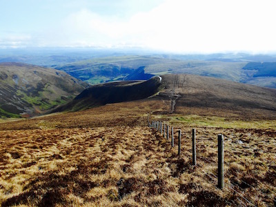
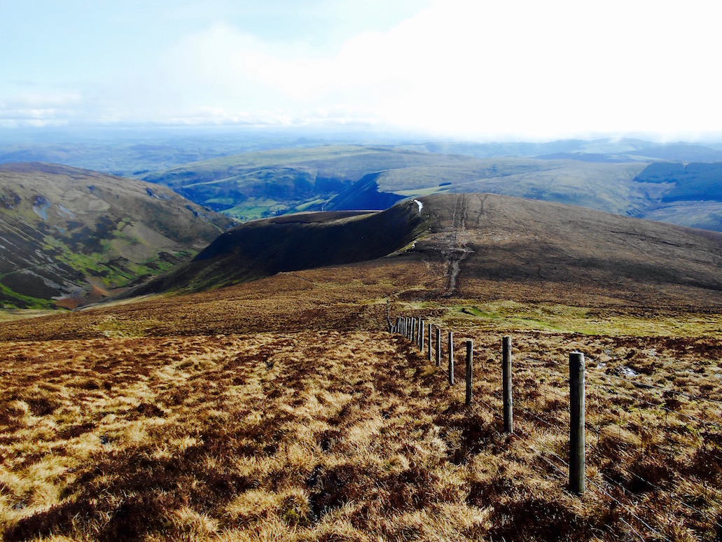
Moel Sych peak route
Second, I unfortunately learned I need to get a new backpack. I knew it would happen eventually, but I found that the all important lower strap hook is starting to snap, as is one of the catches for the top of the bag. Also, the inner lining is coming apart so everything I put in it comes out with little black pieces of plastic lining all over it.
Third, and most importantly, I learned how much it can feel like you're going to be torn off a mountain top, and are entirely unable to walk straight, when you're wearing a large pack and there's a wind up. And I remembered exactly how disconcerting that can be.
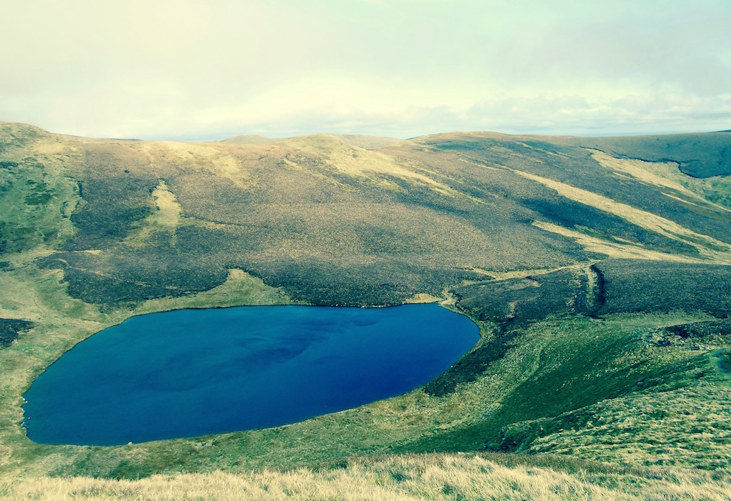
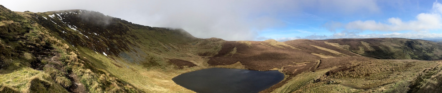
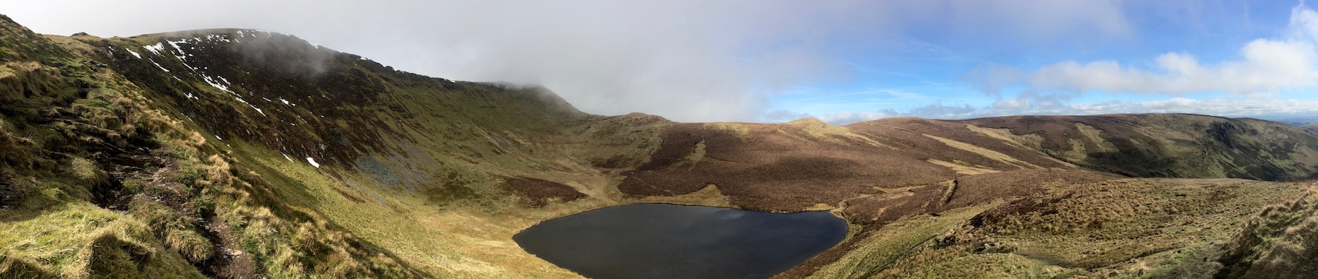
Llyn Lluncaws
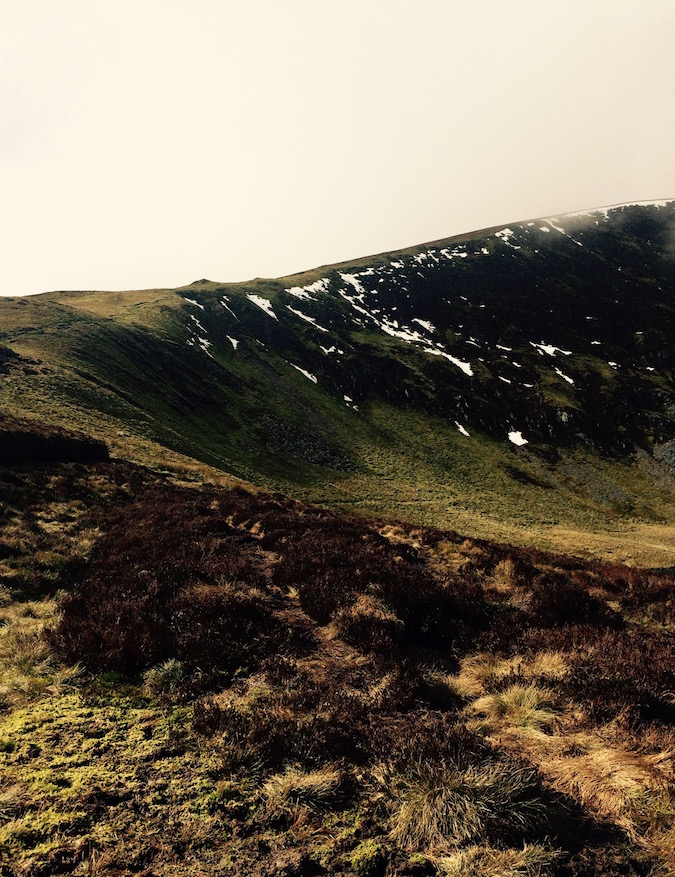
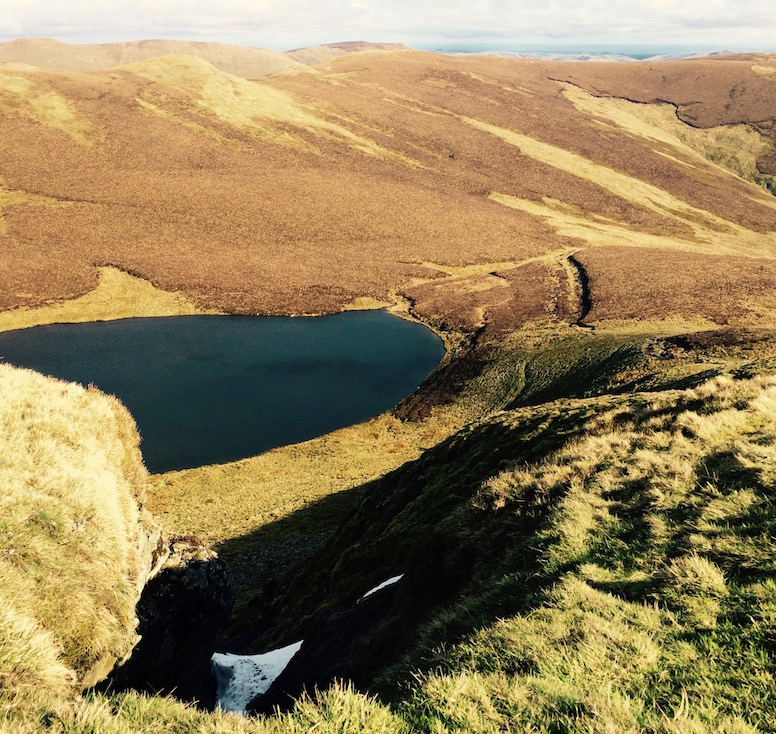
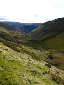
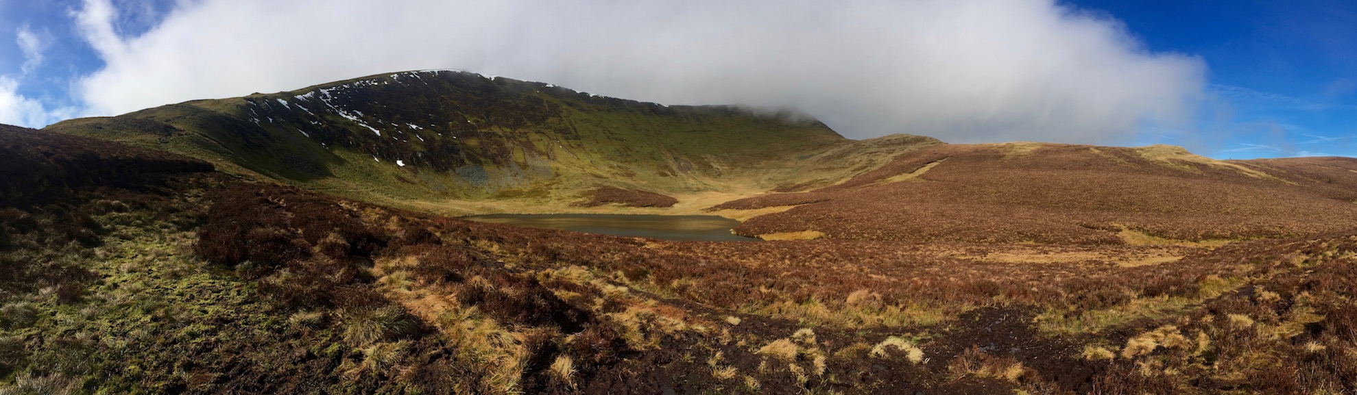
Basically, the day was sunny, but the wind was blowing from the west, and fog was billowing rapidly over the mountain top. It was really scenic to watch the fog retreat somewhat as I approached from the mildly sloping path along a valley from the south east. That first part of the trail was a long slog, but if anything the main trouble was that I was too warm. Which was one of those situations that felt weird because you could see there was still snow on top of the mountain.
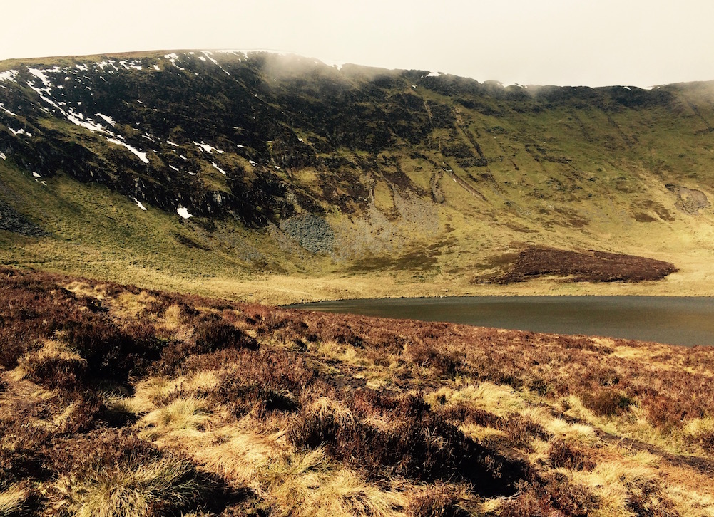
When I got to Llyn Lluncaws, the lake at the base of the mountain's peak, the trail that followed the cliff's edge around the lake got much steeper, it got colder as I was now under the layer of fog so there was less sun, and, most importantly, it got windier. Because the mountain had been blocking the wind previously, I hadn't been able to tell - but now that I was climbing on the exposed face of the mountain, it was getting progressively breezier.
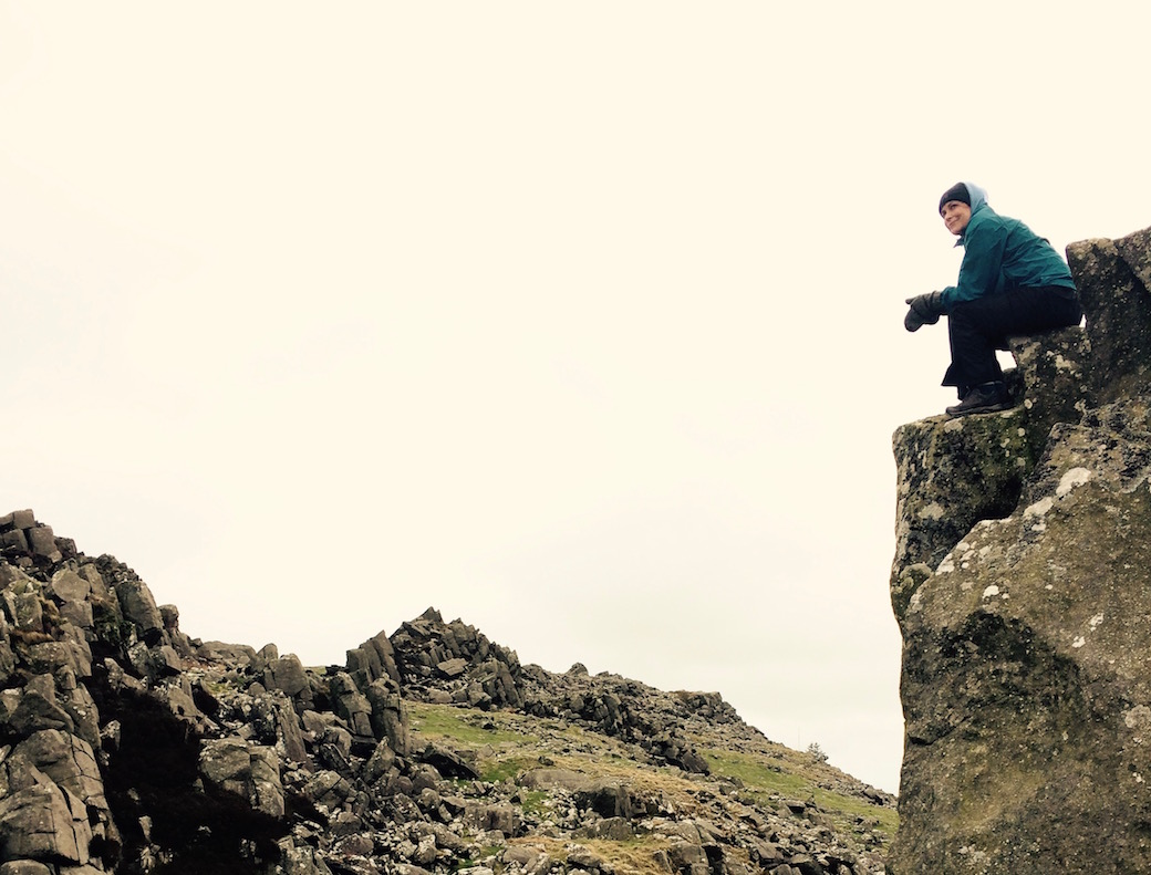
Yes, very nice. However I don't want to fall into this beautiful scene.
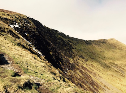
That in itself would have been manageable except for one thing - the wind was coming out of the west to my left, and the trail climbed directly along the overhang above the lake now to my east. That meant that the wind was pushing me and my giant sail of a backpack in the direction I least wanted to go - off the path and over the cliff into the 1000 ft drop immediately to my right.
On an extremely steep, wet, slippery path, this wasn't the best situation. I tried to get as low as I could and make myself aerodynamic enough to climb that way. It worked somewhat, but I was in such a weird position that I got worried I was just going to trip over my own feet and fall off the cliff anyway. I tried to retreat further away from the cliff, just climbing the mountain away from the path. This also worked for a while, but the grass was so hillocky I got worried I was going to break an ankle.
Really wish this edge was a bit farther away
I was now stopping every ten meters or so just to reassess where I thought I was, and how much farther I had to go until I got to the top of the mountain. The wind had gotten worse, and now I was actually in the fog so there was less visibility.
At one stop, I silently asked myself how necessary I really thought it was to reach the actual top of this mountain. I then compared that to how much I really didn't want to very quickly reach the bottom of this mountain at a tremendous speed. I decided the latter desire was definitely stronger than the former, and I decided to go back down.
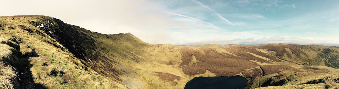
Close enough
The Long Way Down
From what I could figure, I probably made it to about 790 or 800 meters - i.e. 30 or 40 meters from the top. While a lot of people might be disappointed and feel like they were giving up, I actually have a tendency to celebrate moments like this - possibly as much as reaching the top. I've been accused in the past of having a lack of common sense with respect to my personal safety in the outdoors, so I always feel like I'm thumbing my nose at people when I successfully give in and show some good judgment.
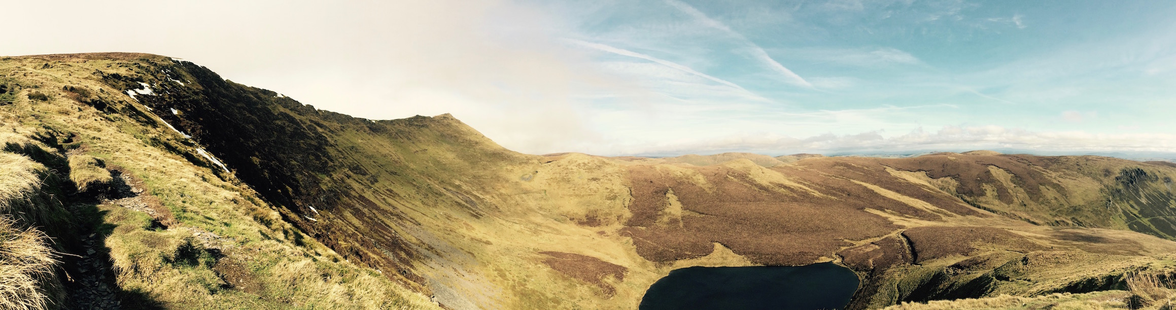
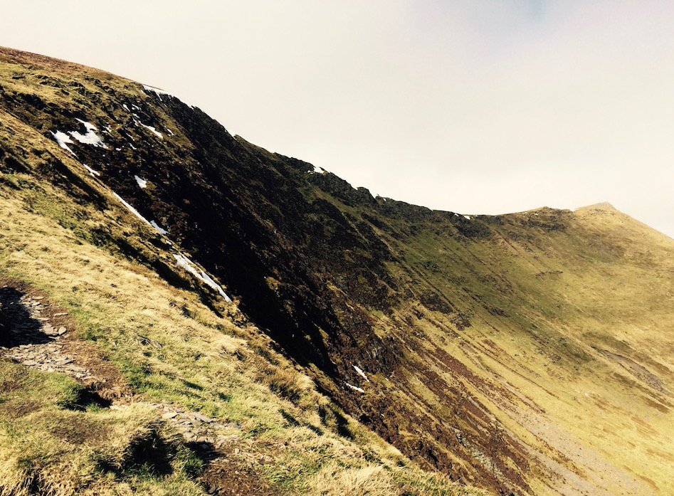
So thinking to myself 'I'll show you!' and laughing silently, I started down a ridge that would eventually lead back toward the top of the waterfall. Having walked up a long valley path, I'd thought the return route downhill along the ridge would be much easier. Well it was and it wasn't.
Sure, it looks nice now. Try it with sideways wind.
First, when I turned around I definitely wasn't on a path anymore. There was one path that led to the top of the mountain along the cliff, and another that led back down along the ridge, a bit more to the west. Having left the cliff path and started back down, I was trying my best to head toward the other path, but now that I looked around, it looked like this might be one of those situations I'd learned about at Plas-y-Brenin - i.e. where the path on the map didn't exist and might be just right of way.
That would have been fine - since this was Open Access Land so I could walk where I pleased - except for the several other problems. Mainly, that the ridge was even windier than the mountain top had been, the ground was hillocky and intermingled with soaking wet stretches of deep mud and intermittent holes possibly from the former lead mining that used to take place in the region, and, as a ridge, the way I was walking still had a cliff towards which the wind seemed intent on dragging me.
OK. Time to go home.
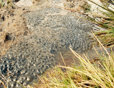
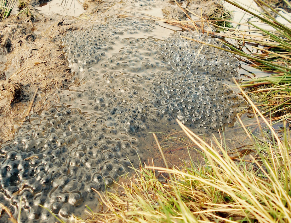
Pushing me at an oblique angle from my right, the wind was violently trying to tear my backpack off of my shoulder. Failing that, it was making it impossible to walk straight. I switched my walking stick to my left hand to try to have something to push off against, because I seemed to be leaning at a dangerous angle in the wind. Stumbling along through the mud, I just hoped that at some point I'd reach a spot where something blocked the wind, and that I didn't break my leg or fall headfirst into a pool full of frog eggs before that point. I also hoped that the way I was going didn't lead to a worse cliff ahead - because doubling back this way would take far too long. The map showed a drop, but at least it seemed doable.
Luckily, the drop was doable (even more so because I used a nearby fence to keep balance), and it also was at an angle that blocked the wind. Suddenly the grass seemed greener and far less horizontal than it had been previously. And then I saw another person! And a sign! A sign for the top of the waterfall!
And then I got to the top of the waterfall, and decided that standing on the edge of a sheer cliff where what you could see from the top was a rushing stream that suddenly, dizzyingly disappeared and then the tops of giant trees 240ft below, was not something - however lovely - that someone who's legs felt very tired after her four hour walk should be doing. At least there was no wind though.
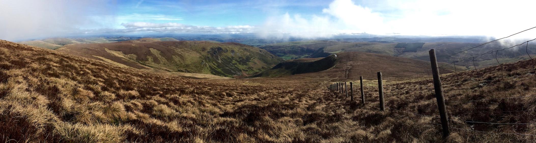
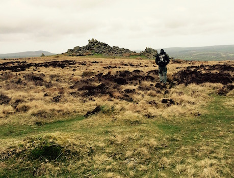
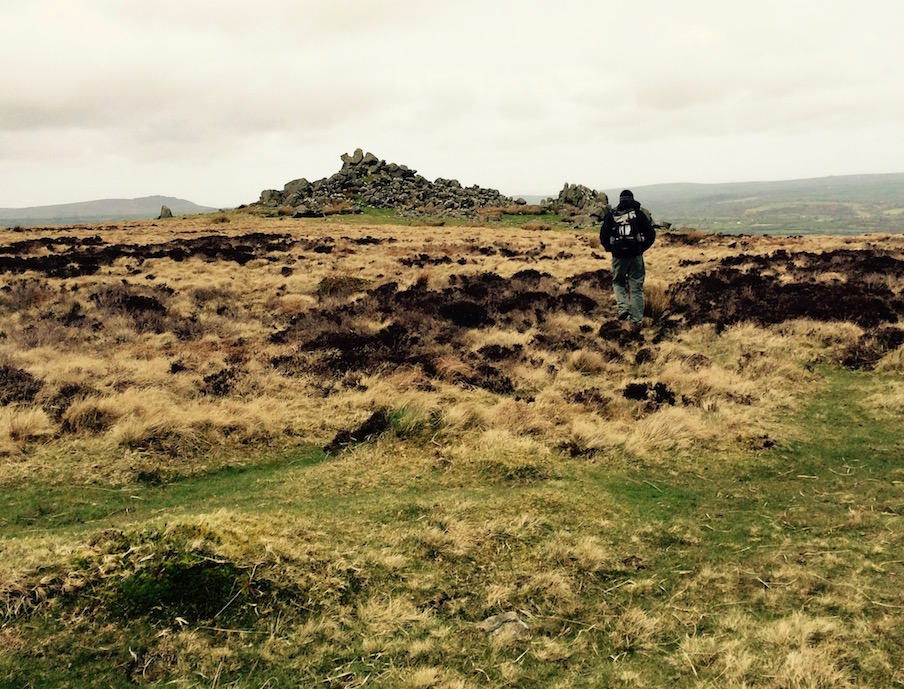
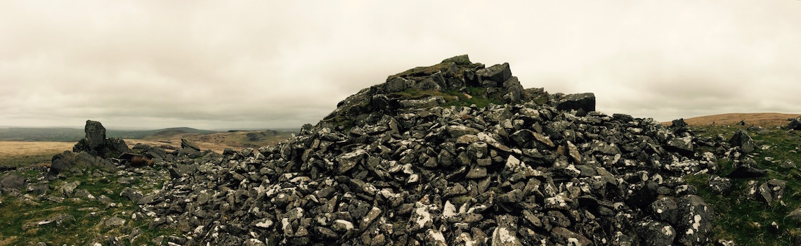
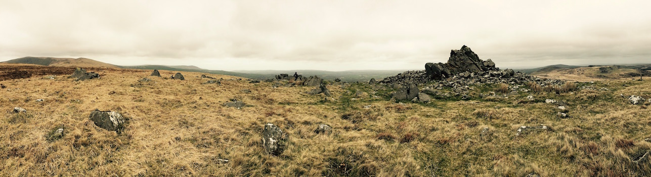
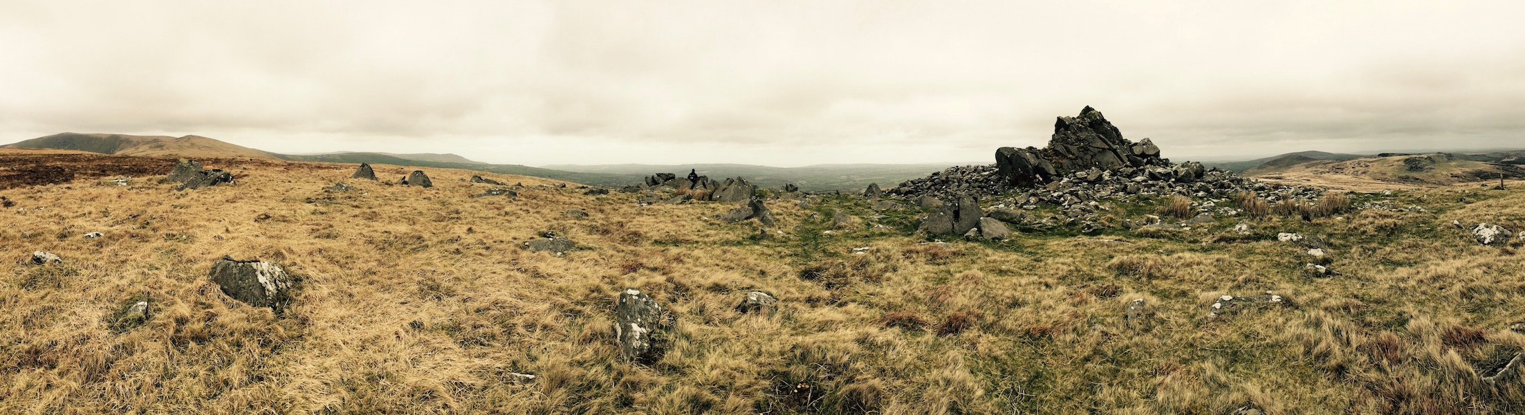
Although Nevern, the Gwaun Valley Brewery, the Llanychaer Cursing Well, Dinas Island and Pentre Ifan would have been reasons enough to take the trip to Pembrokeshire, there was really one specific point to my deciding to come here - the 'Golden Road' in Mynydd Preseli. Although apparently ignored for the beachside resorts in the summer, the Preseli range isn't just full of lovely hills, fields, walking paths, and 38 ancient monuments - it's where the bluestones for the center ring of Stonehenge came from.
Stonehenge, the prequel
That's right - Stonehenge, that most famous hotspot on the tourist trail of England. Stonehenge, which when I first visited in the 90s you could still drive past and get relatively close to. Stonehenge, 200 miles away, on the Salisbury plain, which now you can visit with busload after busload of thousands of your closest friends from around the world, each fighting to get the best selfie from behind a roped off barrier a hundred feet away. Stonehenge, where you can spend great amounts of time in the newly remodeled visitor center, seemingly larger than the monument itself, buying yourself a Stonehenge necktie or a Stonehenge bottle opener or postcards to prove to everyone at home that you were at Stonehenge.
Stonehenge!
Unlike Stonehenge, you do need a map to get here
Or you can visit Mynydd Preseli virtually by yourself, climb the hills, cairns, quarries and monuments where thousands of years ago, before the invention of the wheel, people built massive hill forts, burial sites, stone circles and quarried several-ton slabs of stone. And you can try to fathom how they managed to transport those several-ton slabs, not just down off the hill you're on, but 200 miles away - and if the slab they found in the 90s at the bottom of a Welsh river means anything, across water. And you can wonder at the meaning of the slabs being quarried 500 years before Stonehenge was built.
Possibly you could even do these things while eating a Cadbury's Cream Egg from high on top of one of the quarry walls.
Is that a manmade pile of rocks or just a regular pile of rocks?
Not so much a road as a track
As we'd stayed overnight in Newport, we only had about a 20-30 minute drive to the eastern end of the path. We'd started to question the 'Golden Road's' existence when neither the people at the Gwaun Valley Brewery or the hotel knew what it was - but I figured that it was just a new name for something that's existed for thousands of years. As soon as I said 'where Stonehenge came from in Mynydd Preseli' they knew what I meant.
If you get an OS map you can see that the hike isn't that complicated and relatively straight-on. There's clearly a path that cuts across the inland portion of the Mynydd Presell (Preseli Hills) - the only real inland part of the Pembrokeshire Coast National Park. Though not marked as the Golden Road, this track's been in use for 3500 years and cuts through dozens of ancient monuments.
Since the western end of the full trail was significantly higher, and we wanted to see the Stonehenge-quarries, we decided to start at the eastern end. There isn't much in the way of public transport back in those hills, so any hiking in would mean an equal hike out.
Great place for a barracks
What a great place for a military training area
We got there easily enough, found a small strip of parking beside the main road, and made our way in towards the 'trail head' of sorts. There we learned from an informative sign that after World War II the War Office had wanted to make the Preseli Hills into a military training area.
If you live in Wales even just a few months, you get a pretty good sense of public works originating in south east England that can seem rather unfair to the local Welsh population. Reservoirs put in place to provide water for large English cities that destroy entire towns, firing ranges that destroy pieces of coastline, nuclear power plants in national parks - and in this case turning out 200 local farmers in an area of 38 ancient monuments to build an off-limits military area.
What a lovely potential firing range
Thankfully, a number of local Nonconformist pastors and headmasters created the Prescelli Preservation Committee hired a barrister and made it known they wouldn't be giving in so easily. They apparently won their battle by emphasizing the 1922 discovery that had made known the place was a cornerstone not just of Welsh heritage but of English heritage - i.e. that this was the unique source of the spotted volcanic dolerite that makes up the inner circle of Stonehenge.
Thank goodness, because despite the day's grey weather, this was a great place to visit - like an outdoor playground for archaeology nerds. Having barred it off or worse turned it into a firing range would have destroyed a really wonderful piece of ancient history.
What do you think this is?
The first part of the hike is a relatively gently incline, past a small woodland to the left. There's a massive hill to the right with an ancient fort on top, but we decided we'd leave that for the return trip, if we still had it in us to visit (we didn't).
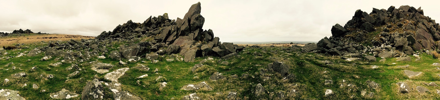
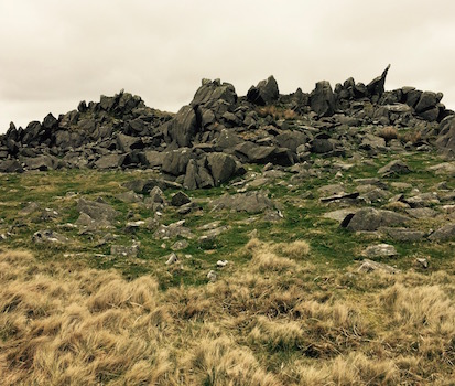
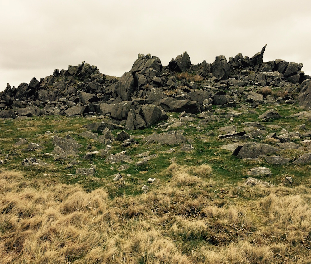
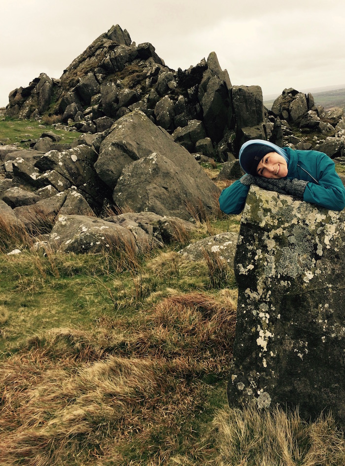
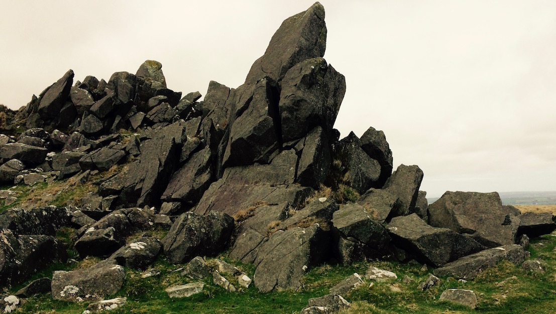
As you crest the incline, you'll see a few ancient cairns and hut circles that are marked on the OS map. I'm not going to pretend that it's easy to tell what's what - some of these might just be rocks, some might be intentionally placed rocks.
This could be anything. Like a giant pile of rocks.
But the great part of the walk is it leaves a lot to the imagination. As you keep walking, you can see several piles of stone to your right, and several to your left. In front there's a valley and then another higher hill, again with what look like scattered monuments. Beyond that is a mountain - today it was dark and foreboding, and probably warrants being the setting of the 'Mabigonian' a set of legends from the Welsh Dark Ages.
Climbing the ancient ice cream stand
We made our way first to some of the cairns to the right, guessing what each one was. P guessed forts and outposts and living areas. I thought they might be the Welsh food trucks and/or roadside stands of the time. Probably selling ancient ice cream and free range eggs, Welsh traditions which I imagine are several thousands of years old.
Ancient Disneyworld
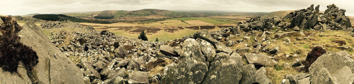
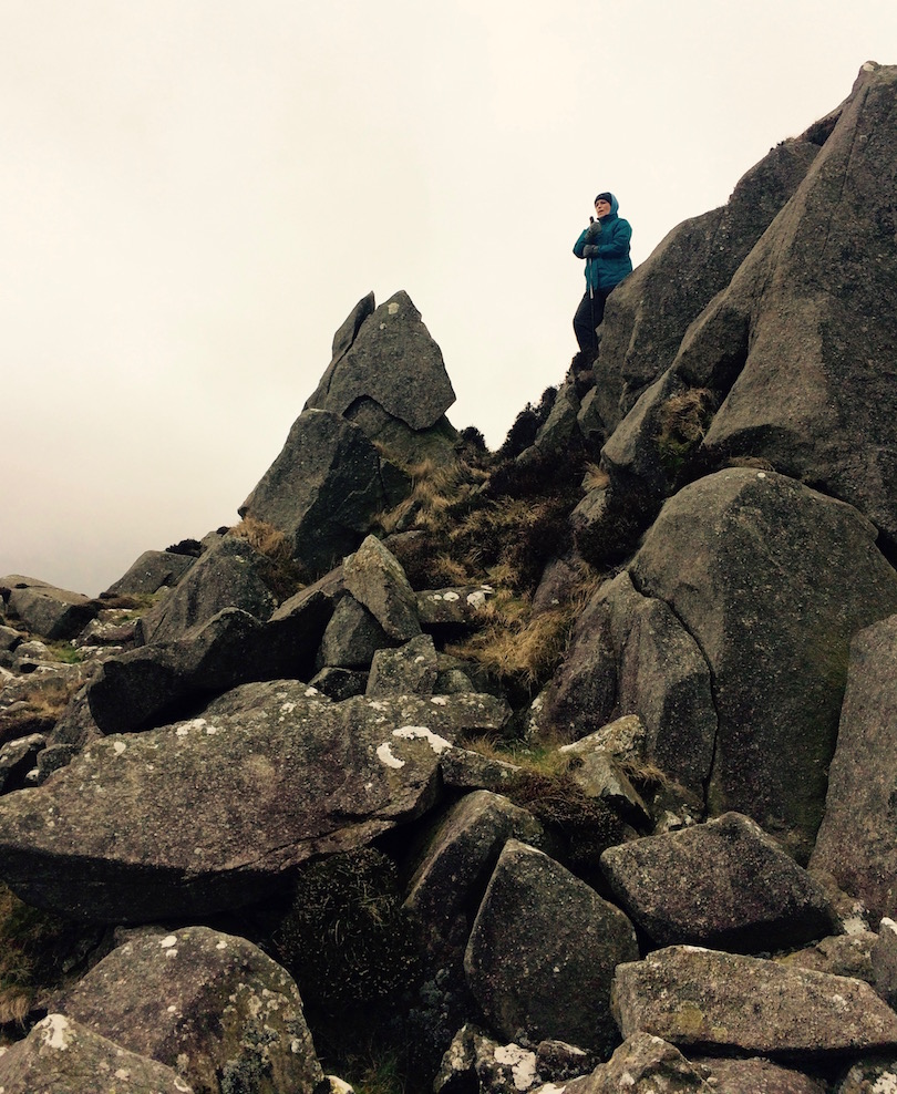
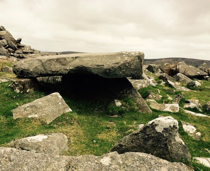
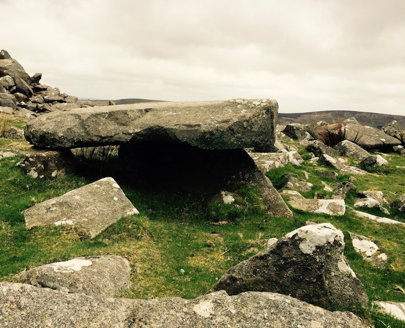
After having our fun, we made our way toward the rock piles on the left (south). Since 1922 archaeologists have done a few more studies of these, and so we know a little more about what they were used for. Specifically, some of this area - Carn Menyn to be exact - was likely where some of the Stonehenge bluestone was cut.
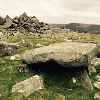
Table, or rockfall?
Carn Menyn was the farthest outcrop as we walked from the east, and as we clambered over and around the rocks, and through oddly shaped and weirdly placed rocks, there was a distinct sense of ancient hands at work. It's hard to describe - but we started guessing what were actual fault lines, and what were cut by ancient tools. Whether this or that rock had been intentionally placed on those other rocks to make a table, or whether they fell that way.
And then when you are at the tumble of boulders that is Carn Menyn, you do start questioning how the heck anyone ever got anything that gigantic off of this hill and all the way over to Salisbury.
Me: "Wait, had the wheel even been invented yet?"
P: "No."
Me: "They probably rolled all of these things down the hill on smaller round stones, then floated them somehow on a boat south of Wales towards Bristol. Then rolled again through England."
However they did it, nice place for a picnic
P: "That would take forever."
Me: "Well, what else did they have to do? Seems to me like rolling giant rocks down a hill would be a more engrossing use of ancient man's free time than, I don't know, not rolling giant rocks down a hill. They were probably lining up to be involved. Like people now when a new iPhone comes out."
P: "Hey, Gurg, tomorrow they choose people to push giant stone things down hill. Meet me in parking lot when western sea god eats giant bright ball that lights up sky. We want to be first to see. Bring goat for snack."
Me: "Something like that."
Imaginations having gone sufficiently wild, we scrambled up to a spot in the outcrop that was sheltered enough from the wind that our lunches wouldn't get blown out of our hands and tucked in. I then climbed to the top and ate my Cadbury's Cream Egg from on high while surveying the scene.
Ancient quarry cart tracks, or sheep path? You decide.
King Arthur was everywhere
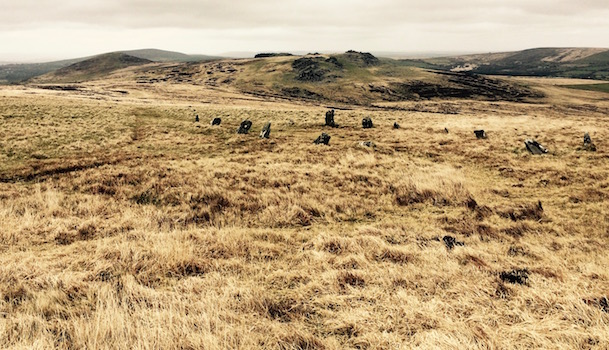
High on sugar and ready to roll, I mentioned to P that I'd read that there was a stone circle on this trail that was where legend had it King Arthur was buried. Checking our map, we saw that it was somewhere just across the valley we were currently on, though we couldn't quite see exactly where. It was close enough that we thought we could make our way there, and then make that the turnaround point.
It has to be somewhere around here
Trying to channel our Plas-y-Brenin training, and using landmarks and compasses, we of course each came up with a different idea of where we were supposed to go. Ultimately we just took the most obvious first path we came across - which didn't dip all the way into the valley or all the way onto the top of the hill. When we got to where we (I) thought we were trying to get to, we found . . . a stick.
Me: "I think this is it."
P: "That's a stick.
Me: "An ancient stick."
P: "It's wood."
Me: "An ancient wooden stick."
P: "I really don't think that's it."
Ooooh, an ancient stick!
Me: "You know nothing Jon Snow. Ancient Arthurian wooden headstone, carvings worn down over a thousand years. Ooooooh, [fancy QVC hand wave] mystical. Unless we find something else I'm going with this."
P: "You don't think maybe it's those stones in a circle over there?"
Me: "Where?"
P: "Fifty feet down that way."
Me: "OK, maybe. But this is probably an ancient horse's grave."
P: "No it isn't."
Me: "Oh, come on, I know it's not. Give me this one thing."
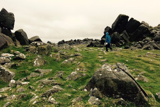
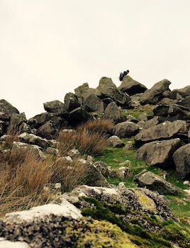
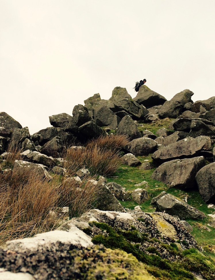
Find the hiker
After which I proceeded to run into the stone circle (in this case more a stone ellipse), and try to hide. As the stones were only two feet high at the most, this wasn't easy. But see if you can find me.
After checking this out for a while and contemplating whether each was a gravestone for a knight of the Round Table (because why not? Apparently no one has ever even excavated this monument for some reason - so who knows!). I proceeded to run off to the next closest pile of stones/monument.
While P was looking the other way, I dropped into a hollowed out pile of stones and decided I was going to try to scare him when he came by.
Five minutes later:
Me [screaming and jumping up]: "Booo! Ahhh!"
Best haunted hiding place ever
P: "Oh hey."
Me: "I totally scared you."
P: "OK."
Me: "You were looking for me weren't you?"
P: "Not really. When I didn't see you, I figured you were probably hiding somewhere and were going to try to scare me. Good job."
Me: "I know, I'm great at this. Also I'm an adult. Also I think my shoes might be haunted now."
P: "What?"
No, surely there aren't ghosts here
Me: "My shoes, I think they might be haunted. After I slid into this indentation that I thought was a windbreak, I sat there for a minute and looked around. I saw a couple other windbreaks around me, and I thought. . ."
P: "You thought maybe you were actually in an ancient grave, didn't you."
Me: "Well, yes. It actually seems kind of likely. But I hope they excavated these at some point. So maybe anything left is small and just buried at the bottom of the barrow. So maybe only my shoes are haunted where I touched that stuff, and not, like, all of me. Or maybe it was a windbreak. Hard to tell."
P: "Mmm-hmmm."
Me: "Probably shouldn't have gone in there."
P: "No, probably not."
Me: "I hope this isn't the part where the mist rolls in and the barrow wight pulls me down into its lair for all eternity."
Find the hiker part 2
Luckily, that didn't happen and we turned around and hiked back out past several other monuments in perfect safety. Except for the part where for the second time in two days I was decidedly not paying attention going downhill and I somehow entirely inexplicably and out of nowhere fell flat out on my face.
But this time I was fairly certain the barrow wight tripped me. I knew my shoes were haunted.