Sadly, January started out with a frantic drive back from Sicily on finding out our cat Shera was dying. Unfortunately we didn't make it back in time to see her, but I just hope wherever she is now, that she has unlimited mice available for flattening - that was her favorite pastime. We came home from vacation once to find a paper-thin mouse on the carpet, and couldn't figure out how she did it. I changed things around on the blog because I used to have a section devoted to her - if you'd like to see what I'd posted you can still find it here.
Otherwise - the thing about January in Wales is - it's cold. Don't get me wrong - the temperatures aren't even close to a midwestern or northeastern winter in the U.S. - but it's a damp cold. And damp cold is always the worst cold.
But that shouldn't stop anyone who's taken the proper precautions - super-early sundown means get in on time and carry a headlamp, warm gloves, layers, etc - from getting outside. And those of us who try to remember the proper precautions, but keep forgetting to buy a headlamp can enjoy ourselves as well. We just enjoy ourselves in the dark sometimes.
Having driven nearly two days straight back from Sicily only having taken turns sleeping in the car, and arriving to a vet in Aberystwyth who surprised us on entering his office that our cat had just passed away - not by telling us mind you, but by leading us in to see her - the New Year was not exactly starting off well. Exhausted and relatively depressed, after a few days we decided getting back outside would be the best thing to do.
Time to Get Back on Track
My Legs May Have Atrophied
That said, physically speaking it wasn't the best time - having taken a week and a half to drive to Sicily, a few days lounging in Sicily for Christmas and New Year's and then two days driving back from Sicily - we hadn't really stretched our legs much. So taking out my north Wales OS maps, I tried to find an easy little walk.
Mentally exhausted, I didn't really find much from the maps. Giving up rather easily, I went online and started scrolling through my Twitter feed, full of Welsh news and outdoor activities. I don't think you should read into the fact that I decided we should go to Bala based on the fact that I ran across a news article that said that the road from our place to there was the one with the most vehicle deaths in Wales. . .
The other direction is an industrial estate
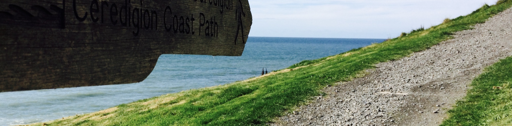
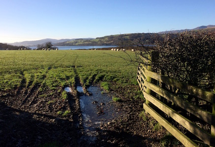
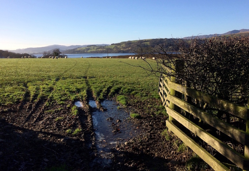
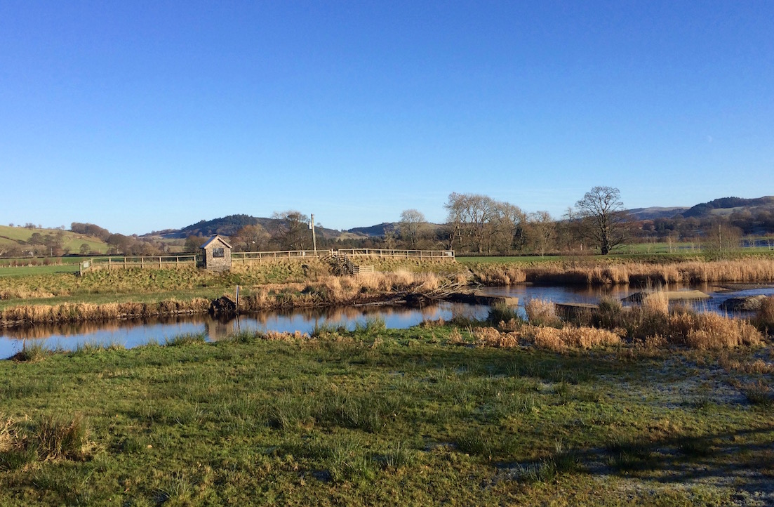
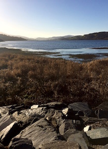
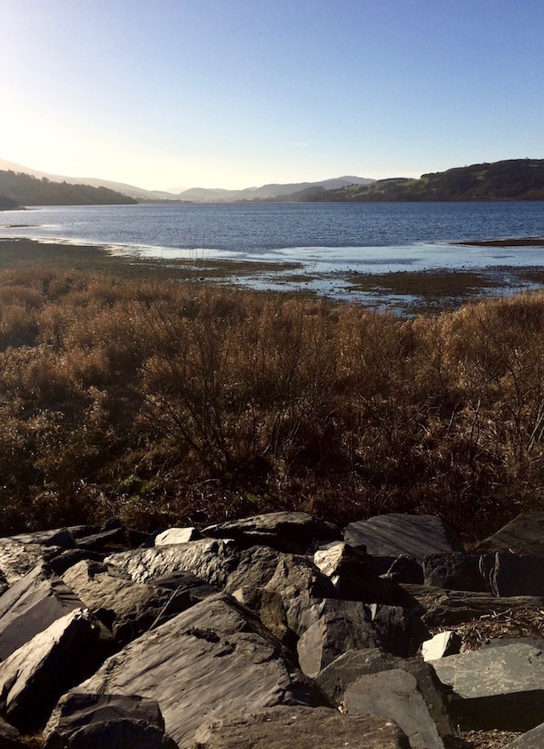
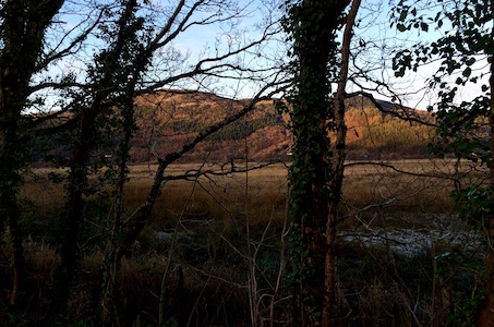
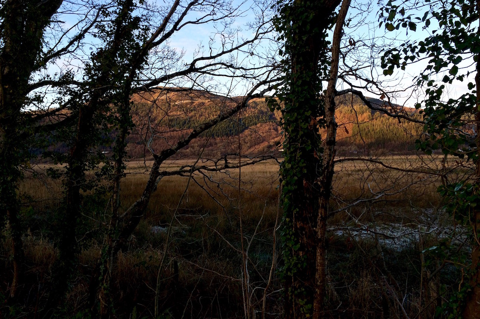
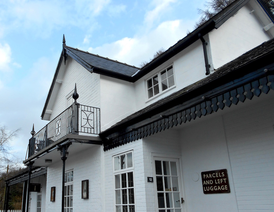
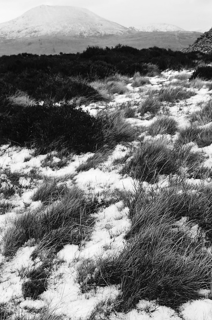
What happened was that that article jogged my memory that I'd seen it on a map, read about it in my guidebook and had wanted to go there. I'd been spending a lot of time on the coast, and this town, sitting on a large lake in a valley encircled by hills, is farther east than most I've visited. Not being up for a ton of physical exertion, and it also being really and truly freezing outside, I saw a few short walks and rights of way that looked short and simple on the road to Bala. So off we went.
Barefoot 16 year old Mary Jones Clearly had Better Navigation Skills than Me
I'm going to keep this short because the walks we actually did were fine but nothing to shout from the rooftops about - basically the OS map showed a nature reserve on the left hand side of the road as we drove from Dolgellau to Bala that I'd wanted to visit. So of course we still have absolutely no idea where that is.
No, I was not barefoot
I know, you're shocked that I once again failed to find something. You're probably yelling "Use the damn internet for godsakes!" Right. The internet that goes in and out as you drive down the road here, and that you can't even get a 3G signal inside your house from. That internet. I'll get right on that.
Anyway, we scrapped the original plan and walked around Bala. Besides the Welsh watersports training center and its narrow gauge railway, Bala is mostly known as the place that in 1800, having saved money for 6 years, 16 year old Mary Jones walked 25 miles barefoot to from the other side of Cadair Idris (right near Castell y Bere) because she heard they had Bibles in the Welsh language. She also didn't use the internet for directions.
A famous Victorian clown hostel until Obamacare ruined it #fakenews
If she had, she would have known that Thomas Charles - who had been distributing Welsh language Bibles there at a time when the established Church was not particularly catering to the Welsh - only had one copy left of his reprint of Bishop Morgan's 1588 original Welsh translation - his own, which he promptly gave to her. Or maybe she would instead have read some fake news website and ended up looking for Bibles in the basement of a DC pizza parlor (if you don't get that off the bat, never mind).
In any case, after this event, ardent Methodist Thomas Charles founded the British and Foreign Bible Society, to distribute local language Bibles worldwide. I learned all this after walking downtown in Bala, and finding a rather daunting, gigantic statue of Mr. Charles - and somehow not one of Mary. . . While there is a plaque at her old house near Cadair Idris, a very short conversation with one of the locals there made me realize the fact that people associate her more with Bala than her home is not something everyone in Wales is thrilled about. [Note: There is also something called 'Mary Jones World' just outside of Bala. There may be a statue to her there. I sincerely hope there is a Bible-walk themed roller coaster.]
Oh Right, I'm Supposed to be Walking here
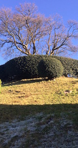
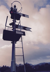
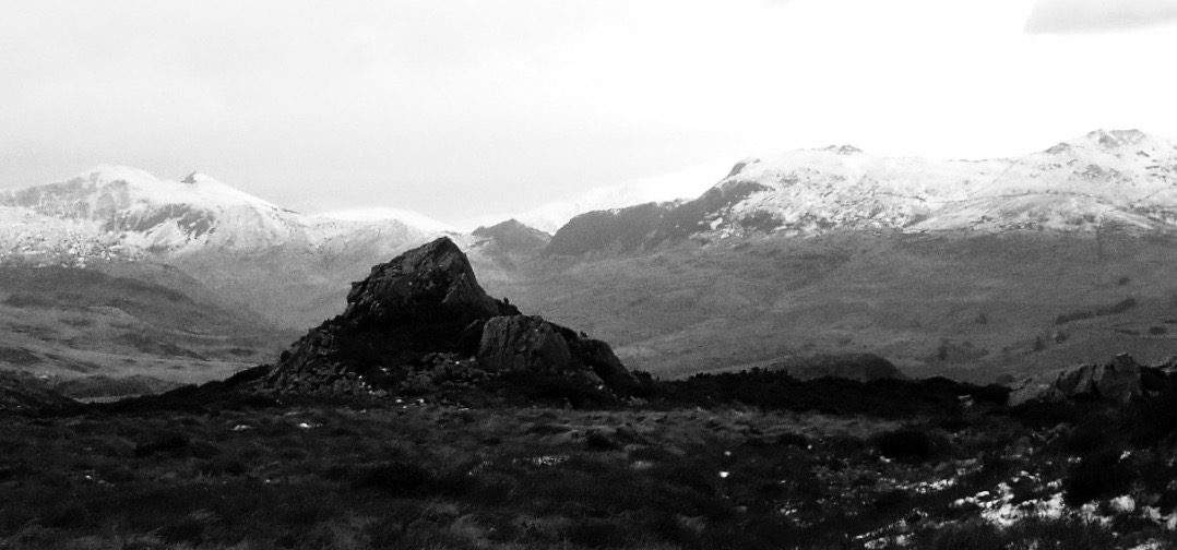
Tomen-y-Bala
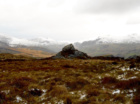
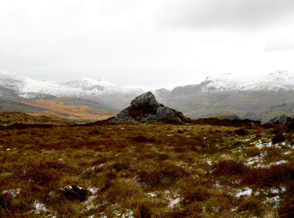
OK, walking, right. From the OS map, there were three things in/near town we could link together: the Tomen-y-Bala hilltop motte dating to 1310, the 'Tegid Way' that ran from the small Industrial Estate in the east of town to the lake and beyond, and another motte and bailey just to the south of town.
Tomen-y-Bala is very easy to find, as it's a tiny grassy hillside just off the main road, with cute views over the town. If you circumnavigate the hill very slowly, it might take you a minute and a half to get to the top.
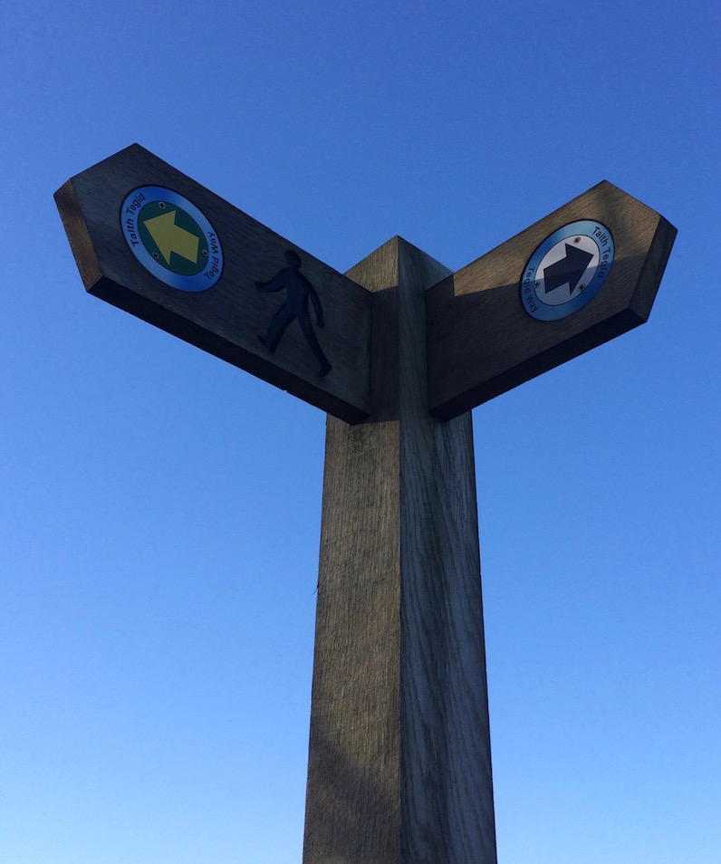
There are no rules on the Tegid Way
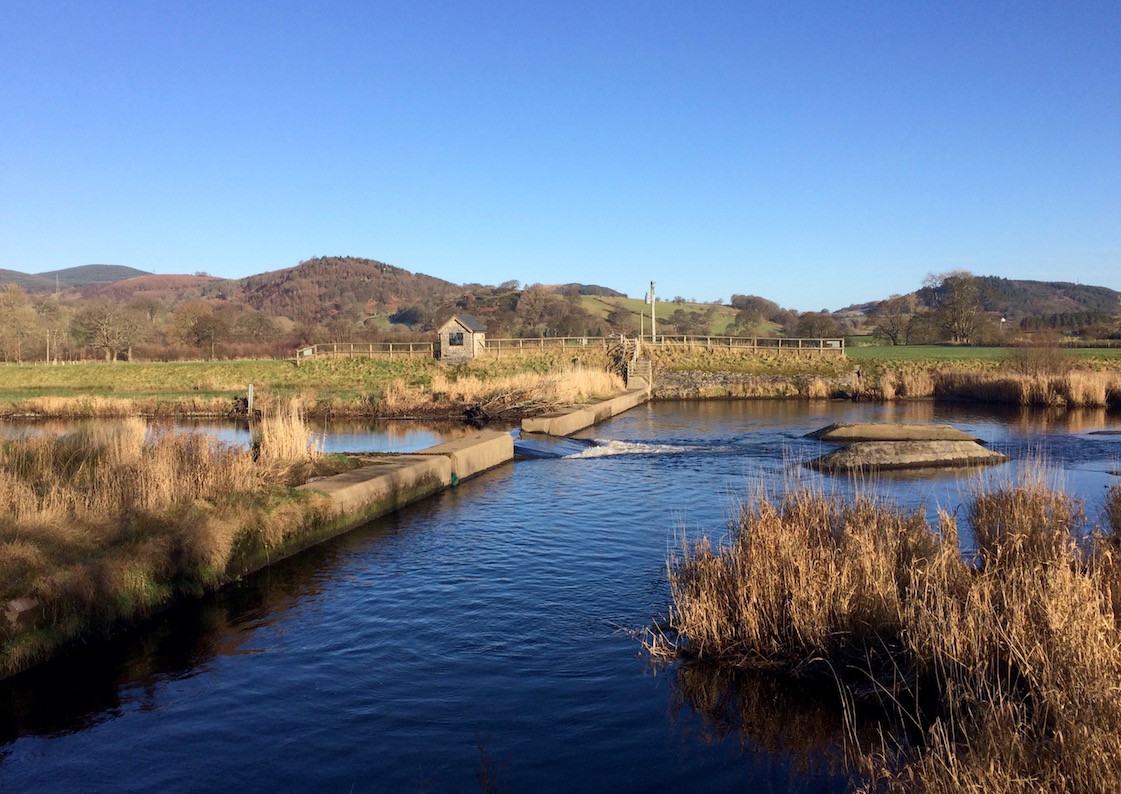
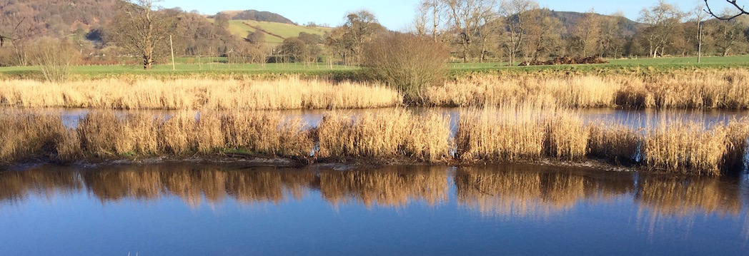
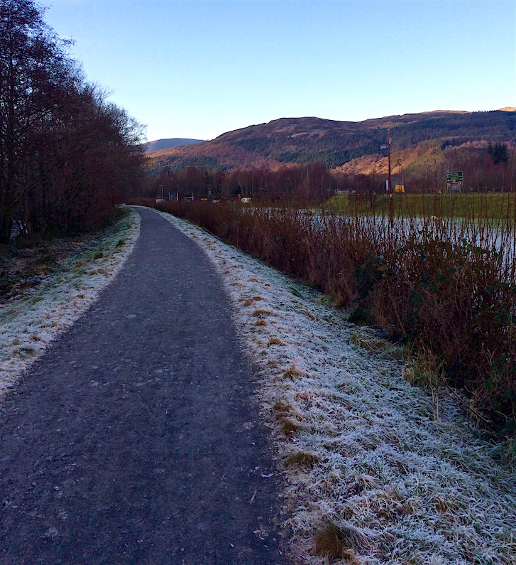
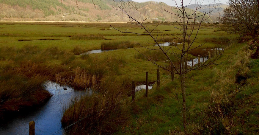
Continuing east, we quickly hit the Tegid Way, which follows the water through a surprisingly pleasant walk past an industrial estate. For Americans who might not be familiar with the term: for reference, this one included a chocolate factory and a place that had a bunch of tractor tires out back. They are not places I'd typically want to walk through - but the water and the views east toward the hills on a particularly crisp and clear day were lovely.
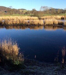
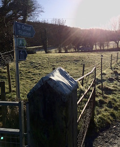
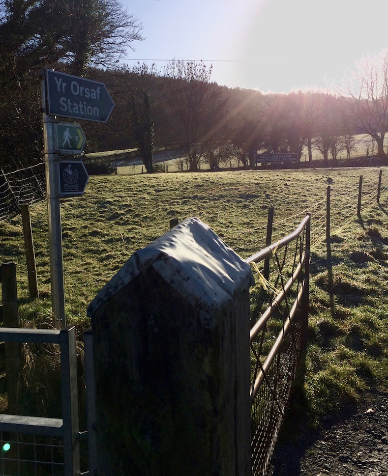
After following the trail south and west for five minutes, we came to the lake, the far end of which was still covered in an eery, frozen mist that I entirely failed to get a picture of. Remarking that "Shera would have hated this so much" as our cat not only disliked the outside, but also the cold and moreover even the sound of water seemed to drive her crazy, we walked toward the narrow gauge railroad station, closed for the winter.
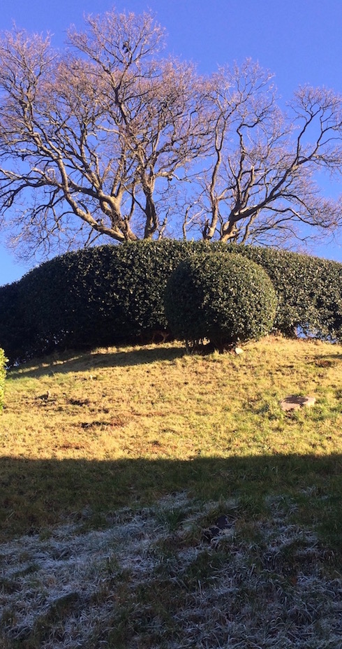
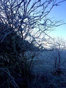
Precision Targeted Frost
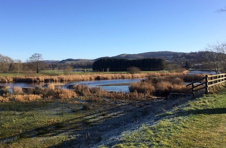
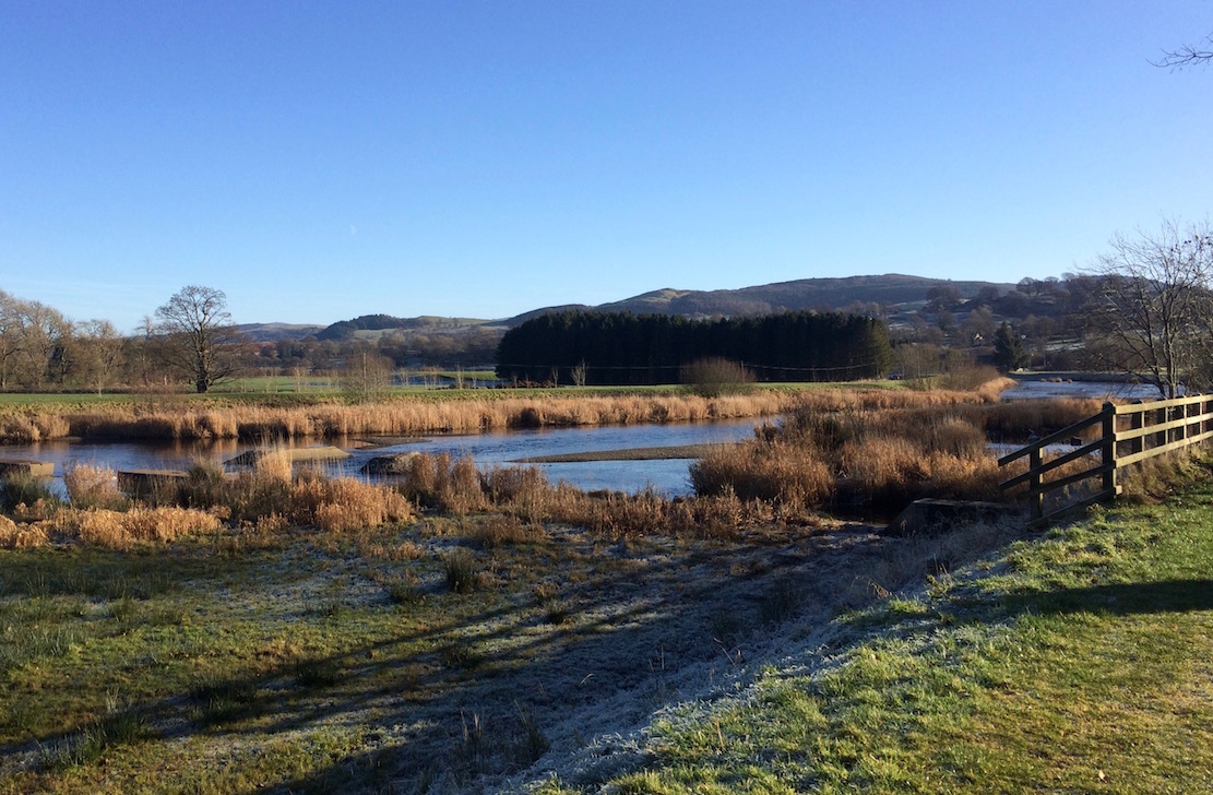
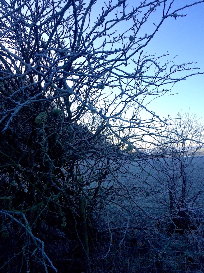
Crossing the bridge over the tracks and a southern right of way through two fields, we suddenly found ourselves entirely in the shade of the nearby hills. On this particular day that meant a seeming ten degree drop in temperature, a suddenly frost covered ground and trees laced with snow and ice. Although we were dressed properly - we hurried east along the path to try to find the motte and bailey.
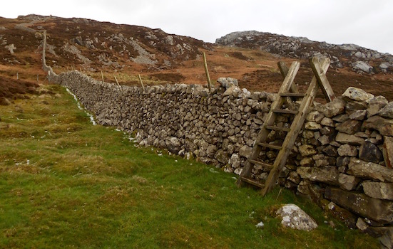
After passing an empty caravan park and again hitting a main road - we think we found the motte and bailey. Unfortunately it was in someone's back yard. Not being able to tell if there was a right of way (that would have run literally through their front gate) we decided to skip this one, even though there was a tiny sign for it in the homeowner's garden.
Backyard BBQ-Castle
If you're interested though - the house was for sale. You could buy it and have a 500 year old castle in your garden.
This was nice but. . .
Later, having walked back to town via the scenic lake-edge path, we found ourselves eating jacket potatoes in a lovely Tea and Coffee shop, the pub next door telling us they'd just stopped serving lunch (at 2pm). We decided that while Bala had been perfectly nice, it wasn't quite what we'd been looking for.
So on the way back to Aberdovey, we thought we'd stop in Dolgellau and take a quick trip on the Mawddach Trail. I mean, it was absolutely freezing and the sun would set at 4:30. Surely this was a good idea.
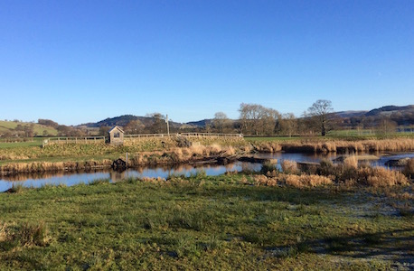
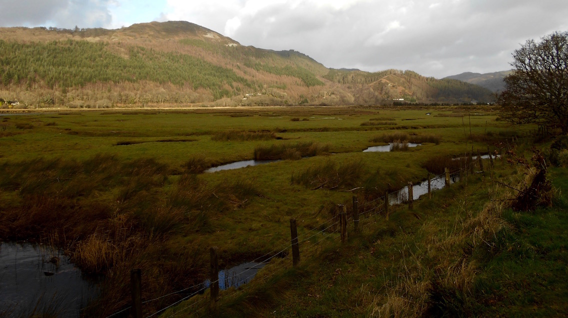
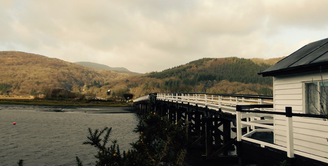
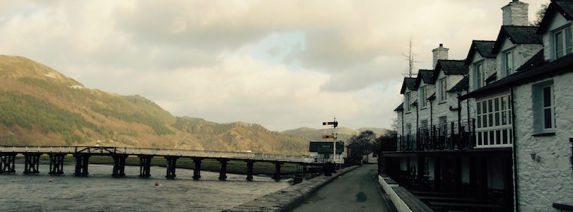
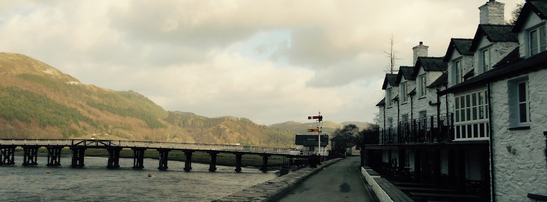
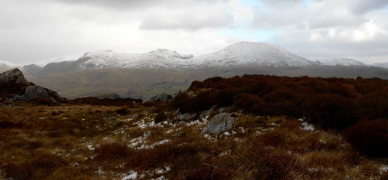
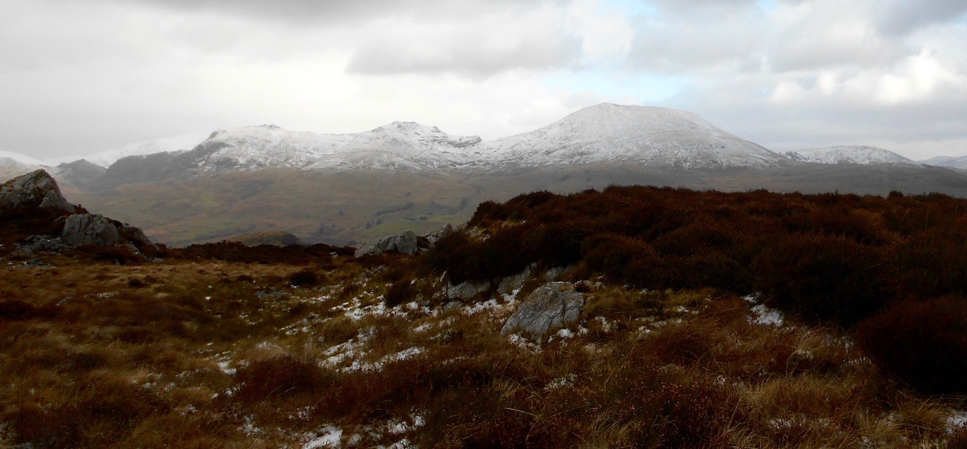
So, we set off from Bala at 3pm on a truly freezing January day with a great plan - we'd take the short, 20 minute drive to Dolgellau and walk a short piece of the Mawddach Trail. This super-scenic, super-flat 10 mile combined bike and walking trail starts at Dolgellau, running west along the south coast of the Mawddach Estuary, so the short piece we intended to walk it has coastal estuary views to the north, and Cadair Idris sits imposingly to the south.
Frosty Afternoon
But the real reason we went there was for the pub
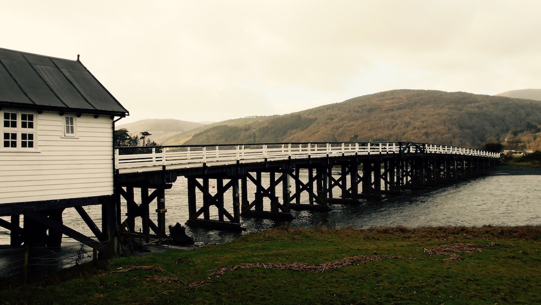
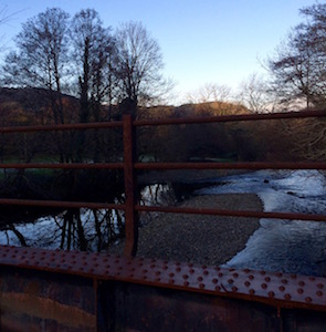
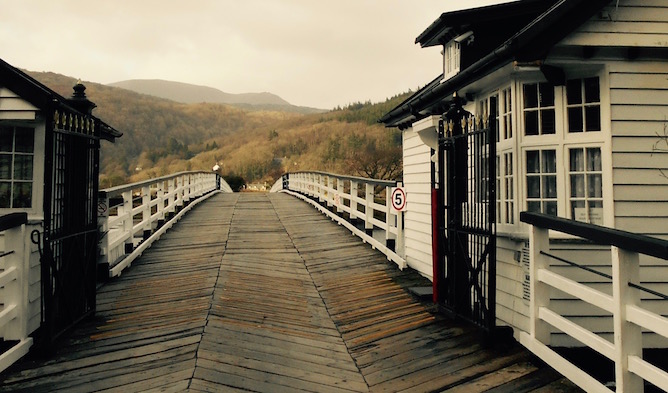
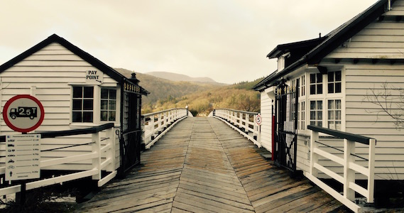
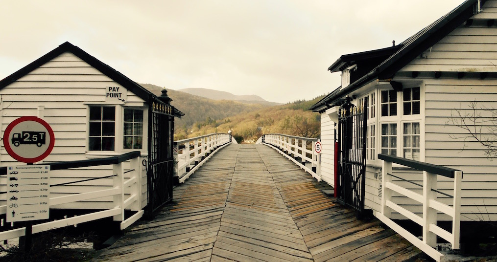
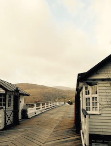
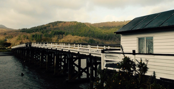
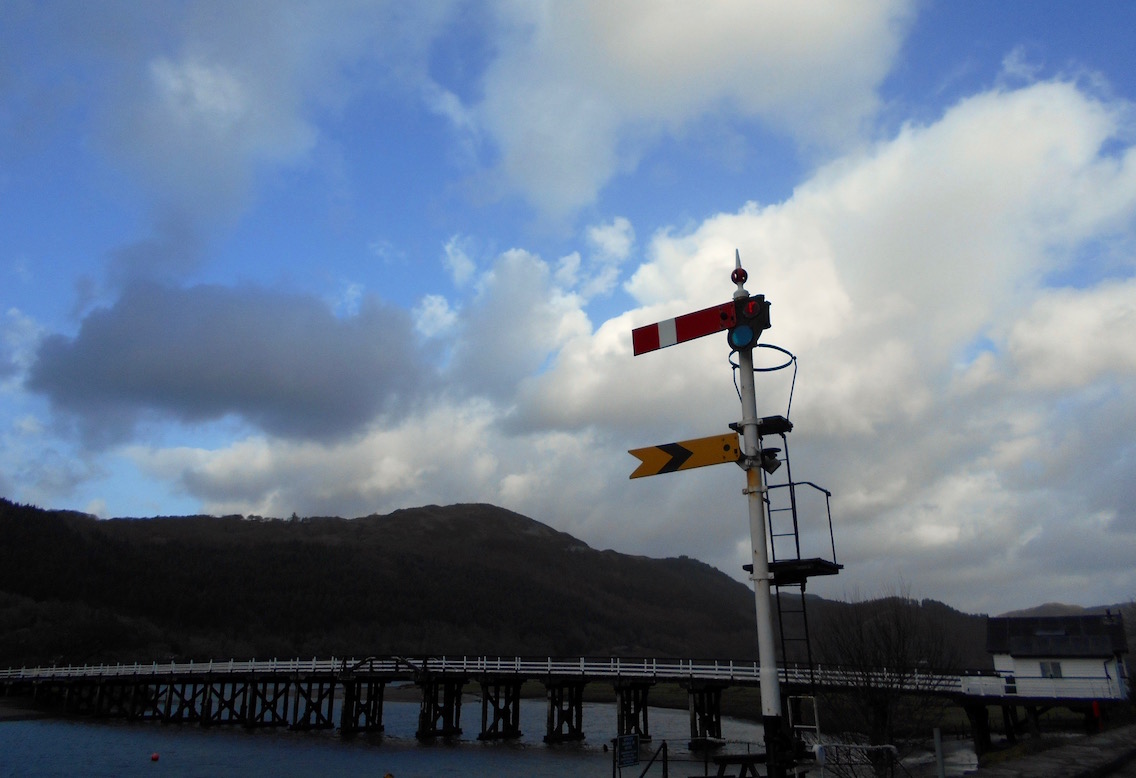
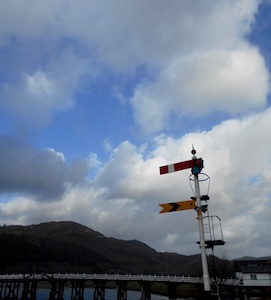
As the title of this section implies, the real reason we went to walk here is that greatest of all benefits of walking in the UK - that there always seems to be a pub somewhere along whatever trail you're on. In this case, when we'd gone to Moelfre in November, we'd noticed there was a toll bridge across the estuary that seemed to cut off the whole drive to Dolgellau you'd otherwise have to do to get north to Barmouth. This toll bridge turned out to be much the same as the one we took leaving Hay-on-Wye - that is to say, wooden, incredibly scenic, and utterly terrifying.
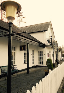
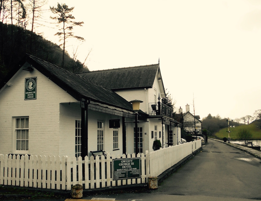
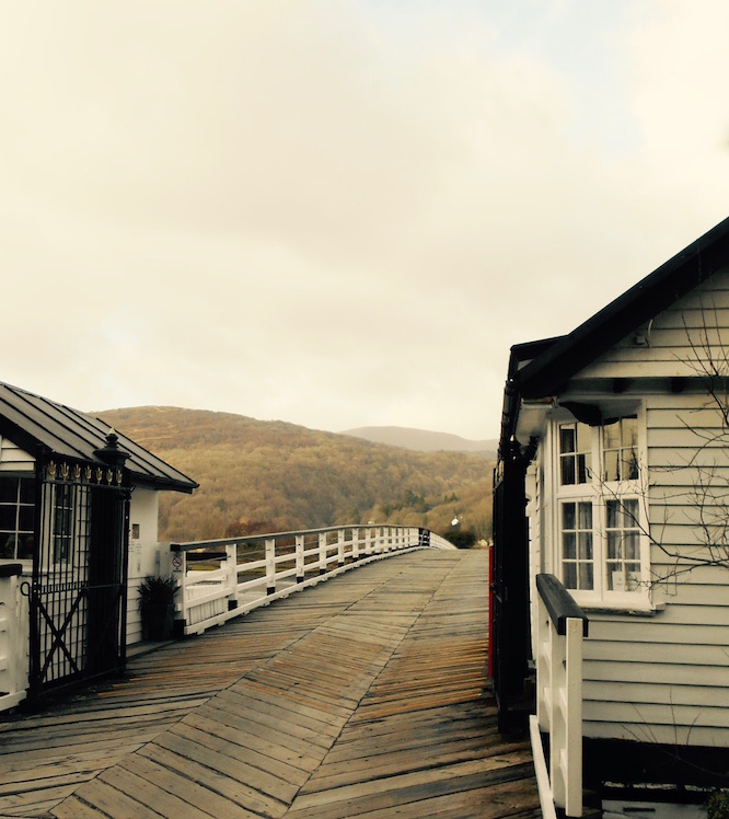
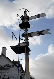
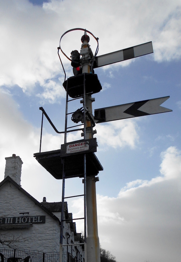
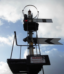
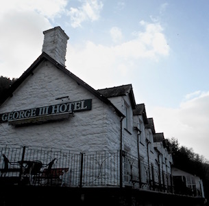
In any case, we had seen an old white former railroad inn called the Hotel George III on the south side of the bridge. This was only a few miles from Dolgellau, right on the Mawddach Trail, so we thought walking there, getting a drink, and then back to Dolgellau before sunset would be doable. It turns out two out of three isn't bad.
Home of the Dolgellau Druids
I hope Dolgellau's rugby team is called the Druids
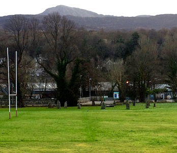
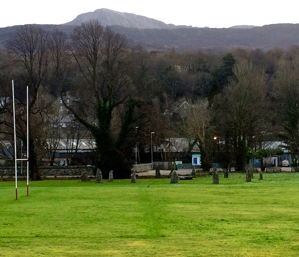
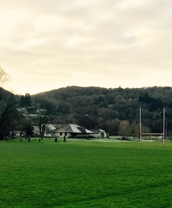
Parking in the lot right next to the old bridge, we walked west along the river, away from Dolgellau's quaint and cozy dark stone buildings. The immediate view of a rugby field wasn't all that enticing, until P said:
"Ummm, is that an ancient Stone Circle over there?"
To which I answered "Huh? Where?"
"Ummm, right over there."
"You mean in the rugby field? Noooo. Hmmm. Wait, yeah, actually that's what it looks like. Huh. You wouldn't have thought that would be a convenient place to put a rugby field. I wonder if anyone ever slams into it."
Snapping some photos we scurried away - we'd only been out of the car a few minutes, but the damp coldness off the water was something to be reckoned with. Also, not being one to ever learn a lesson, I suddenly realized that just like in Dolgoch, we were walking on the north side of a hill - in this case a mountain actually. As it was after 3pm the sun had in fact already dropped behind Cadair Idris (if it had ever come out at all) and we were walking in shadow. In an absolutely freezing shadow.
Funny, it seems like it's getting dark. . .
It was the kind of cold that's vaguely shocking - and makes you hurry despite yourself. It was the kind of cold that shuts off all your electronics, despite your having charged them shortly before. It was the kind of cold that makes you try to remember how long it takes to get hypothermia, so you try to Google it, and then you remember that the cold shut off your phone, and now your fingers are freezing too.
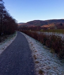
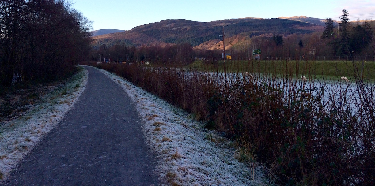
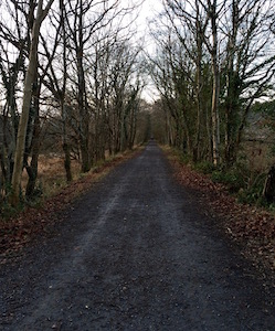
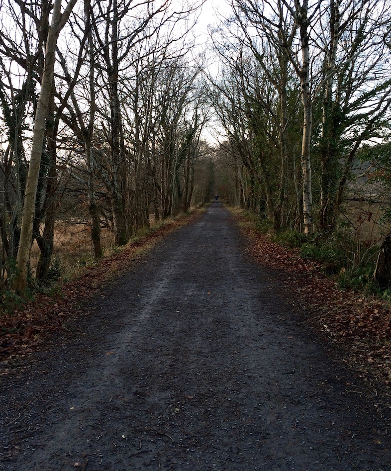
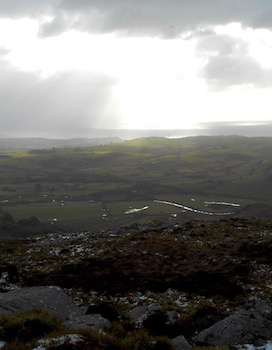
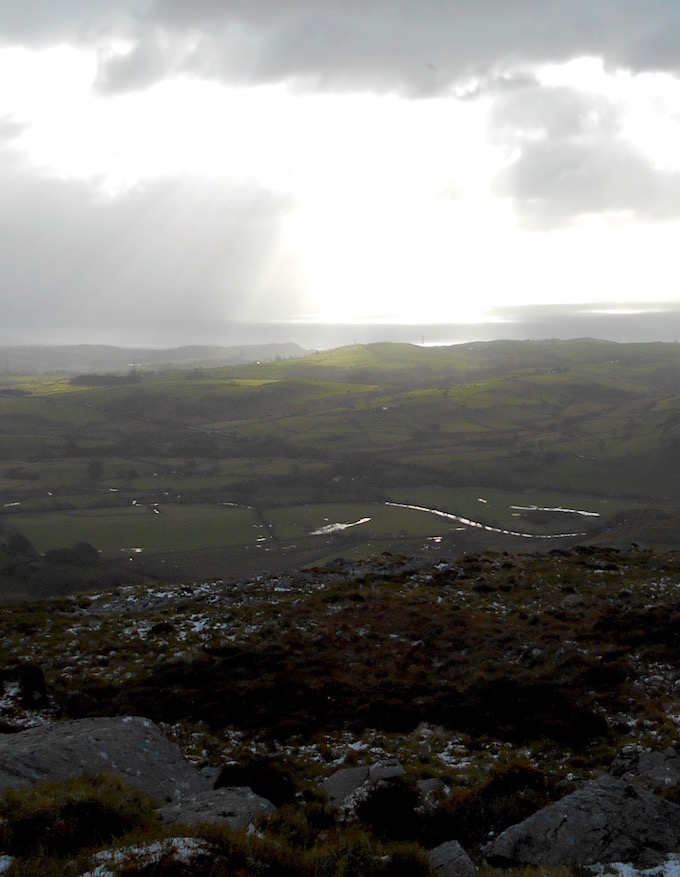
Given how cold it was, there were a lot of people on the trail - so I imagine in the summer it's hopping. Flat, straight, and easy to navigate, the trail follows an abandoned railroad track through several tree-lined avenues, across railroad bridges made vibrant red with rust, over a glassy frigid river and past views of the southern reaches of the sunset-lit Rhinogydd across the estuary.
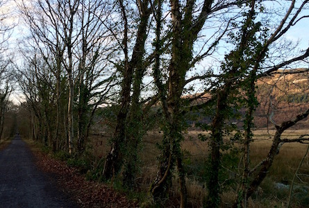
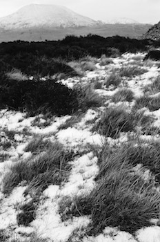
At the moment, also notable where the clearly outlined patches of frost and snow where the sun didn't shine all day, and the sheep chewing away on the small green islands between these. We hurried past.
But it's only 3:30! We have plenty of time.
The problem with a heaven-sent pub with a fireplace
It was only a few miles, but we couldn't get into the Inn quickly enough. Figuring I'd take pictures of the redone railroad station, the quaint but terrifying toll bridge, the Inn and the stunning views after we'd warmed up a bit, we hurried inside. We were greeted by a cozy pub atmosphere, and after a quick chat with the barman about Ohio, we positioned ourselves and our newly acquired ales right next to the fireplace, and right across from some views made more spectacular by the fact that I could again feel my limbs.
So we talked, and we sipped, and the place filled up a bit. Chat, chat, chat, chat, sip, sip, chat, sip. . . "Oh, crap P, what time is it?! 4:30? Oh my god it's practically dark outside and we have to get back to the car that's miles away in Dolgellau!" Face palm.
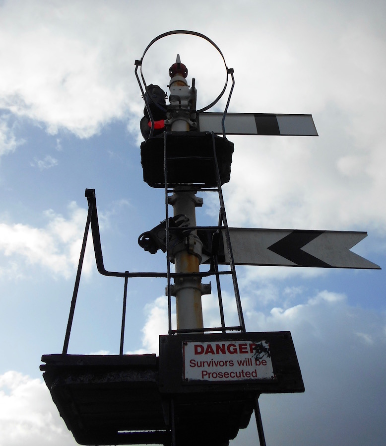
Survivors will be prosecuted?
So, we ran outside, and if it was shady before, it was now properly dusk, bordering on dark. It had taken us at least 45 minutes to get to the pub, so we clearly weren't going to make it back before dark.
Hikers like us are how Welsh werewolves find dinner
If we had been more in the wild, we'd probably be dead. But as we were following a level, fairly straight bike path, we figured we could figure out where to go in the dark.
Damn your coziness!
So we fast-walked as quickly as we could, sharing the path with absolutely no one. After it got completely dark we were helped along by the frost along the sides of the path that seemed to almost glow in the moonlight. It would have been beautiful if I hadn't managed to even unnerve myself by trying to scare P by suggesting all the kinds of supernatural human-eating scary things that clearly hung out by Welsh paths at night - I believe I went from trolls, to vampires, to werewolves, to zombies, and probably a few others.
And it was in this atmosphere that I truly had the crap scared out of me. It was pitch black. We had had the trail entirely to ourselves, and were almost back to the rugby field, when suddenly there was a bright light. It was moving very slightly, and very slowly up and down, but more quickly toward us. At first I thought it was a bike. Then I noticed it was way higher than a bike light, it was well above my head. And it was going eerily slower than a bike.
If you're wondering - I came back later, when the sun was out, to take pics
It kept getting closer and closer, and my heart kept pounding louder and louder. Suddenly it was right in front of us, and I kid you not, I almost screamed. I don't know whether I thought it was an alien, something rising out of the Standing Stone Circle across the way, or a sasquatch riding a giant, silent moped with the light on, but I stopped short, grabbed P's arm, and tried to pull him away from it towards the bushes with me as it passed.
I really truly hope that the really tall jogger with a headlamp on didn't see me do any of this. That would be embarrassing.
A few minutes later we were laughing in the parking lot with the heat in the car cranked up. And I reminded myself one more time that I really, really, really needed to pay more attention, even on an easy trail like this cold and dark are not great combinations. Also that I really need to buy a headlamp.
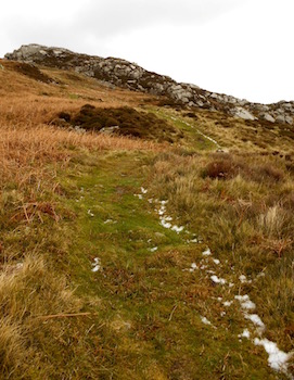
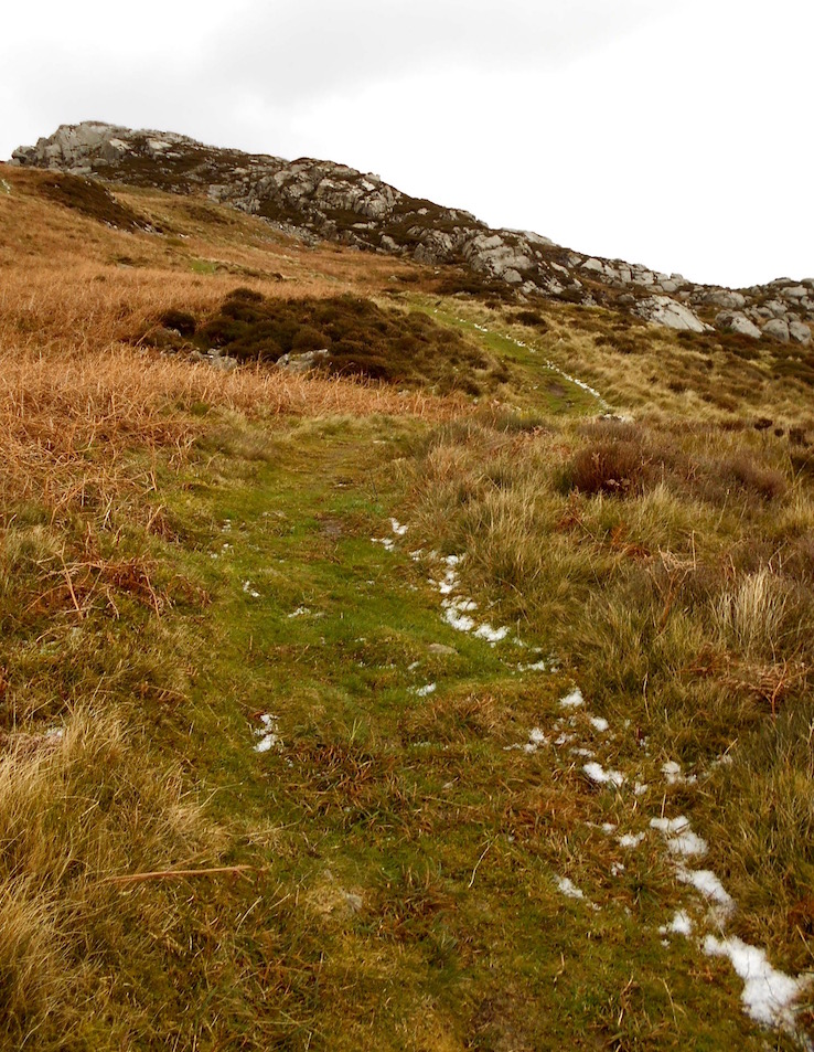
On our quest to Criccieth to score a single free bottle of wine at Dylan's, I thought it would be nice to tack on a walk in the Eifionydd, the western mountain range in Snowdonia.
Views from the saddle back
Actually, our decision to go may have been based more on hiking near Criccieth; having a received a newly minted library card at the Tywyn library (from library staff who seemed overjoyed to have a new customer), I'd recently been thumbing through John Gillham's 'A Pictoral Guide to the Mountains of Snowdonia: The Western Peaks.' It's a great book where he draws his own trail maps, and describes the various walks - highly recommend.
In any case, he describes the walking culture in Snowdonia to be, well, particularly Snowdon focused. And the Eifionydd range to the west as largely ignored in favor of it's eastern neighbor. The beauty of not having grown up with any cultural reference for why people would only hike Snowdon [answer: it's the highest], means I have absolutely nothing pushing me to follow the crowd and check certain hills off of my list. Thus, I love the idea of hiking the hills people ignore, because then I get them largely to myself.
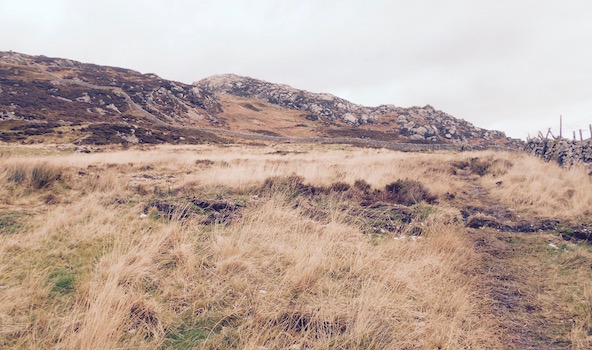
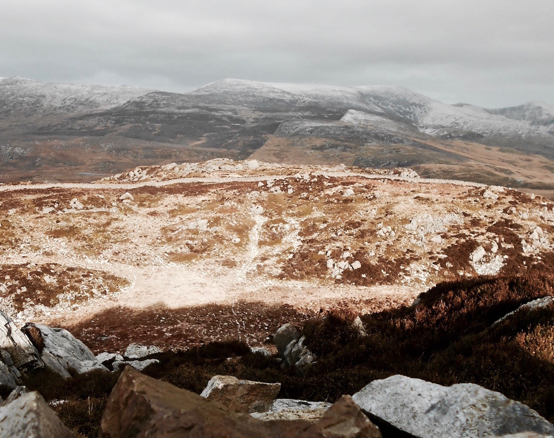
Enter 362m Craig-y-Garn
Gah! Snow!
So enter Craig-y-Garn, a hill near Criccieth effectively described as the short little sister of the Eifionydd range. Nonetheless, because it's separated from the rest of the range mostly by marshland, the book said it has the best views of the range itself, as well as down the peninsula. Given we'd be cold-weather hiking after an evening of drinking, an easy hill with great scenery seemed like a good plan.
And I do think it's lucky I hadn't set my sights higher. Our drive up from Aberdovey to Criccieth the day before had been a drive through intermittent snow. To be more precise - the snow was constant, but the elevation of our car varied - when we crossed over mountain passes, I could barely see through driving snow, but on lower ground it was more of a slushy rain falling from the sky.
If you're used to snow, it wasn't that much - but with the number of people telling us to 'drive safely, what with the snow' or asking 'how was the snow?' or 'but you drove here through all that snow', you would think we'd been taking a Snow Cat to the Overlook Hotel in "The Shining". (OK, you probably wouldn't think that because Wales isn't full of haunted hotels and insane Jack Nicholson-esque axe-murderers, but for some reason that's what came to mind).
Forecast: Wind and More Wind
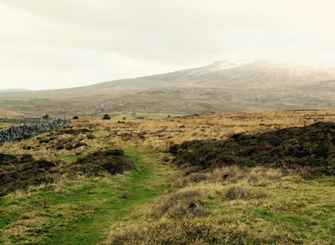
Nice views even from the bottom
Nevertheless, when you see the forecast for snow and wind, and you've been driving for an hour through intermittently driving snow, you start to wonder whether you've made a good decision to go hiking. In particular if you don't have crampons.
Then you decide it was a brilliant decision to go hiking, because (a) you have brought your snow pants (even if you don't know what the proper term is in the UK, given 'pants' means underwear 'snow pants' conjures up an entirely different image, so you giggle every time you say snow pants); (b) you have your long underwear (same comment - so are these long pants here?); (c) you have your super-warm jacket lined with some space age fancy shiny warm stuff; and (d) you have gone skiing in New England in this same outfit when it was 10 degrees Fahrenheit outside (no, I don't know what that is in Celsius, negative a whole lot).
Also, you've picked literally the smallest hill ever, so there probably will only be a little snow, if any.
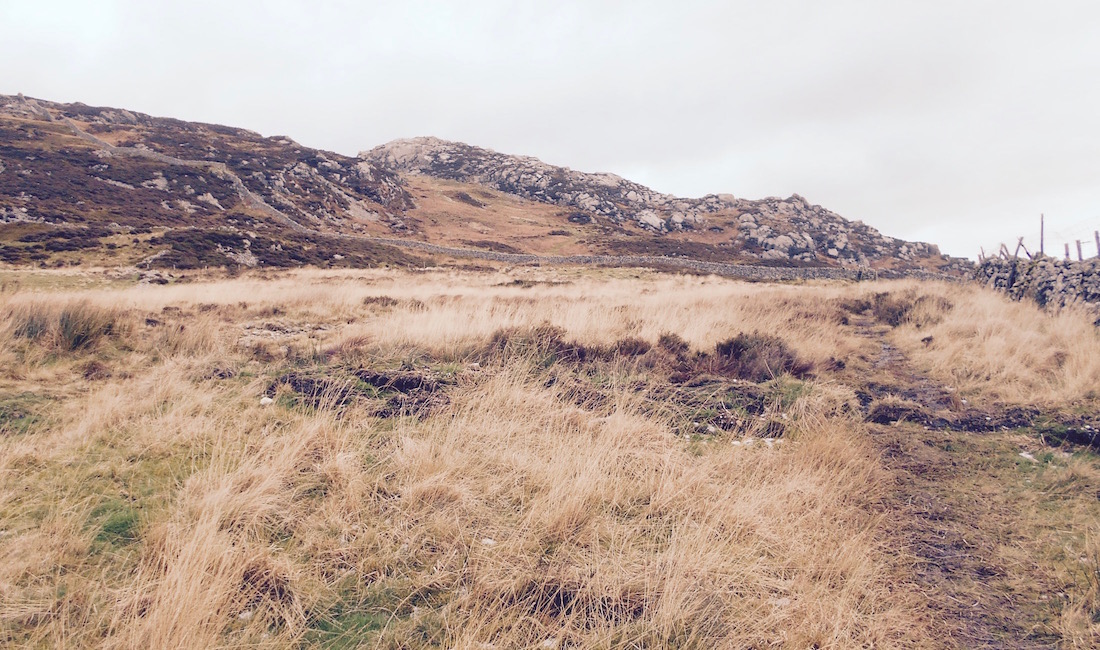
Well this doesn't look so bad. . .
And for once, thank god, I was right. Mostly.
Parking below an old children's playground in Garndolbenmaen that made me wonder if there was an unknown Italian immigrant population, as half the equipment was painted like the Italian flag (realizing only later that the colors are the same as the Welsh flag), as soon as I opened the car door to get changed it started to hail. Sideways.
No, seriously. Wind.
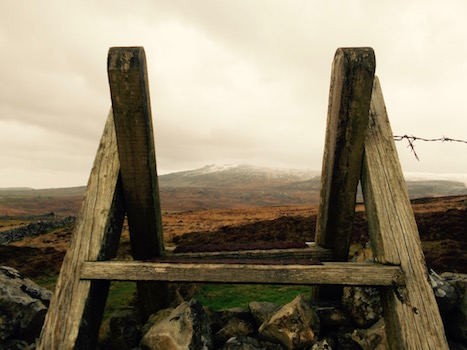
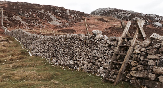
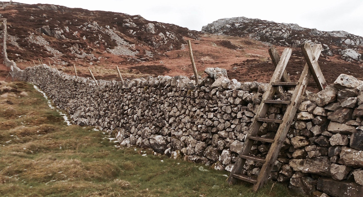
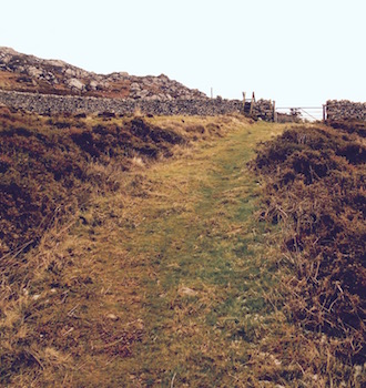
As we started walking northeast, uphill on pleasant village lanes, the hail mostly died off. The wind, however, did not. When we turned right and through a farm gate to cross the Pen-y-Braich spur to get to the hill itself, the wind was still manageable. After we got past the farm yard dogs, and turned right to cross two walls via ladder stiles, the wind was a little stronger, but still alright. Turning left and heading up toward the small saddle back (if you can call it that for such a small hill), we were being pushed around a little, but it was still ok.
Yes, that's a plant blowing sideways
Then we got to the top of the saddle back, and turned right to try to climb to the summit. Then, all of a sudden, the wind was not ok. Not ok at all.
At first it was blowing exactly in the direction I was climbing - so I opened my arms wide and pretty much let it carry me up the hillside. I was making very little effort. But the very top of the hill - effectively a large rock pile with patches of scrub and gorse as well as snow - was now to my right. The path to climb the rocks wouldn't normally be that daunting - maybe ten or twenty feet of maybe using your hands - but the wind was blowing parallel to it, and I could imagine being simply peeled off the hill entirely.
So I took the long way around, using the rocky hill top itself as a windbreak. We climbed around and up that way until we got to a convenient cleft in the peak - high rock walls on either side. Now on my left hand side and up I could see the marker for the top of the hill - to get to it you had to walk through to the end of the cleft, then turn left and climb the last tiny bit.
WIIIIINNND
So I quickly went and did that. Having been protected by the hill top for a few minutes, I may have forgotten how strong the wind was. I was quickly and violently forced to remember when it full-body slammed me as soon as I set foot outside the cleft. The wind felt infinitely more powerful than it had just a few dozen feet below.
After I'd stopped dropped and rolled to safety
I apparently have a fairly strong survival instinct. This, coupled with my complete lack of caring about what I look like in times of danger seem to have immediately combined such that I quickly found myself doing my best possum imitation - I basically let my whole body go limp and just fell flat on the ground like I was dead. Standing up was clearly not in the cards for the top of Craig-y-Garn today.
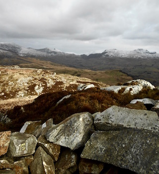
From this position, I surveyed my options, considered going back, but then noticed that there were three wind shelters just up ahead. They were basically semi-circular walls built to the height of the ridge I was currently lying on. So I pretty much crawled forward, and then, to put it as accurately as possible, rolled and flopped my entire body horizontally down into the nearest shelter. If the shelters hadn't been there, I absolutely would have turned around at that point - it was way too dangerous for walking.
As it was, inside the shelter P and I marveled at the wind. I tried to stand up to take pictures, but it literally kept knocking me over. I had a great panorama picture set up by bracing most of my body against the wind shelter wall, but when I got halfway around, the wind actually knocked my arm so violently away from me that it ruined the whole thing and I almost fell over.
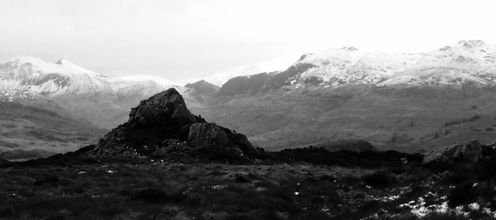
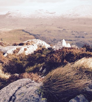
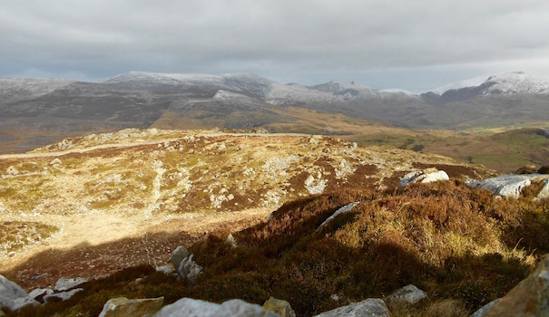
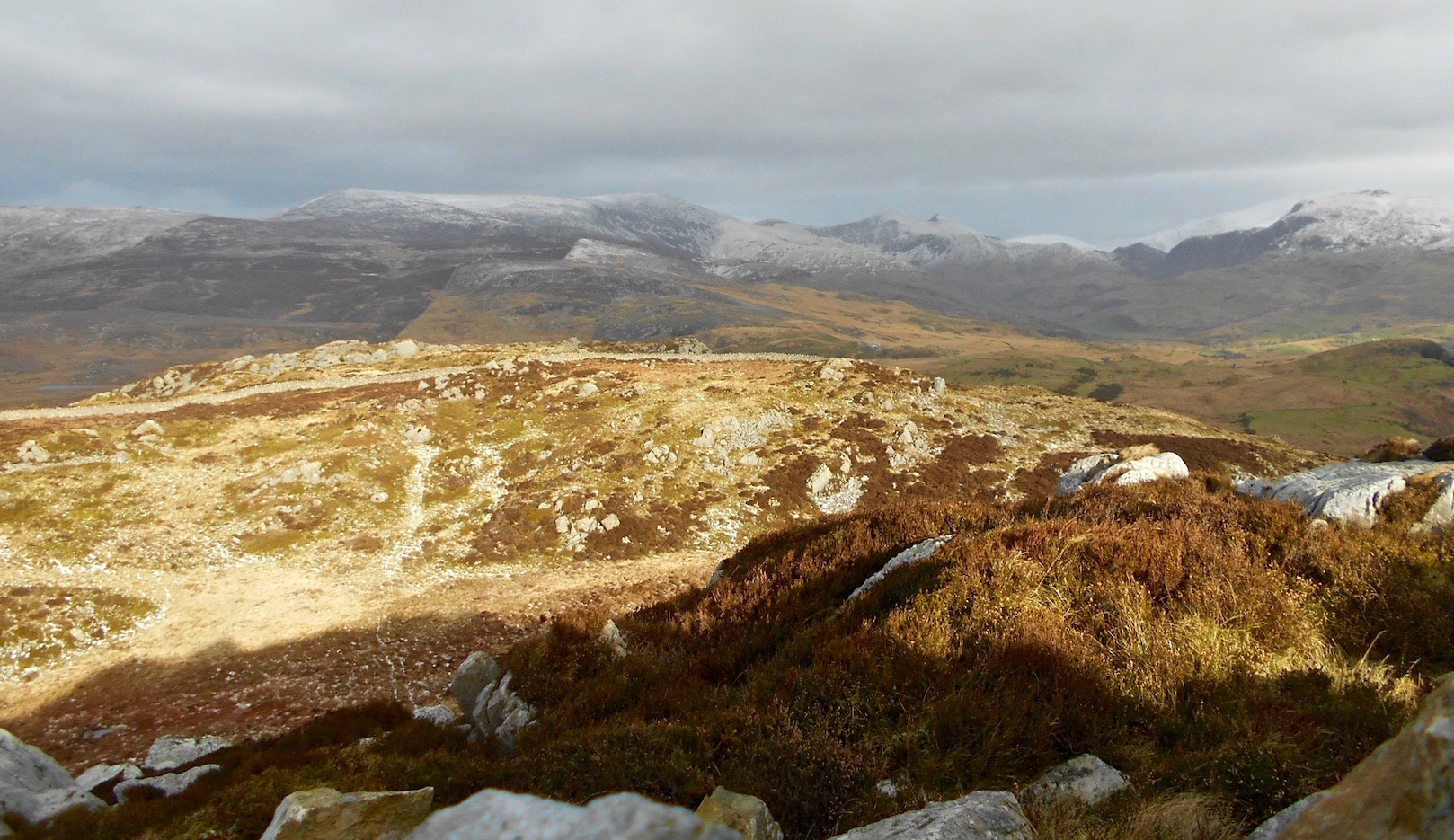
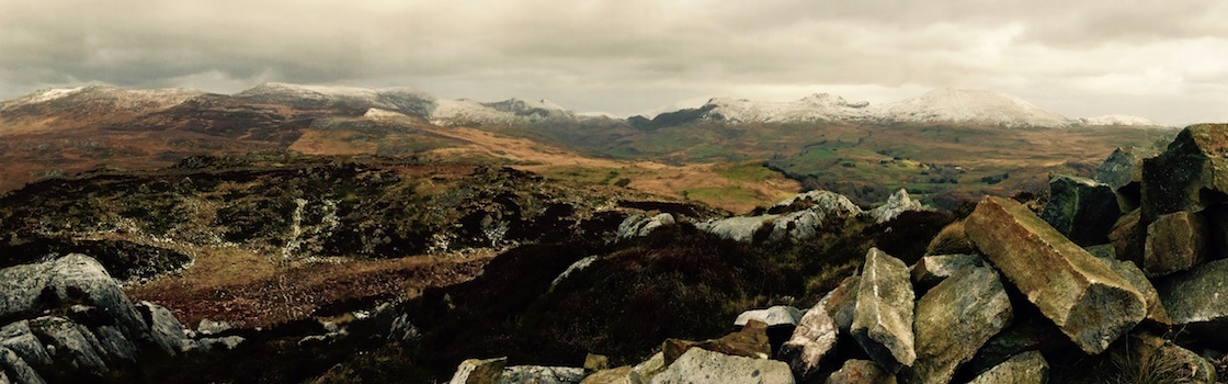
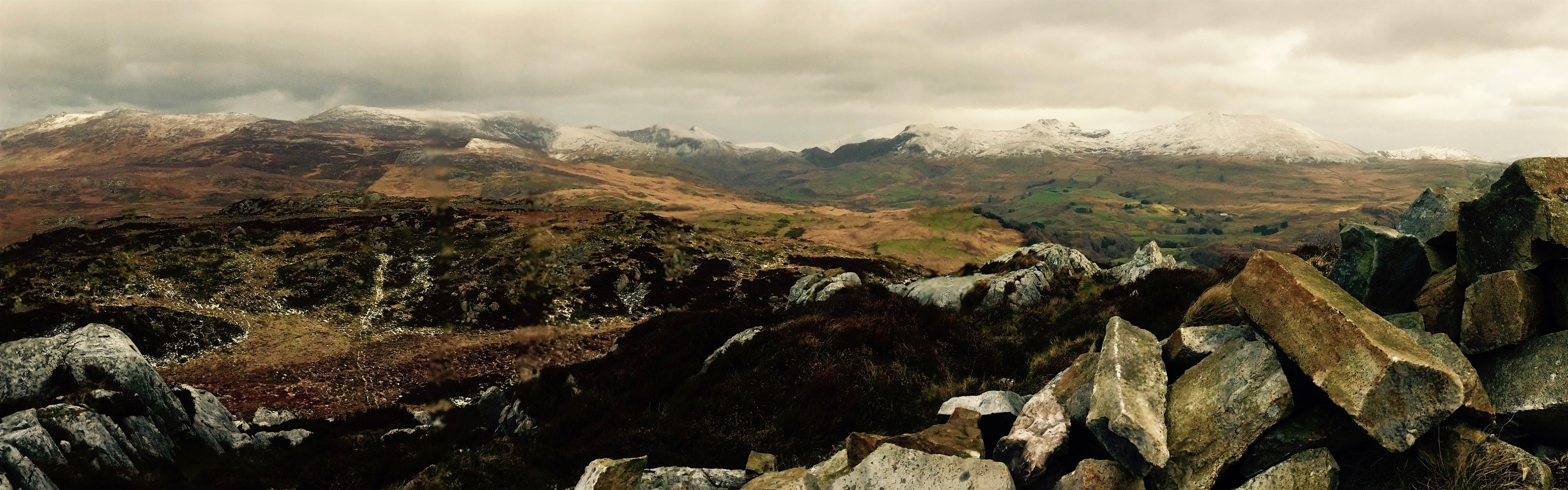
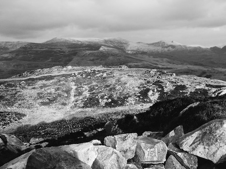
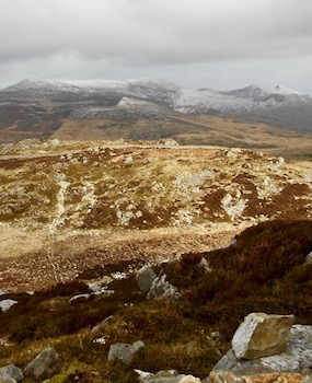
It may be windy, but it sure is lovely up here
That's why, though the views of the larger Eifionydd range were just as incredibly lovely as my guidebook promised, all that I have to show for it are mostly blurry, sort of ok pictures that took way too much effort.
Of course, I still had eyes. And when I peeked them up over the top of the wall, as the wind threatened to tear the hood off my coat and my coat off my back, I was able to see a really gorgeous sight - the Eifionydd range with its upper reaches dusted with the new fallen snow.