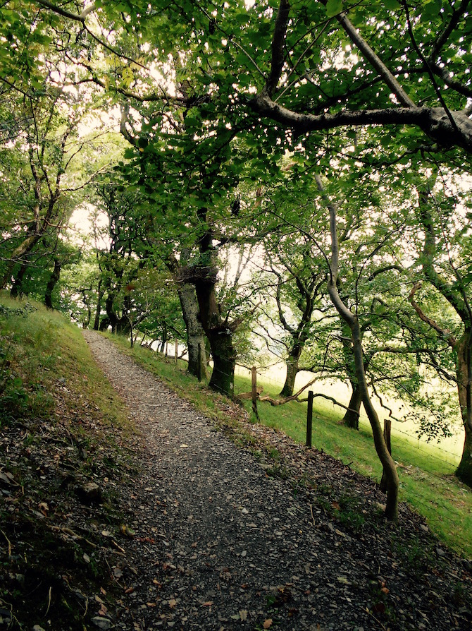
This was a month for learning - how to drive on the left hand side of
the road, where to shop, how long it actually takes to get from one
place to another, how badly I needed to get back into shape before taking
on more strenuous routes (seven years at a desk will do that to you).
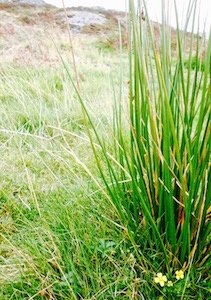
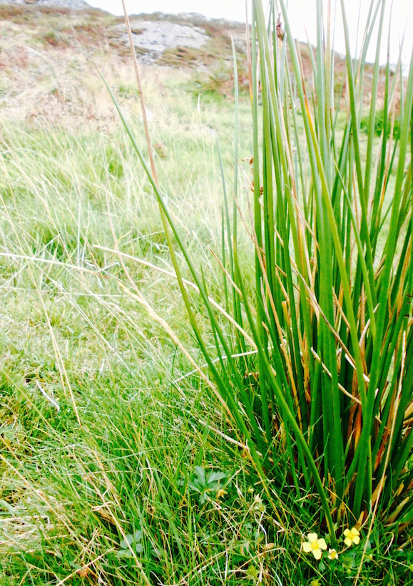
Although most of the walks weren't that difficult, a truly gorgeous
month weather-wise meant I got to see a lot more sites in mid-Wales than
I'd thought I'd be able to. Castles, wetlands, forests, hill-tops,
'picturesque' style estates and Iron age hill forts all made the list, and
all really gave a beautiful introduction to how varied walking in Wales
can be.
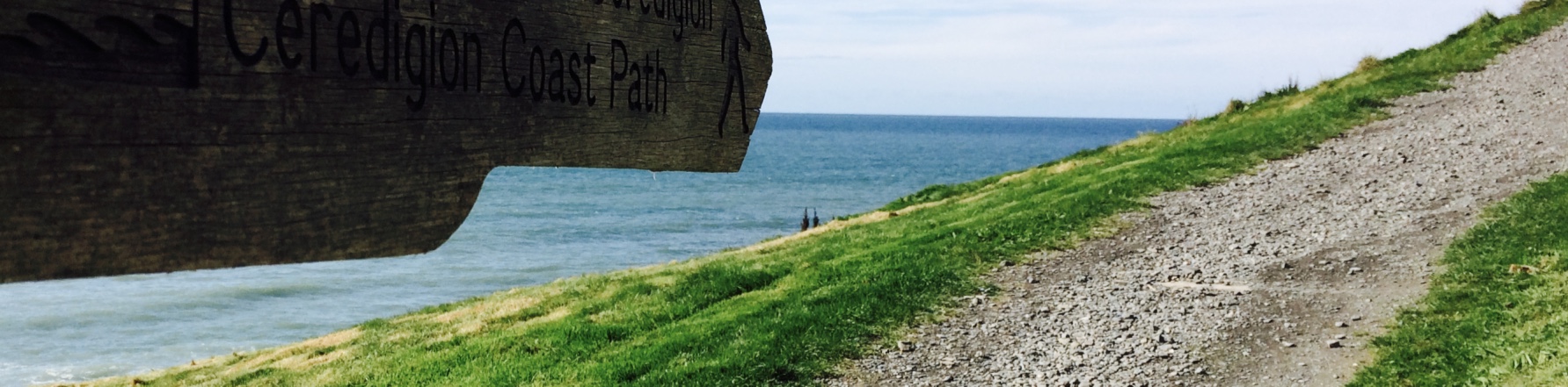
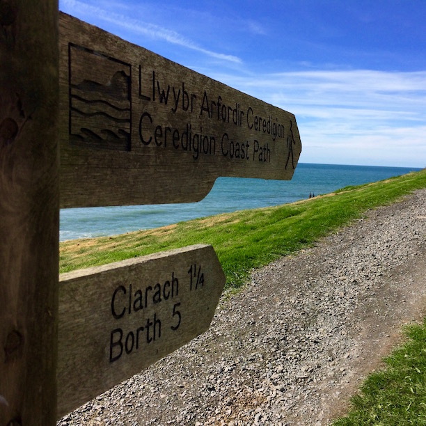
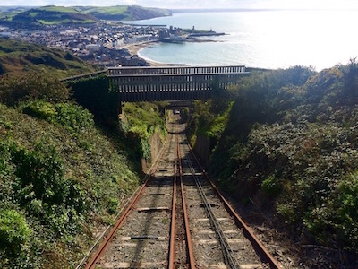
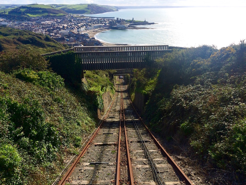
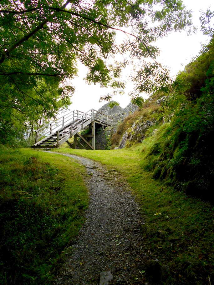
If your idea of a hike is taking a 120 year old railway up a 430ft high hill, well then this is the hike for you!
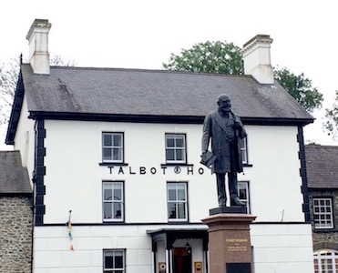
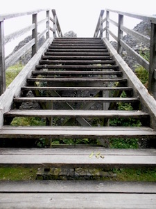
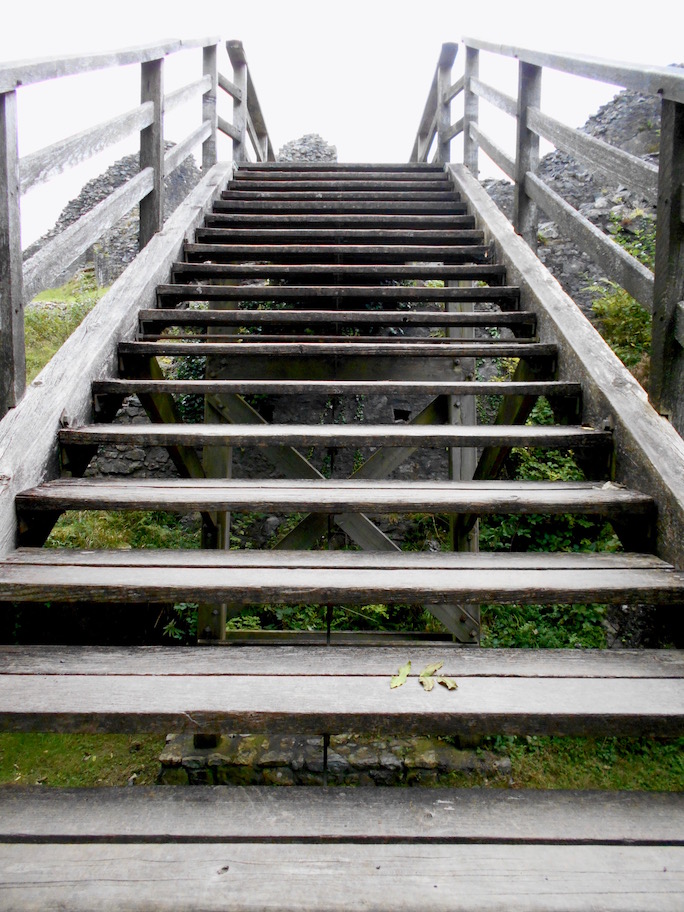
Having been in Wales a few days, and basically gotten over our combined jet-and-transporting-a-cat-in-a-box-across-an-ocean-and-several-countries lag, we arrived in Aberystwyth one sunny late-September day with every intention of hiking the most obvious trail in the Aberystwyth area - up Constitution Hill/Y Graig Glais. Unfortunately someone wasn't feeling well (hint: it wasn't me). So we walked right past the trailhead at the end of the Promenade, and went just a few feet farther up to the quaint brick station at the top of Queen's Road.
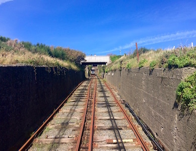
Instead of my first Trail in Wales - my first Train in Wales
I think I just heard something snap. . .
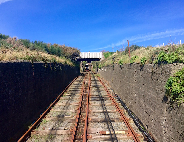
There we began our first Welsh train ride on what the Rough Guide tells me is Britain's longest electric funicular railway. This 1896 cliff railway had it's benefits compared to the trail - among them, my only having to hear Sicky McGee worry about the height of the train ride for a few minutes, rather than hearing illness complaints for an entire hour long hike.
Of course I didn't admit it at the time, and I'm sure the good people of the Aberystwyth cliff railway know what they're doing, but the train did seem to be huffing and puffing to make it to the top. My quiet wondering as to whether the steel cable would snap as it dragged us to the top, of course, made the trip worthwhile in and of itself. There's really no sense in taking a 100+ year old train up a cliff if you can't feel the bumps in the road.
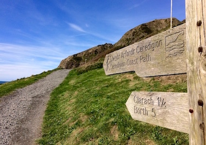
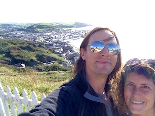
In any case, the best views are definitely from the bottom end of the train. On the way up, Aberystwyth and eventually the entirety of Cardigan Bay slowly reveal themselves as the train approaches the top terminal. You also get a lovely view of the hike I'd actually intended to take, including under a bridge where the hikers stop to take photos of the train passing. The trail looked lovely, you should definitely do it, two thumbs up.
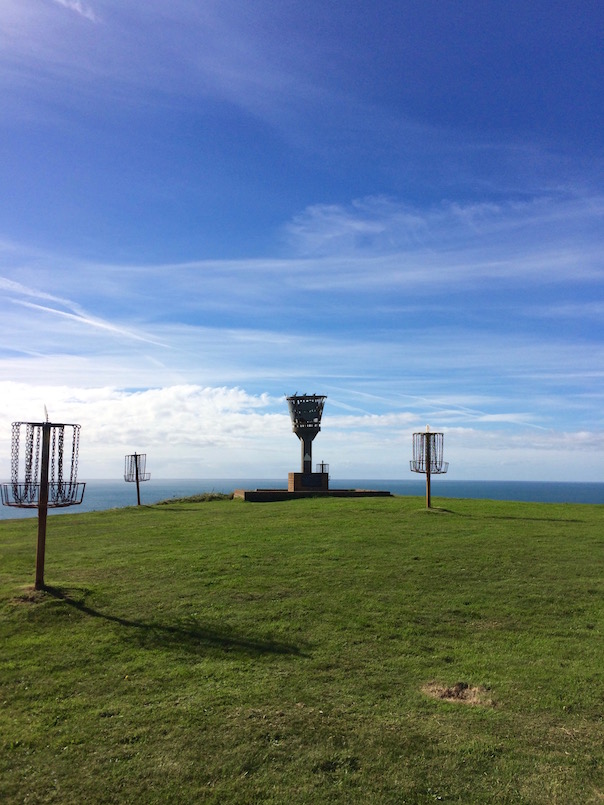
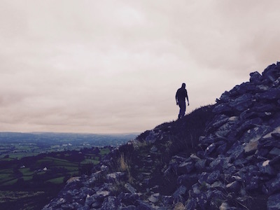
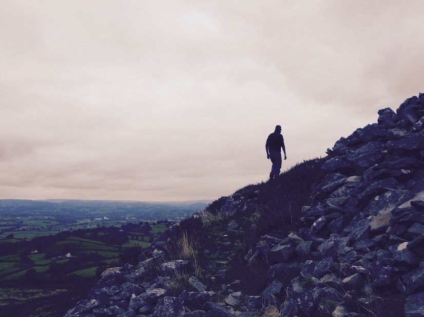
So I'm on Constitution Hill - Now What?
Forth Eorlingas!
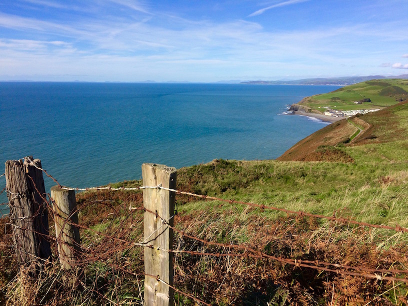
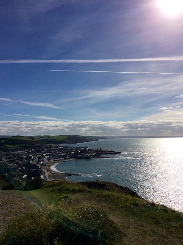
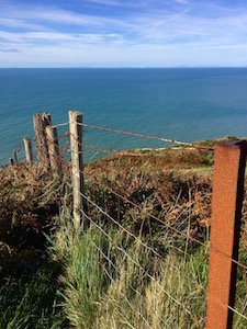
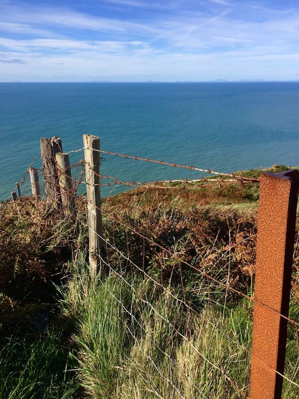
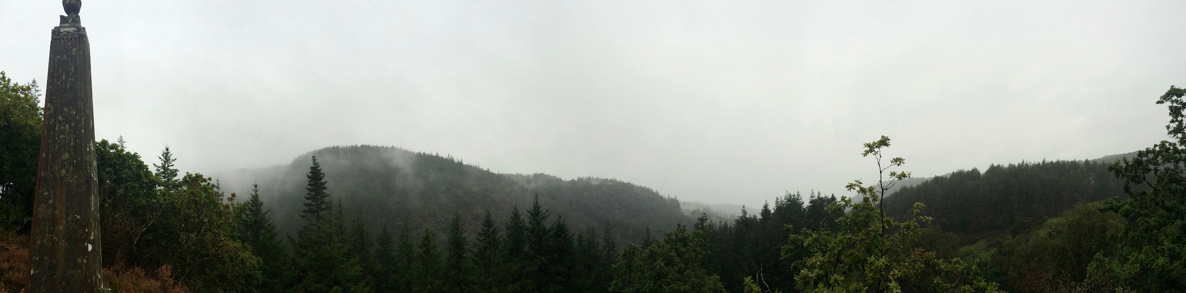
Two things will strike you after you leave the top terminal and started ascending Constitution Hill. First, the beauty of the view of all of Aberystwyth, the blue sweep of the south of Cardigan Bay and the surrounding emerald hillside to the east.
Second, the certainty that soldiers of Gondor, torches aflame, are definitely on their way to light the giant metal beacon you will see inexplicably standing right in front of you, obviously put there to call the Riders of Rohan in case of Gondor's need against the forces of Mordor. On closer inspection this beacon will turn out to be the rather intricately worked end of a frisbee golf course. Same same.
Anyhow, due to sickness we didn't spend a ton of time on top of the hill, but during a decent circuit we found some comfortable benches in a little landscaped grove, a cafe with great outdoor views, and something called a 'camera obscura'. I have since seen a few other references to these machines but haven't gone in yet. Apparently, Victorian beach goers flocked to this sea side activity, where, using mirrors and lenses far away scenic views were projected against a screen, or something like that. Anyway, if YouTube ever breaks down, it still exists.
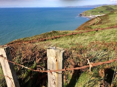
No, that is not Ireland
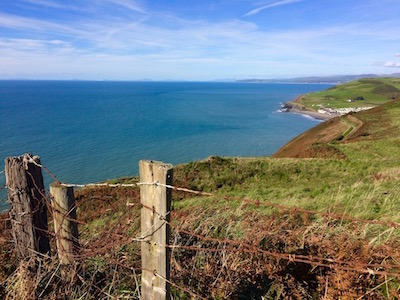
As we walked around, we tried to figure out what country we were looking at, and did a pretty poor job of it (hint: none of what you can see from the Welsh coast is Ireland. None of it. That? Nope, not Ireland. But what about. . .? Nope, still not Ireland.) I really hope nobody heard us because in hindsight we sounded like giant morons. After consulting a map, I can now confidently say that we could see the entire Cardigan Bay - all the way south, and all the way north. We saw absolutely none of Ireland.
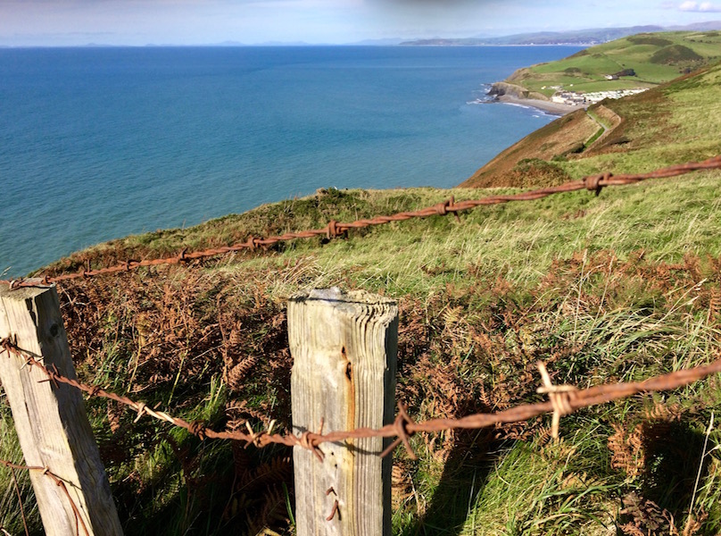
On Caravan Parks
[Side Rant: Despite Rough Guide Wales' concerns about a northern vista that includes 'hordes of caravans. . .resembling legions of tanks poised for battle' - I barely noticed they were there until I re-checked my pictures. I've since gotten the idea into my head that the Rough Guide Wales authors seem to have a problem with caravan parks. To my non-British mind, while the deep green hills and blue inlets that house these rows of neatly arranged green trailers would absolutely be more scenic without them - pretty much everything on the planet would be more naturally scenic without our stupid vacation houses stuck on it. And I don't see how I can begrudge someone who wants to affordably make what I also consider a beautiful view a permanent fixture on their holiday. End Side Rant.]
Lovely views. . . Except if you hate other people going on
vacation
But anyway, in case you were wondering - there are caravan parks in between Aberystwyth and Borth. If you're terribly bothered by them, while on Constitution Hill try to spend your time focusing instead on the beautiful green-blue Irish Sea vistas, where the tiny boats bobbing on the horizon only add to the beauty of the scene (and it's harder to tell at this distance whether their owners are rich or poor). [OK now for real End Side Rant.]
The ride back down on the funicular was just as pleasant as the ride up - possibly even more so given we shared this ride with benches and benches of lovely silver haired Welsh-speaking tourists. Because there's nothing like the feeling that you are about to slow motion crash-land in Aberystwyth to the accompaniment of quietly raucous laughter to jokes told in a language that sounds strangely like a Swedish person speaking Irish backwards.
Anyway, Constitution Hill seemed like it would have been a good hike, and since it's straight from the middle of Aberystwyth, it's pretty easy to make happen. Maybe I'll take advantage of the Aberystwyth micro-climate and actually hike this hike in the future. . .
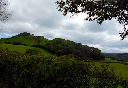
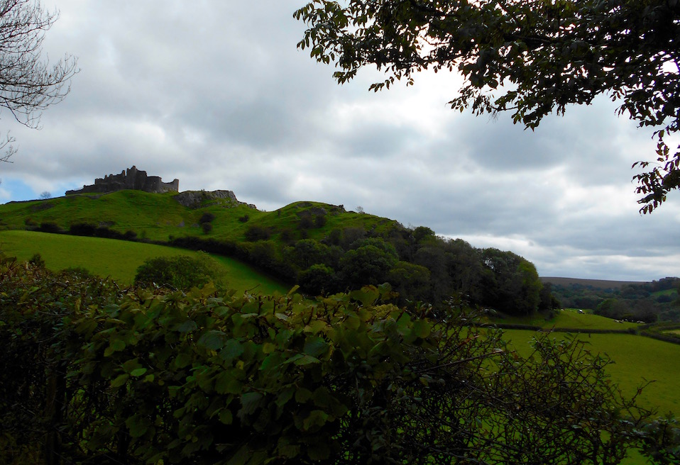
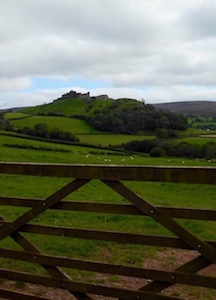
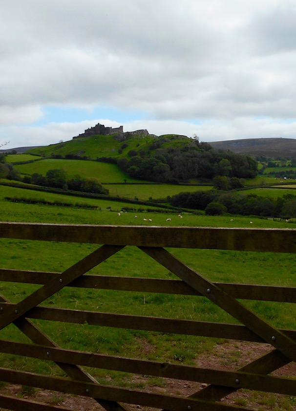
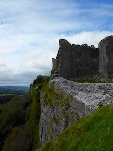
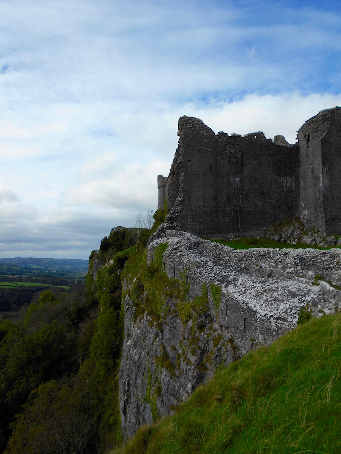
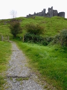
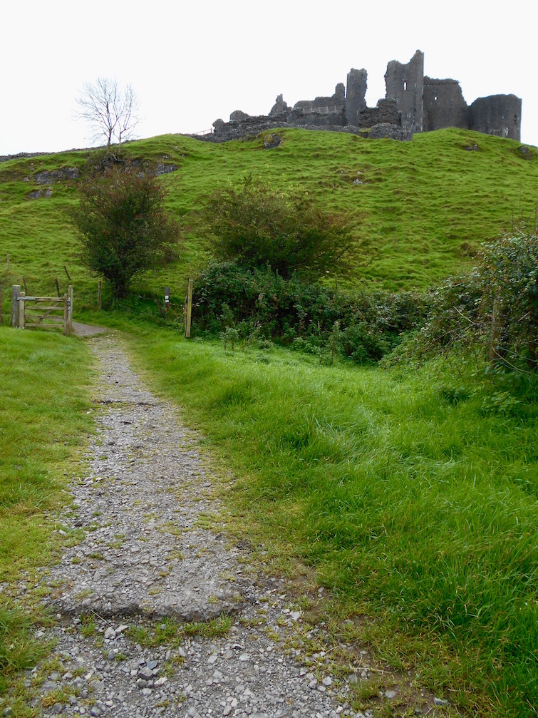
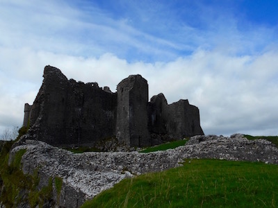
Our first week in Wales we'd failed spectacularly in several areas - we had a giant van that was too big to negotiate the local roads, we had no place to live, and we had very few prospects to look at before term started the first week in October. So, our first weekend in Wales, we decided to head ostrich-like to the 'best sited' castle in the country, Carreg Cennen. Because for some reason the absolutely lovely re-done barn with sleeping loft in a lovely mid-Wales hillside farm location, with sweeping views and fabulous Air bnb hosts just wasn't good enough.
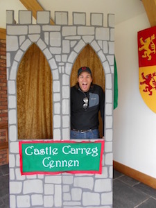
Always wanted his own castle
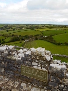
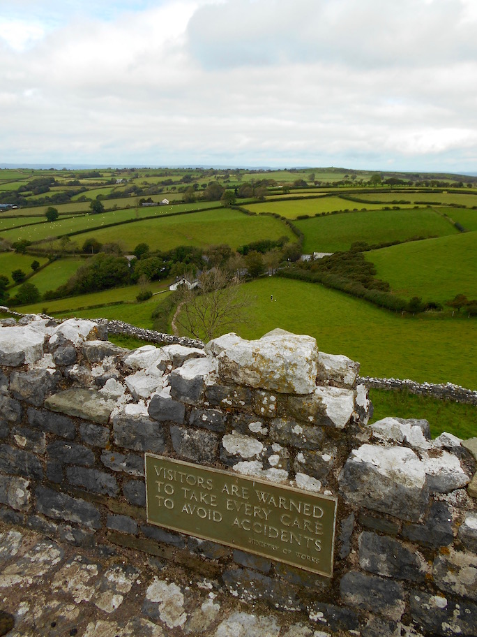
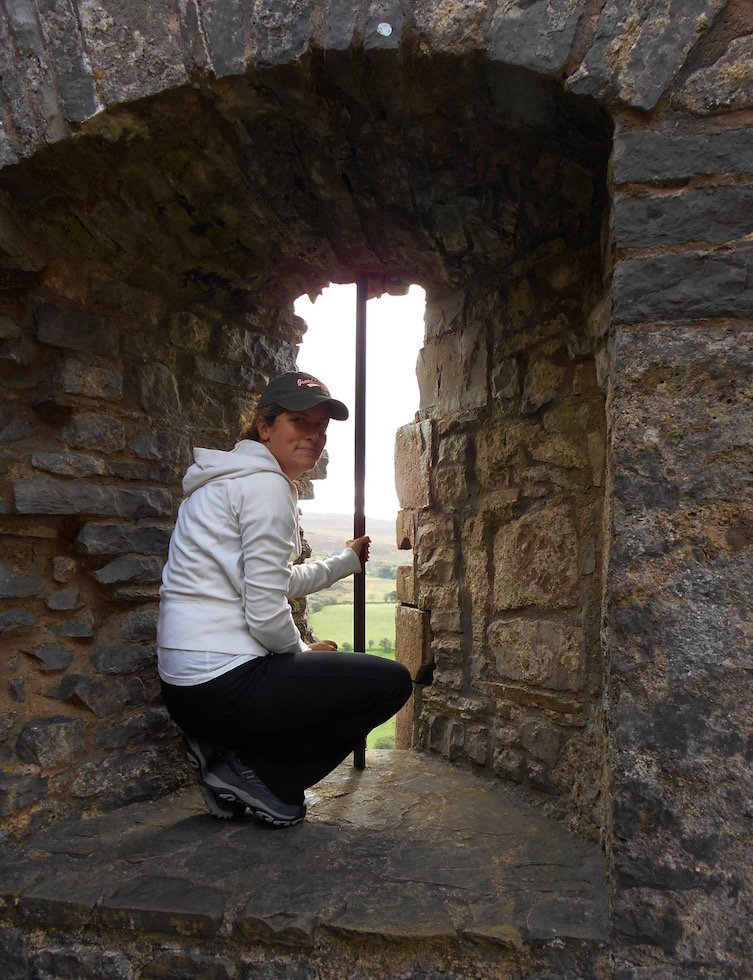
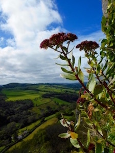
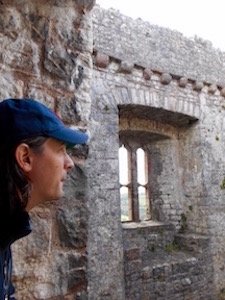
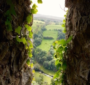
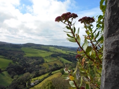
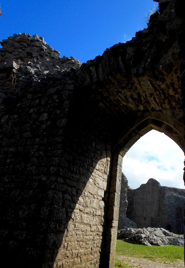
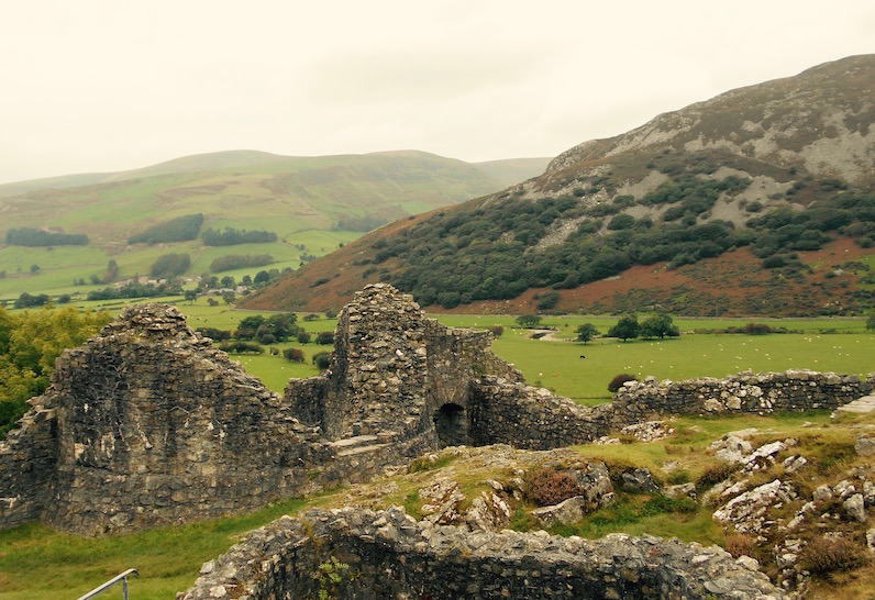
After the hour and a half it took us to negotiate the drive south in our too-big van on too-little roads, I almost forgot I was homeless. Not only did the children's area and interactive timeline of the castle have lots of buttons to push, cutouts to play with, and attempts to make Lord Rhys's having 25 children through various wives and mistresses sound both amusing and child-friendly (all of which are great fun for jet-lagged adults), Carreg Cennan clearly lived up to its reputation. Built in the mid-13th century on the same massive stone outcrop that King Arthur's knight Sir Urien is fabled to have built on earlier, it's a 300 foot drop down to the Cennan River. Sitting in Brecon Beacons National Park, on one side there are rolling bucolic green sheep-dotted hills, and on the other is the imposing Black Mountain.
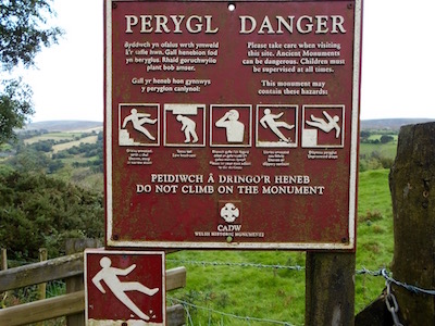
Beware of migraines, banana peels and Atlas Shrugged
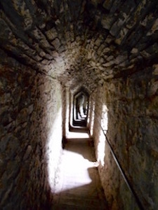
A short walk from the visitor center brings you to where you can pay to get in and rent a flashlight to explore the cave under the castle (you can also use the light on your phone). Possibly more importantly, there is also a sign that gives great detail about the many ways you can hurt yourself in the castle, including, I believe, eating a banana,
dropping the banana peel on a parapet, and then your becoming distracted and stepping on said banana peel and falling to your death - all this being explained in very detailed cartoon-form.
Right next to this sign of death and destruction, was another sign where we learned there were 3 to 4 thousand year old burial cairns (Tair Carns Uchaf and Isaf) on top of the nearby hills. I barely restrained P from randomly setting off into the wild without a map to see if we could hike there. The compromise being that later we took a short hike on the path leading away to the left of the castle, in search of a nearby geocache. Although I didn't get a 6000 year old monument under my belt, we did unearth some
well-geocached pink nail polish.
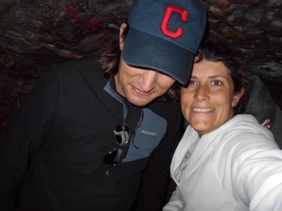
This is a selfie - or is it?
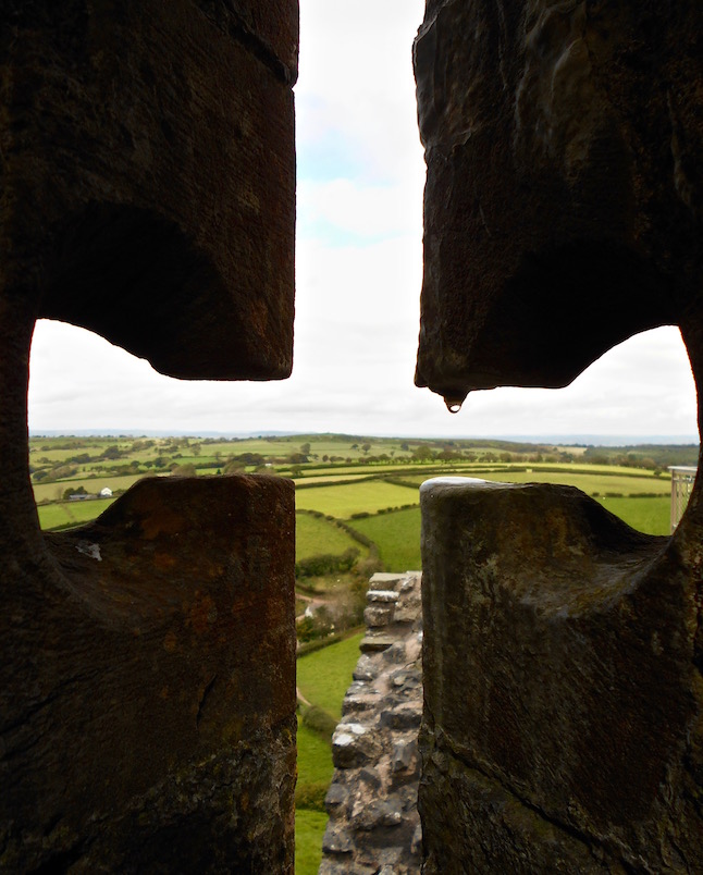
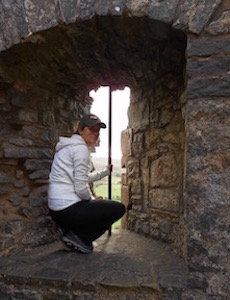
At Carreg Cennan itself, P was very excited about his first Welsh castle. I was very excited to be outside, in particular not in a giant van on tiny hairpin turn roads on the left-hand side of the road. The castle itself was in pretty good shape for a ruin, it's still a pretty massive structure. But the definite best parts were the view and the cave that ran under one side of the castle. Apparently this cave was used as a shelter thousands of years ago - and now it definitely gives you the opportunity to see what the color 'pitch-black' really means. I of course took the opportunity to try to scare P as much as possible in the dark, and succeeded in whacking my head pretty bad against the ceiling, and nearly killing myself sliding off wet stones.
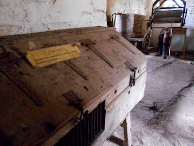
Don't come a-knockin' when this ferret hut's a-rockin'
Other notable highlights included the very green grass below the several story-high giant toilet chute running down the back of the ruin leaving very little to the imagination, and the long house below the castle, where for centuries people lived 15 to a room, alongside cattle . . . and apparently ferrets. Although for some reason the ferrets had their own quarters, living in something called a ferret hut, which I guess was necessary if you didn't want to wake up next to your 14 brothers, sisters, aunts, uncles, cousins, parents and grandparents, only to find during the nighttime you had somehow acquired a squirming ferret in your pajama pants.
Yup - that's a view
In any case, we left happy and hungry. Although the nearest pub we could find (which inexplicably was right next to a road-sign showing a nearby helicopter) was closed, we drove back over the truly lovely bridge into Llandeilo, back out again on the other side, and after getting a little lost, went to the Plough Inn. Although I managed to change out of my hiking boots into the red shoes I luckily found in the trunk of the van, we were notably underdressed for the restaurant on a Sunday afternoon - we really should have figured out where the pub was rather than blindly following the hostess to the restaurant section. In any case, no one made any mention of our being notably dirty and also 30 years younger than everyone else, so we ate our perfectly acceptable Sunday roast with more vegetables than I've ever seen in total leisure, and went on our way.
Of course, I'd found a marking on the road map that said 'Carn Goch.' Since we'd decided to forego the other Carns, and this one was on a map, we figured 'why not?'
So, after seeing Carreg Cennen, eating lunch, and then proceeding to take several backroads in entirely the wrong direction, we found ourselves in a giant van on a two way road that really wasn't big enough for one car never mind two, with either stone walls, plants, curves or forest blocking visibility on all sides. Just a typical day on Welsh backroads.
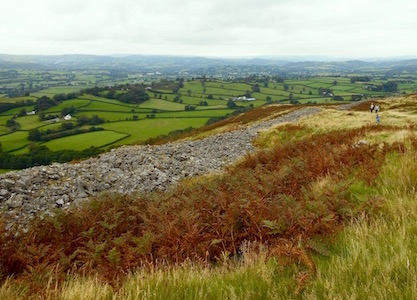
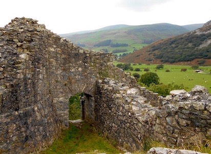
So the burial chamber is actually a fort
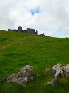
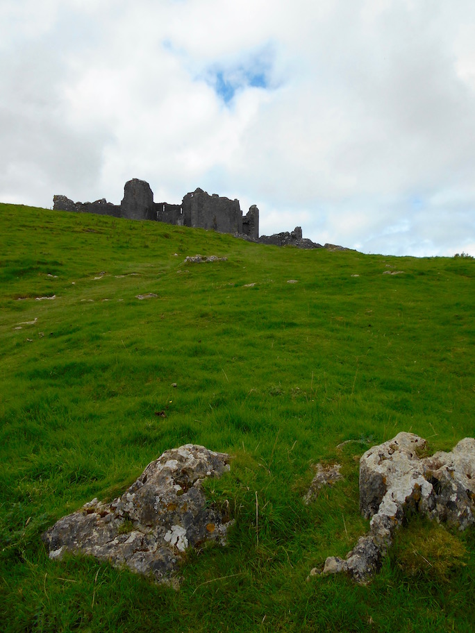
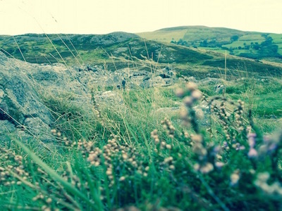
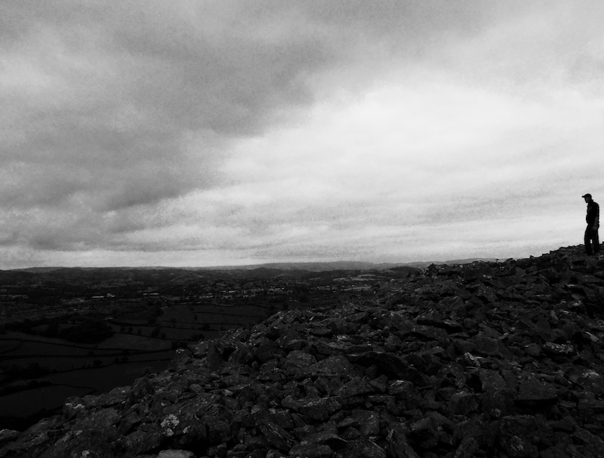
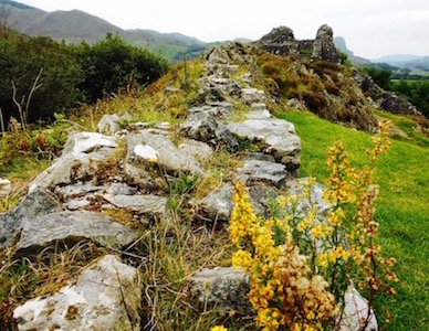
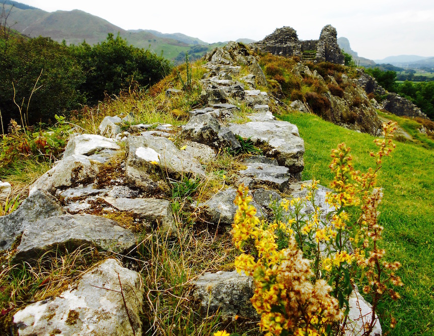
We did finally make it to Carn Goch, and found a few other cars of people taking a post-Sunday roast ramble to who-knows-where. As it turns out, the Carn Goch of my map, is in fact the more alliterative Garn Goch, and isn't a burial chamber but is two Iron Age hill forts.
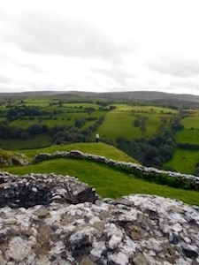
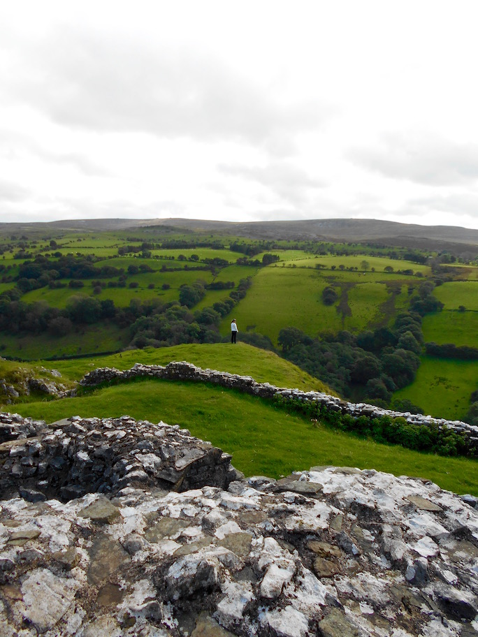
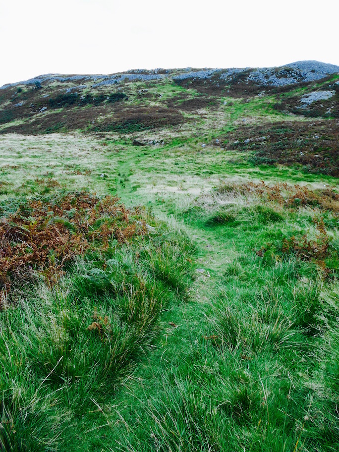
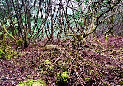
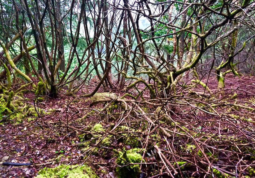
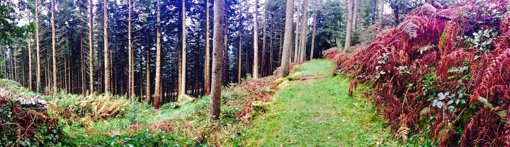
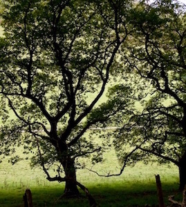
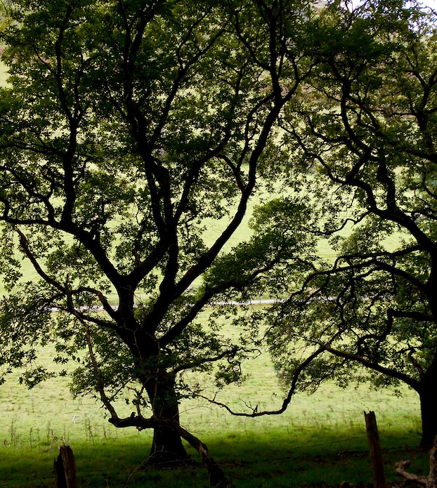
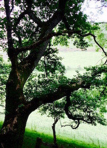
What I learned from Garn Goch is that Iron Age people really could haul stones. I mean, this place was on top of a hill, and although the walk itself was only forty five minutes roundtrip from the car park, I wouldn't want to do it over and over and over again for years while carrying giant rocks. I don't know what else the Iron Age inhabitants had to do with themselves, as this was well before Sunday night football and everything, but basically they encircled themselves with a giant pile of stones on all sides, as a way to keep out the enemies which they'd be able to see advancing from their panoramic hilltop location. It's hard to tell from the pictures - but the site is actually really huge. A lot. of. rocks.
Rocks. On a Hill.
Maybe the Romans stole the geocache
Of course, this walled hilltop failed to keep out the Romans when they came in 70AD and slowly brought Wales into Roman Britannia, but that doesn't make it any less interesting to walk around now. Because this is Open Access land, you can walk wherever you want. We tried to use this to our advantage to finding the day's second geocache, but not only did we get stuck in some kind of nasty ferny/rocky/not very nice terrain, when we got to where the geocache was supposed to be hidden, we couldn't find it anywhere.
Regardless, the views from the forts were charming and expansive, the hike itself was very pleasant, and may actually have made the not-inconsequential drive back to the main-ish roads to mid-Wales worth it.
It turns out this jacket isn't entirely waterproof . . .
September 21, 2016
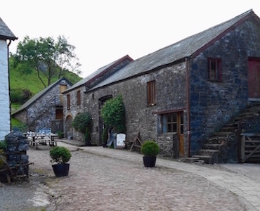
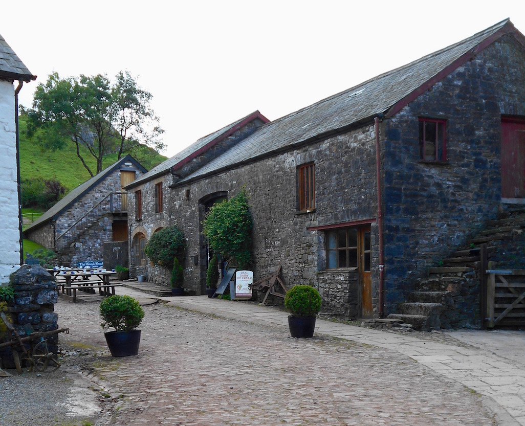
Second week in Wales - still no place to live, and we had to switch Airbnb's to the only other pet-friendly house in the area. Luckily, we found ourselves in a lovely converted goat-shed with fabulous hosts who surprised us with homemade cakes, fresh eggs and organic vegetables. Also they have a small picture book devoted entirely to 'Men in Sheds' which would have made the stay worth it all on its own.
Hello, complete absence of visible wildlife. How are
you?
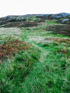
The out-of the way location near Llangeitho wasn't just idyllic, it also allowed me to explore what turned out to be some of the better-signposted short walks in mid-Wales - Cors Caron and Hafod - while P went to his school induction. Unfortunately, the lovely blue skies and downright steamy weather we'd come to expect from our first week in Wales had suddenly turned to rain. But, fresh from a quick shopping trip to the local Mountain Warehouse (and a prior trip stateside to the local L.L. Bean), I was intent on testing out my new waterproof trousers and shoes - my jacket had been well-tested skiing in New Hampshire the year before.
Or so I thought.
It's just a little rain
So this is why Wales has a reputation for rain . . .
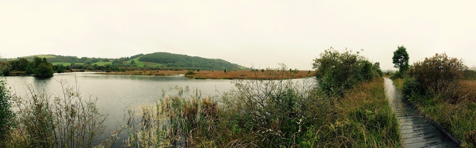
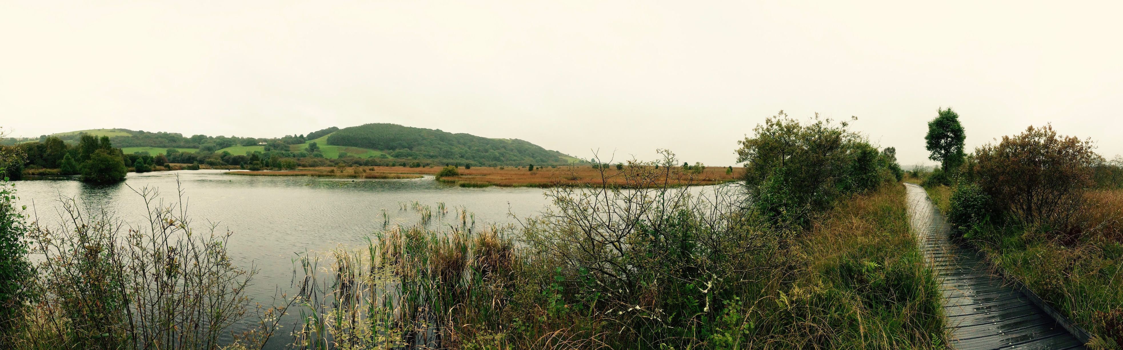
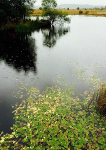
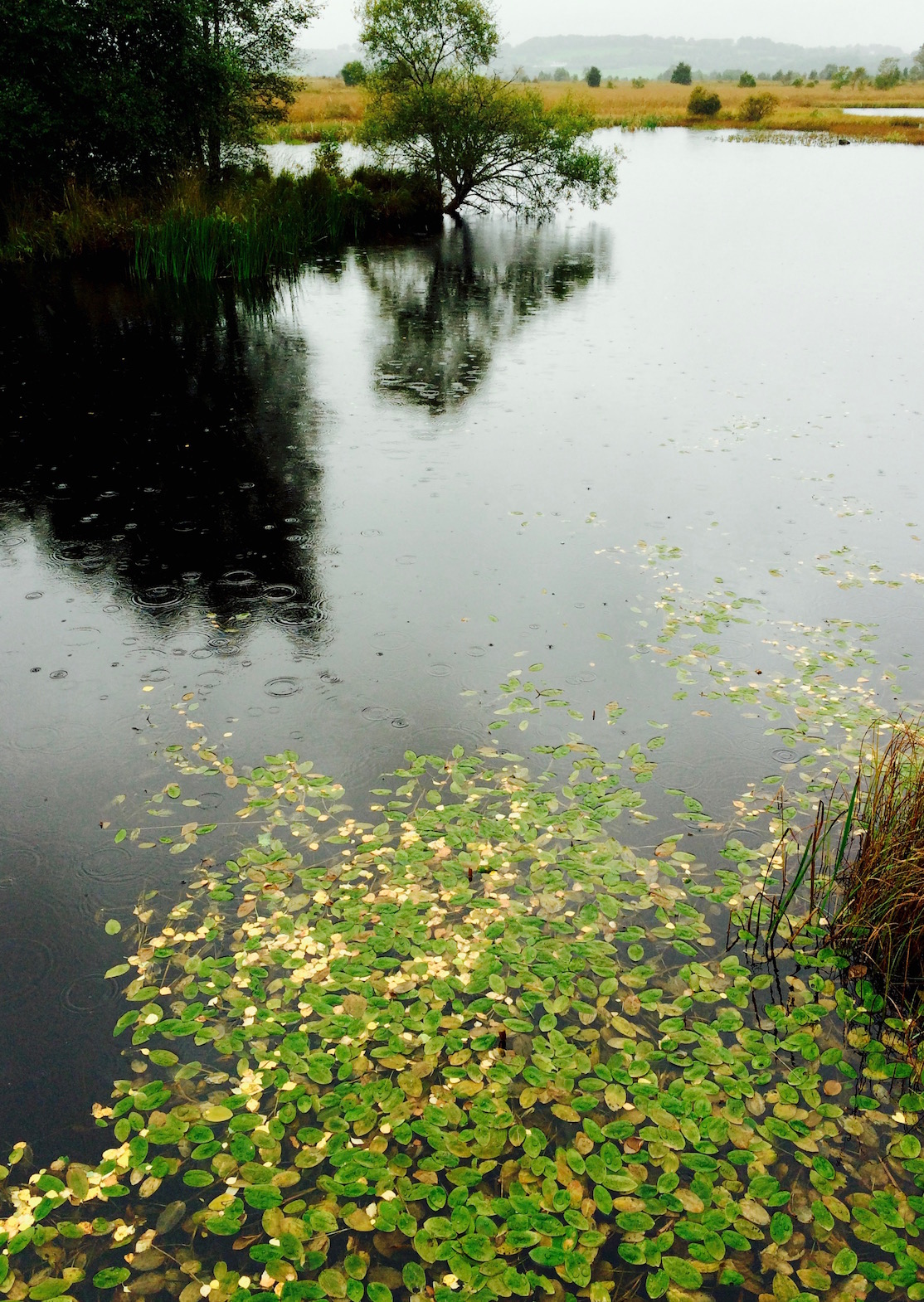
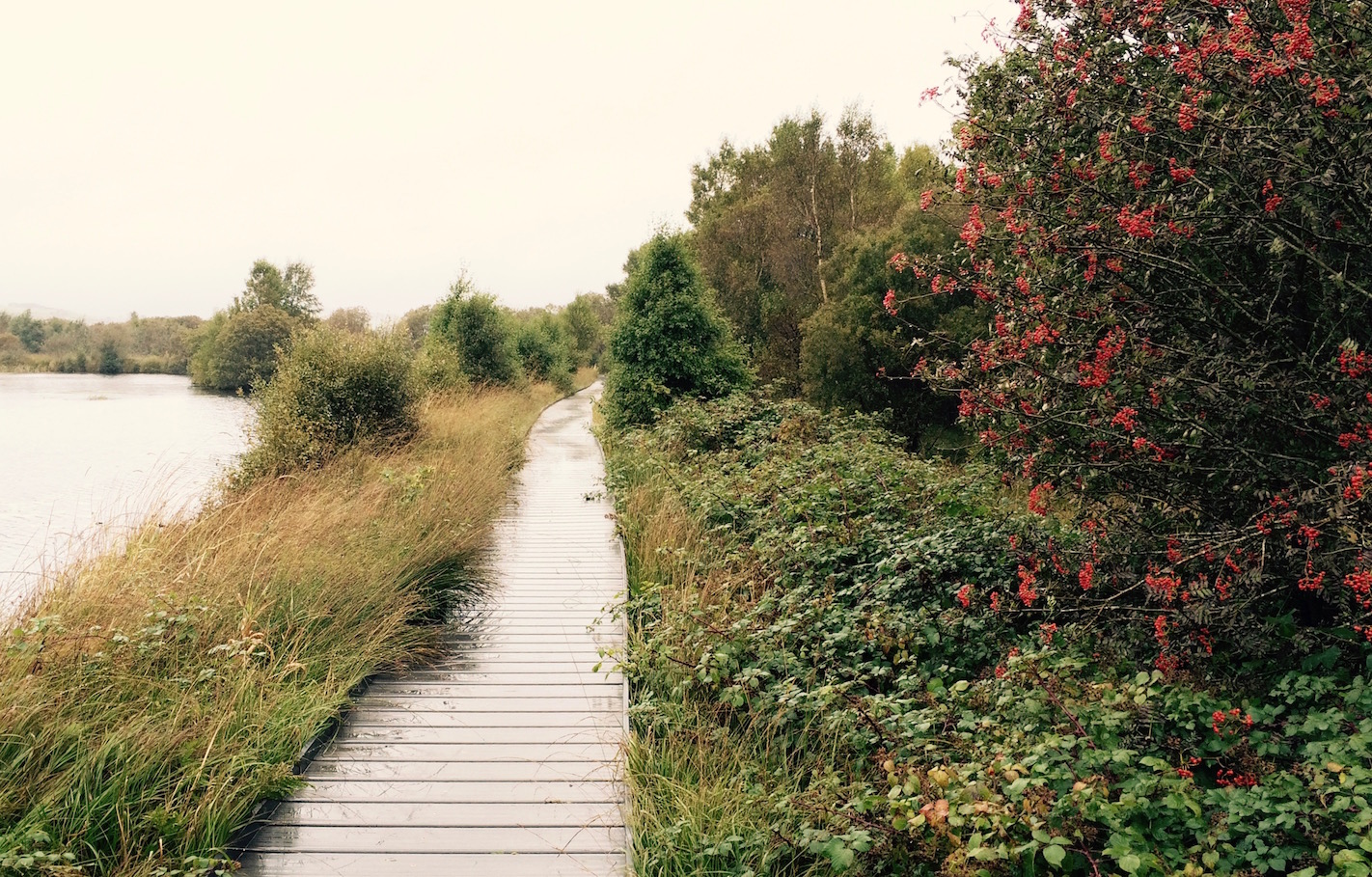
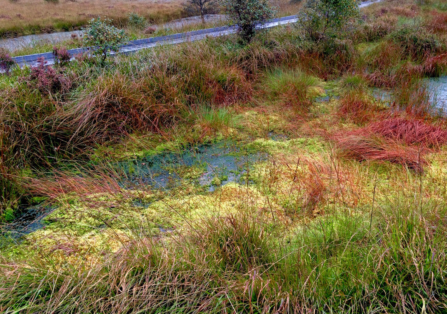
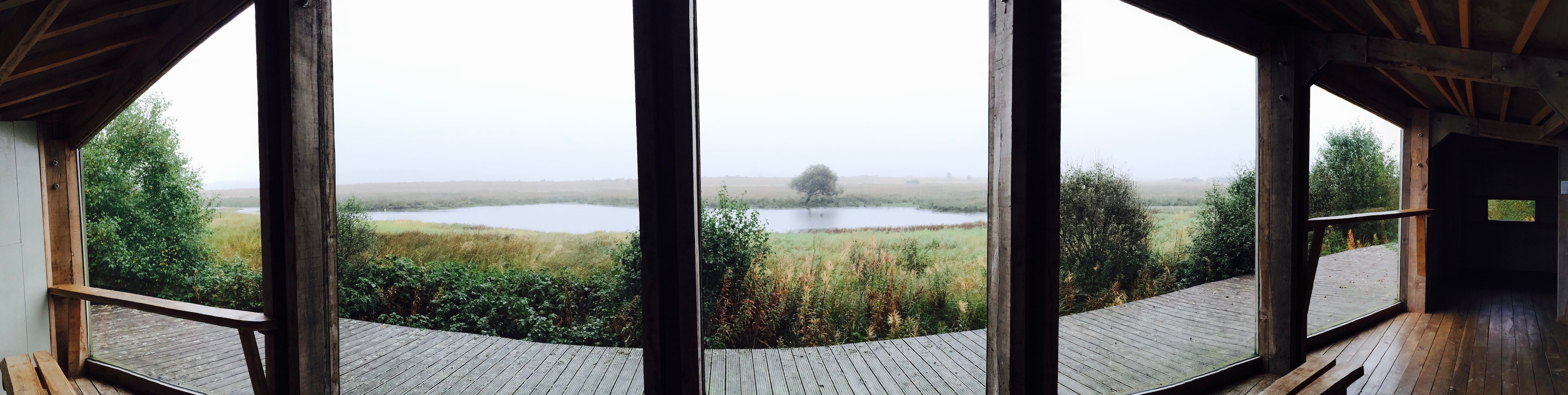
Cors Caron is a wetland wildlife refuge near the town of Tregaron (birthplace of the man who thought up the 'Peace Union' - precursor to the League of Nations and thus the UN in the 1800s), which according to the Rough Guide is 'one of the most prodigious [for wildlife] in Wales'. Although I soon learned the meaning of the word 'wetland', the wildlife were unfortunately few and far between during my trip.
You see, when I got to Cors Caron it was raining a little. When I left Cors Caron buckets of water were being unceremoniously dumped on my head. In the mid-point of my walk around the very pleasant, entirely unchallenging, one mile boardwalk circuit, it had started pouring buckets - and I noticed that although nothing was getting through my waterproof trousers and shoes and hood, my pockets were like soaked sponges. Apparently my jacket was mostly waterproof - but when water ran off the bottom, it soaked one of the linings of the coat, and the pockets were external to the internal waterproof layer, and so . . .
Oddly enough, I was weirdly somehow excited about being out in my first real Welsh rain. I figured I needed to get used to it, toughen myself up for all this walking in bad weather I'd be doing.
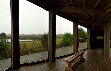
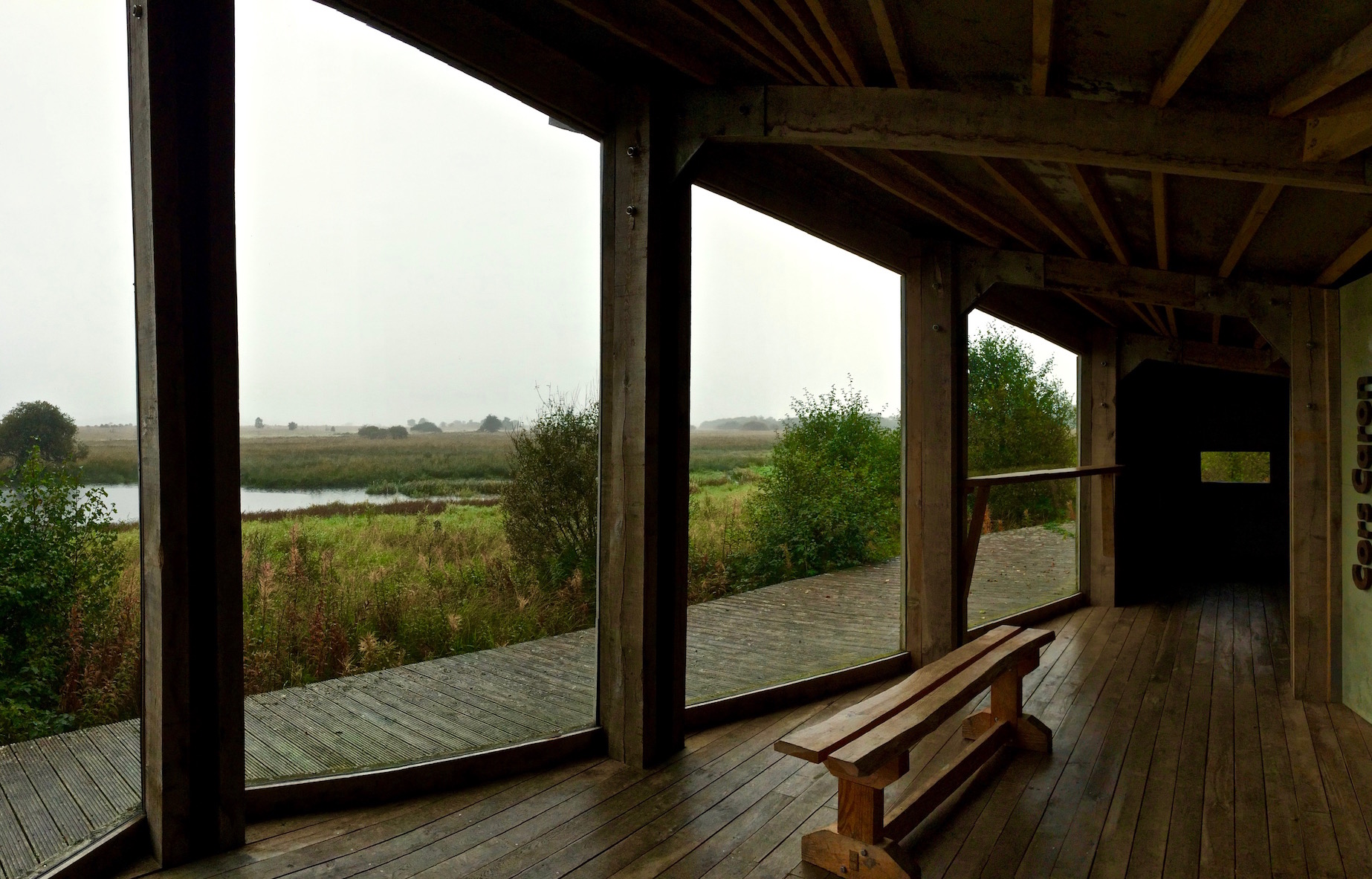
There are (soaked) birds out there somewhere
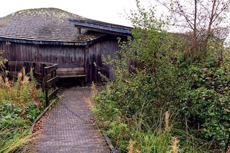
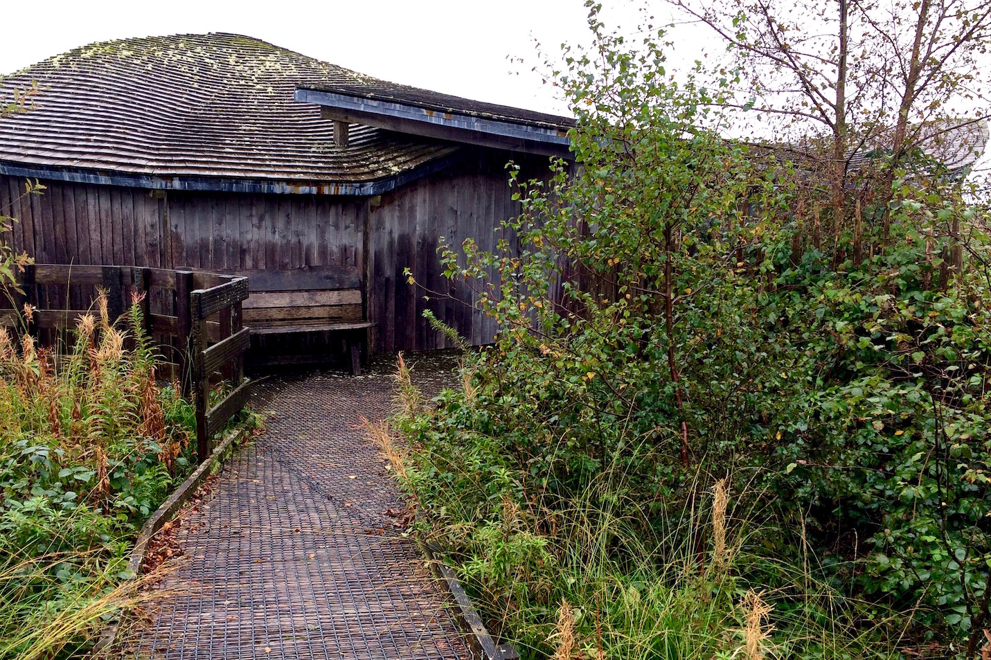
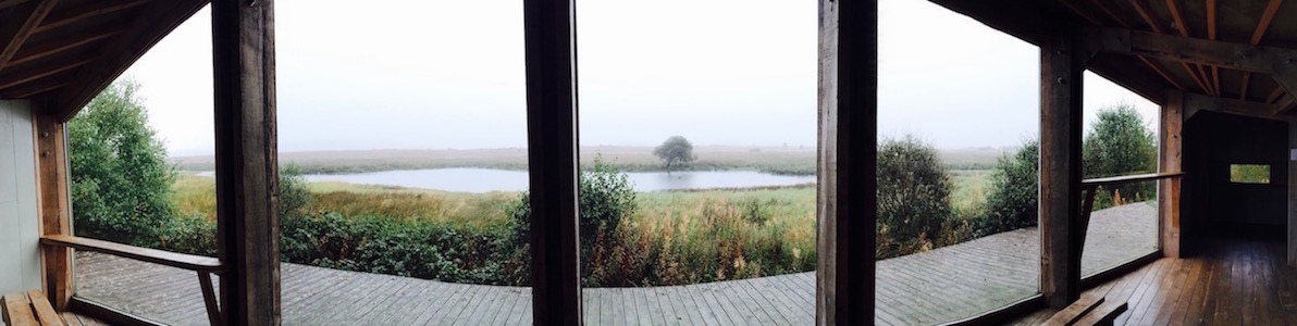
Meanwhile, it was raining so hard I couldn't see anything, and could barely keep to the boardwalk. Luckily I had had a brief respite earlier in the hike and had seen some horses, a few birds and some interesting colors of grasses and trees. There was also a quaint wildlife viewing blind - where the only other visitors were watching a single bird through binoculars. Ah, binoculars. That would have been a good idea.
In any case, I couldn't see any wildlife either because the rain was so hard I couldn't open my eyes, or else the animals weren't as stupid as I was to be out in that much rain. I tend to think it was the latter. I'm sure they were out there somewhere, as the place is a reclaimed peat bog that has built up over 12000 years, and is supposed to be surrounded by many different kinds of habitats.
Other activities in the area
I think the other trails here would have been great in other weather. There's the harder surfaced cycle and hiking Ystwyth Trail that follows the old railway route to Aberystwyth as well as the 7km Riverside Walk that is probably better for wildlife viewing, as it goes into the heart of the park, but also overflows or gets muddy in the rain.
A gateway to. . .
Also - there's the snake problem. I actually don't have a problem with snakes, myself. But apparently Cors Caron is the only place in the UK where you can find a black adder, so I'm glad I didn't get caught on that track, in the mud, in rain that I couldn't see through, where I could have potentially stepped on a snake.
As I was about to huddle back in the warm and dry rental car, I noticed a sign by the lavatories that listed out the 'to do' tourist attractions in the area. Half of them I'd never heard of before - I'm starting to think that you can only learn about what to do in Wales only once you get into Wales. One of the listed attractions was the 'Hafod Estate' - which I had remembered passing a sign for earlier in the day and also had had a small mention in the Rough Guide.
As I only had two hours left before I had to pick up P at the university, I thought I could at least take a quick look around . . .
If you're not paying attention and you're coming from the south, you'll drive right by the small brown sign off the B4343 indicating the way to the Hafod estate - which would really be a shame (if you're coming from the north, on the B4574 from Devil's Bridge, the Hafod Church is pretty obvious). My car struggled a lot on the steep first hill - and then I struggled on the rest of the single lane but open to two way traffic access road.
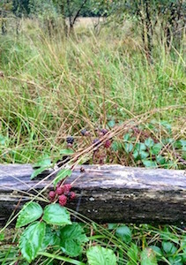
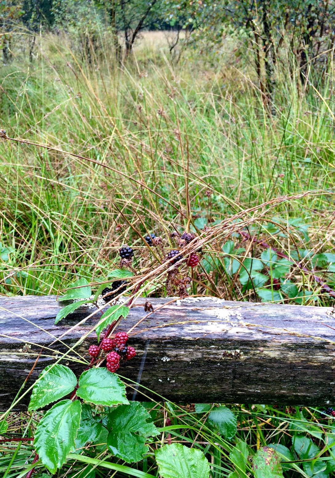
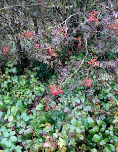
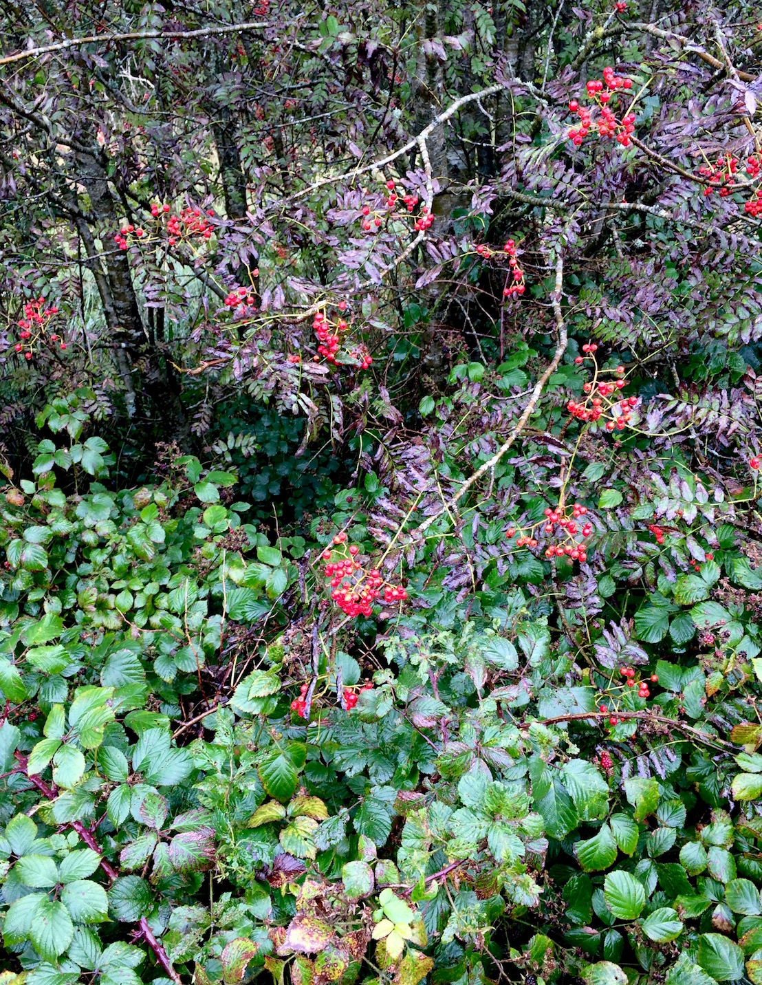
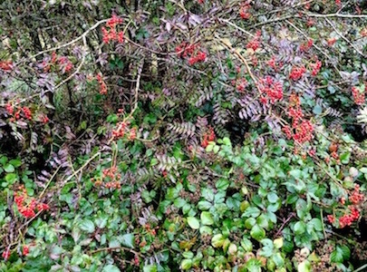
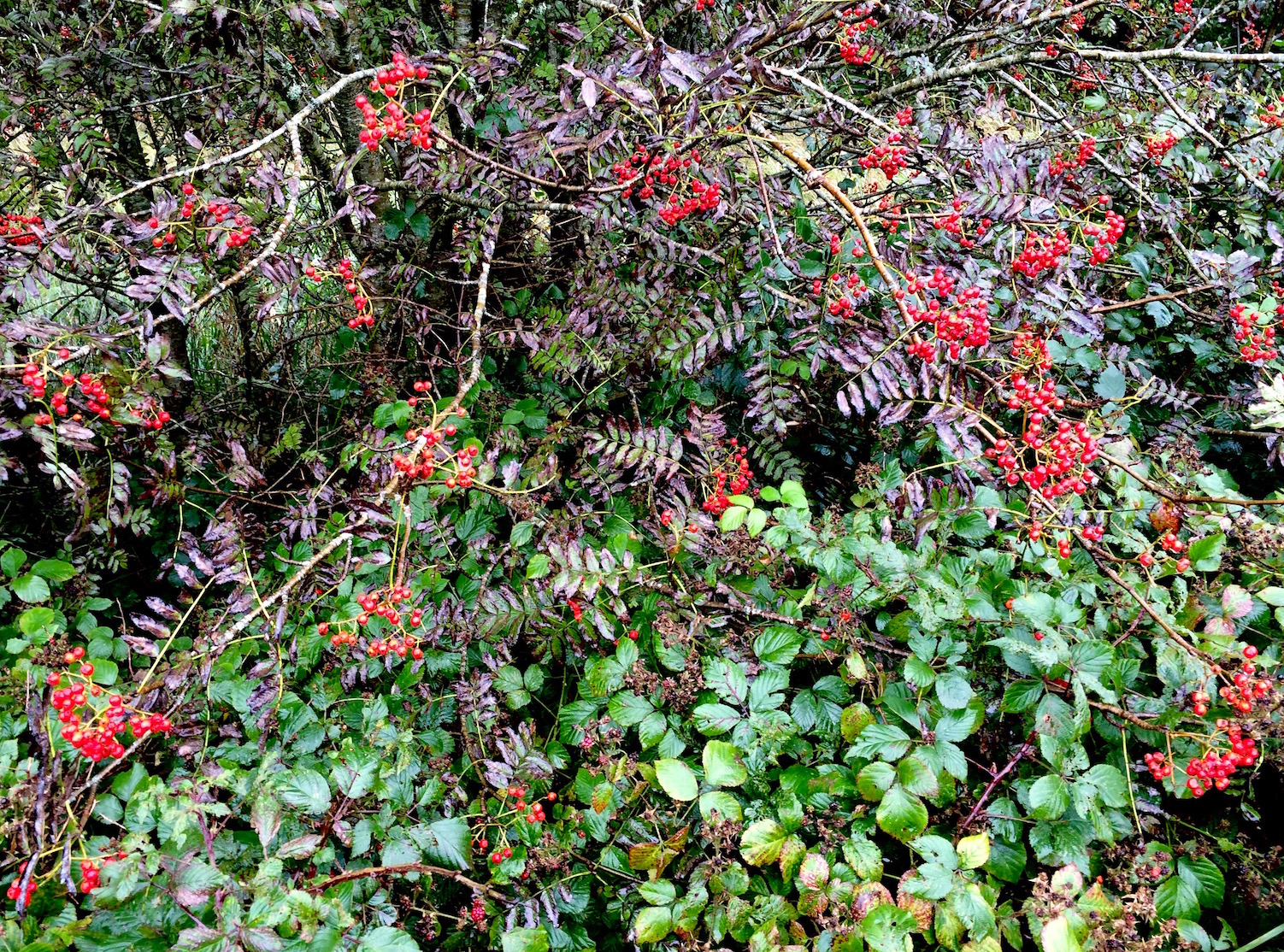
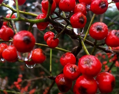
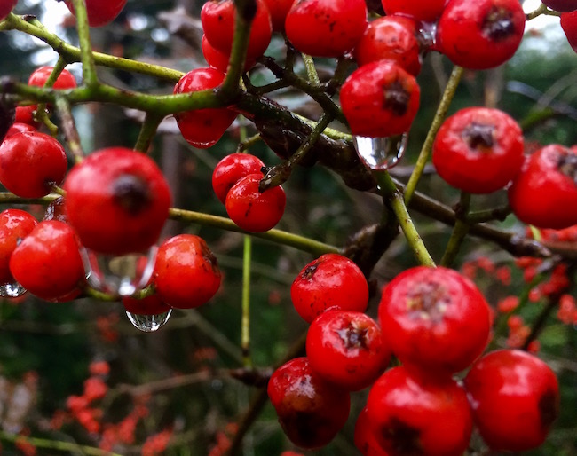
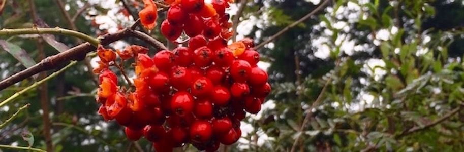
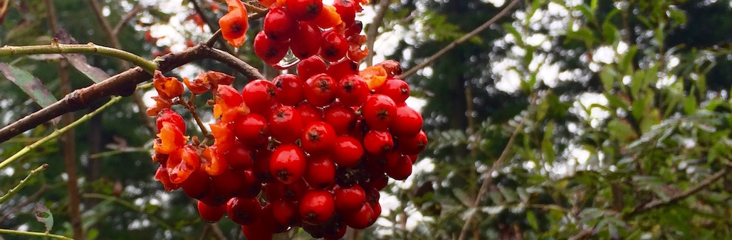
Photogenic berries
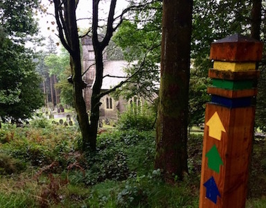
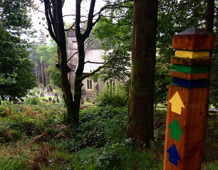
The rain had eased up - slightly - since I'd left Cors Caron, but I'd taken some wrong turns on the winding backroads to get to Hafod, so I didn't have much time left for a walk. Skimming the handy and informative sign at the Hafod Church trail head, I decided I'd learn more about one of Wales' best examples of the 18th century Picturesque movement when I came back later in the week.
For today, I decided to blindly take the yellow Bedford Monument Trail because at only one mile long it was the shortest trail - and it didn't descend all the way into the valley floor. Although there were one pound trail maps available, I decided to set out without one, since it looked like there were signposts.
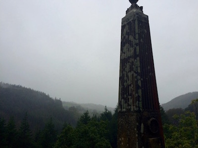
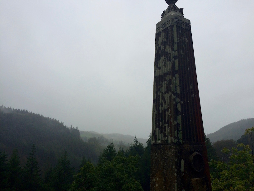
Berries and Benches and Obelisks oh my!
So this feels kinda graveyard-y
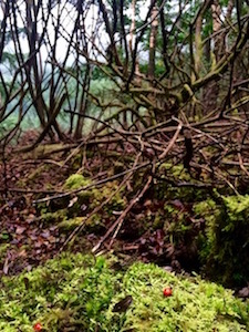
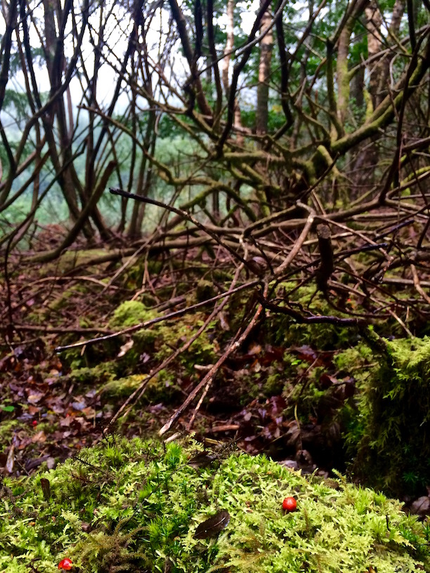
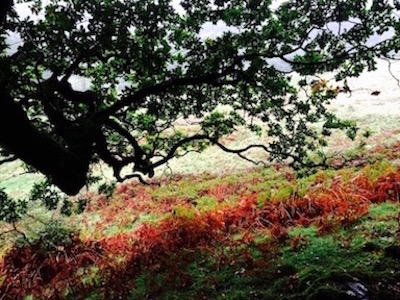
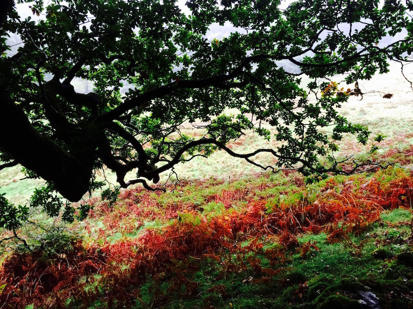
So inevitably, after about 5 minutes of walking high up along a forest valley of lovely green grass set against bright red fall ferns and giant bushes full of red berries, I got lost. Not lost like I'd never be able to find my way out - I'd only gone a few minutes past the parking lot. But lost like I found myself sitting on a white wrought iron bench in a walled garden on a hill because I couldn't figure out where I was supposed to go next.
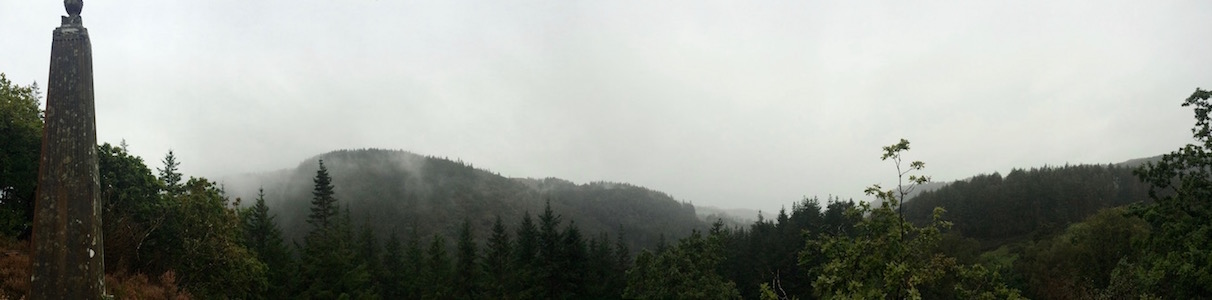
Eventually I found a small gate that wasn't obvious, and followed a few unmarked paths until I again found a yellow arrow down steep slopes, and I eventually hit the Bedford monument that the trail is named for. The monument itself is an obelisk of purplish stone, dedicated to the Late Duke of Bedford by the estate's 18th century owner, Thomas Johnes.
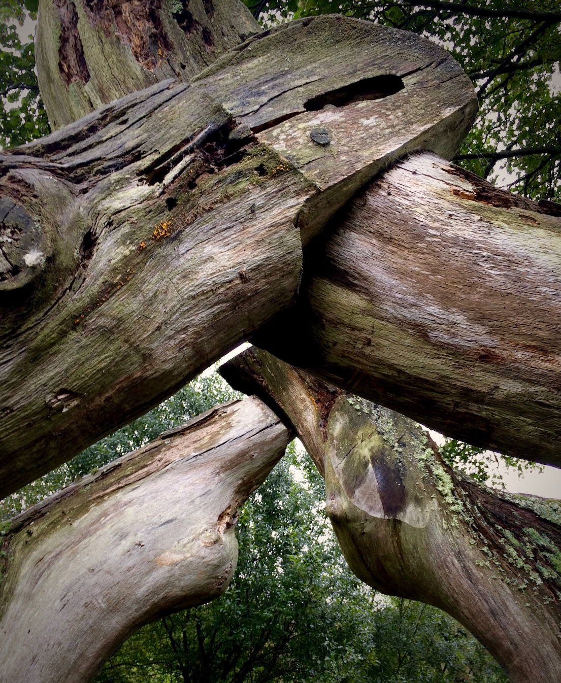
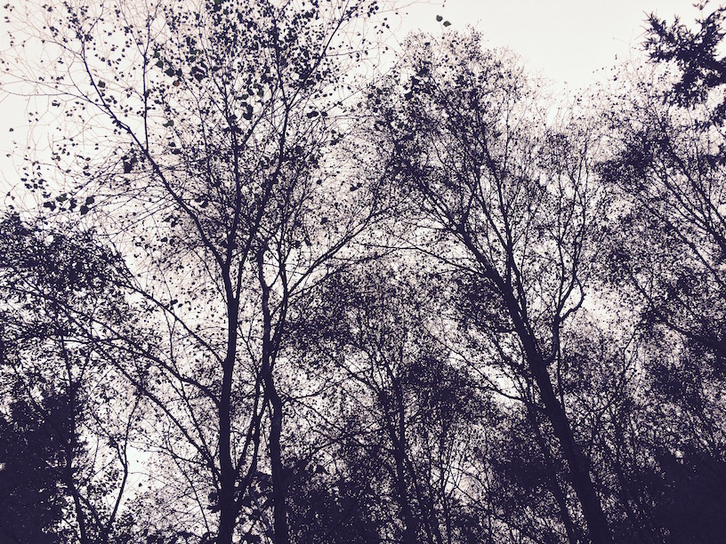
Even these trees are creepily interesting
On a clear day, I think the views from this spot would be lovely. In the cool mist and rain closing in the valley views, it was more eery than anything else. Continuing on the short circular path there were pleasant views of the open field where the estate used to be, and ascending a hill my progress was tracked by many many anxious sheep.
I'll be back
I could see smoke coming out of the chimneys of a small cottage at the bottom of the valley; when I shortly got back to the parking lot I found that this was a historic vacation rental called Hawthorne Cottage. Telling myself that from the small corners I'd seen of Hafod today, I definitely needed to come back later in the week, I hurried back to Aberystwyth to pick up P.
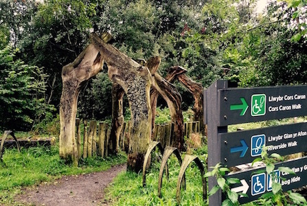
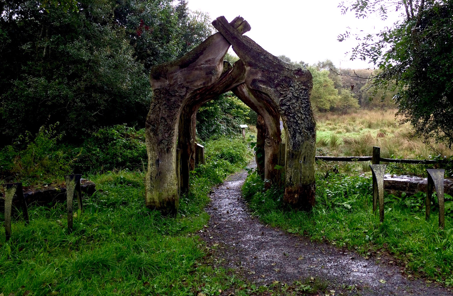
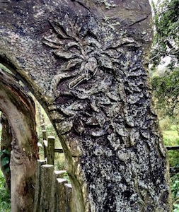
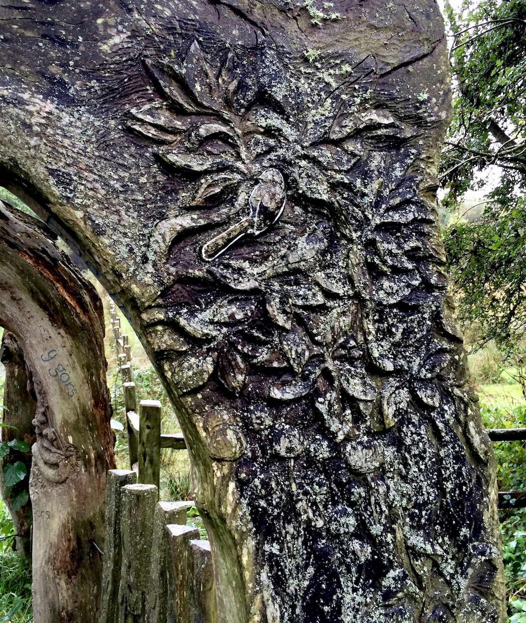
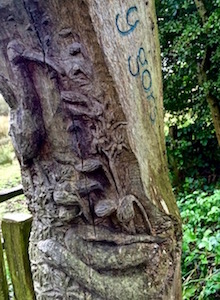
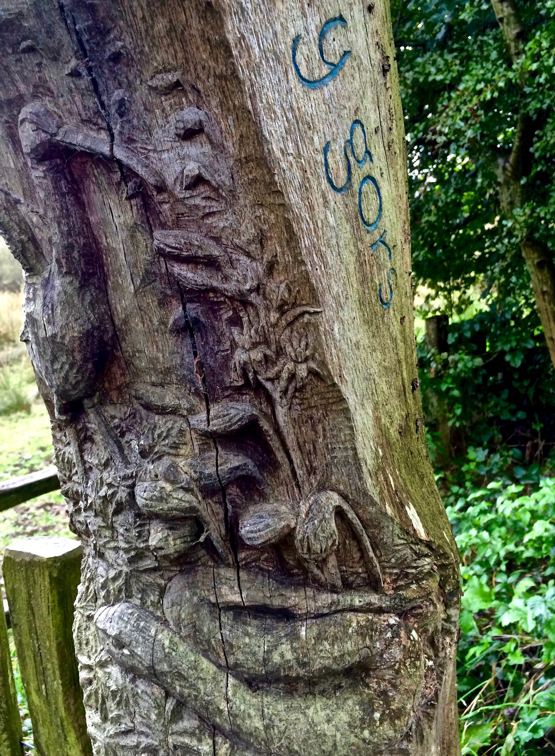
Then, on the road towards Devil's Bridge, I saw a random giant archway, set all by itself on the side of the road. Another thing I'd need to come back for . . .
The first foray into North Wales - beautiful and easy
September 23, 2016
So mid-Wales is truly lovely - but today we found north Wales . . . And I have to admit even the more accessible and less dramatic southern parts of the region are really spectacular.
In searching for a place to live P randomly found a rental property in Aberdyfi, a British beach town in the southern part of the northern Gwynedd region. We decided on a whim to visit because we couldn't see the harm - even though it would be a 45 minute train ride to Aberystwyth . . . Because if we're being honest, that was half my commute to work in DC - and I lived only a few miles from work.
An easy walk with great views
And we fell in love with Aberdyfi. But more on that later.
Let's go see what's up there
After seeing the converted fisherman's cottage in the morning, we realized we were an hour and a half from our Airbnb in the southern part of mid-Wales, and it would be stupid to drive back after only spending 20 minutes in Gwynedd. So I looked at the map, found the nearest castle - Castell y Bere - smack dab in the middle of the peninsula Aberdyfi sits on, and off we went.
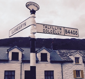
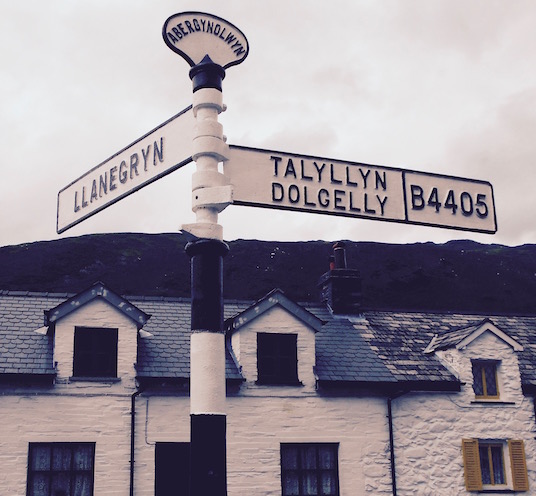
Past the windswept Irish Sea-side Aberdyfi golf course, past the miles of dunes, through the seaside town of Tywyn, onto the tiny B4405 and past miles and miles of hedgerows, we eventually found Abergynolwyn and the signpost for the left turn to Llanegryn. Then over the bridge and through the woods, on an even tinier one lane road, a right at the crossroads, and you're there, the small parking area for Castell y Bere.
I really didn't think this through
It was at this point that I suddenly realized that having come north to look at a rental (and wanting to look respectable), I actually wasn't dressed at all properly for hiking to a castle. Sadly once again confirming to myself that this would forever be my M.O. and I should just get on with it, and remembering that time many years ago when I found myself having hiked to the top of the hill overlooking Edinburgh in a red zebra striped pencil skirt, flip flops and a tight t-shirt that said 'Liar' on it, I sighed and looked down at my skinny jeans and ballet flats, and figured it wouldn't be all that terrible.
So this is north Wales . . .
Surprisingly enough given how these things normally go for me - it ended up being not bad at all. Although I wouldn't recommend walking to the castle in shoes you can feel every tiny stone on the trail through (and there are many), the other couple I saw putting on leather hiking boots were well and truly overdoing it.
Though I didn't realize I was walking to Peru
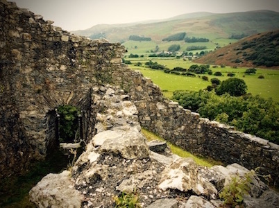
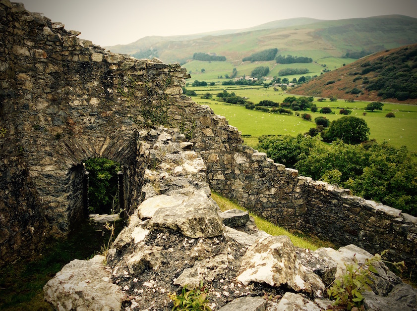
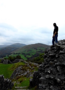
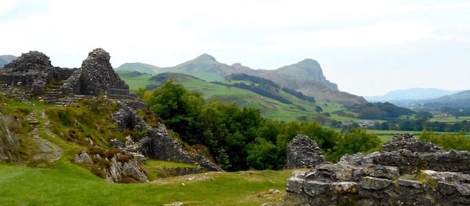
Basically, the castle isn't very far from the parking spots - less than a 20 minute walk through some woods with pleasant views of hills and fields, up gentle slopes. When we got there and started exploring the castle's remains, I agreed with the interpretive sign at the trailhead that said that the castle is today as remote as it was when Llywelyn ab Iorwerth (Llywelyn the Great) first built it in the 13th century. It was still the Dysynni Valley and hills and fields and Cadair Idris all around.
I never thought I would say 'Wales looks like Peru'
either
Sitting on the southern end of his northern kingdom, Llywelyn had seized the land from his illegitimate son Gruffudd, and built the castle both to protect his southern border, and to protect his cattle - as apparently cattle grazing areas were few and far between in mountainous north Wales.
And in building on this site, I swear to you, from a certain angle it looks like he built a much more low lying Macchu Picchu. While I've admittedly never been to Macchu Picchu, since so many Americans now have the same ubiquitous photo on their dating profiles, I'm now starting to question whether they went all the way to Peru or just took the easy trek to Wales and brought their own alpaca.
A stunningly situated ruin - close to a lovely Inn to boot
Anyway, back in Wales, Castell-y-Bere was besieged and captured in 1283. Though Edward I initially tried to rebuild and re-fortify the castle, by the 14th century it had been burnt during a further Welsh uprising, and, due to its remoteness, was never restored. It sat crumbling into the beautifully-situated ruin it now is for 700 years. Even for those of us who arrive in ballet flats, there are many stairways, towers, walls, windows, and nooks and crannies left to explore.
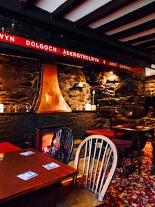
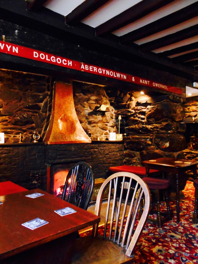
Cozy? Check. Fireplace? Check.
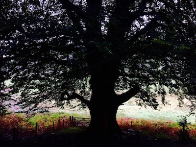
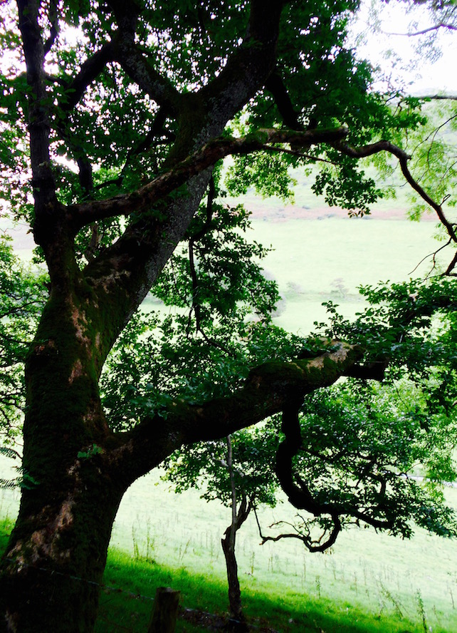
I imagine in better summer weather it would be a stunning place for a picnic. As it was not that time of year, we decided to walk back out through the gnarled oak canopy and head to the nearest pub.
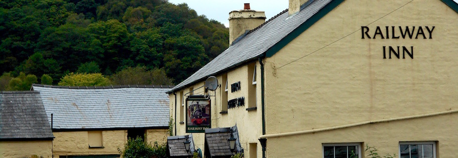
As it turns out, the nearest pub was 'testing it's fireplace for the season' and so we were treated to a roaring fire in the railway-themed Railroad Inn, despite it not actually being cold out. I can honestly say there is nothing that makes me happier than having a pint while sitting in front of a fire in a stove with beaten copper accents set into a larger stone fireplace, that clearly used to be big enough to cook a whole cow in, in a maroon-plush cozy pub dining room with painted exposed wooden beam ceilings. Even if it was 2 million degrees, it was worth it.
After a nice chat with the friendly barman about 'the season' - only 7 weeks in the summer apparently - we ate our sandwiches chatting about how places like this were always actually better outside the prime tourist season when no one else is around - and how we needed to come back in the dead of winter when it would be absolutely marvelous.