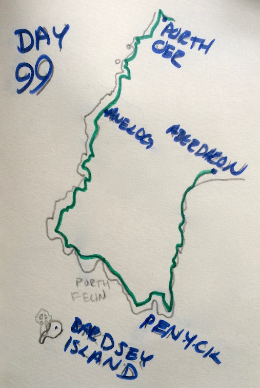

Day 99
Porthor to Aberdaron: 10 miles
Best Place I've Still Never Been To: Bardsey Island
Reason: If there are really 20,000 saints buried there, there's probably something to it.

So, I've actually sat out the last two days here on Llŷn - because, as the kind people on the bus after my last walk had warned me, the weather was absolutely godawful. I'd thought if it was just going to rain a bit, I'd still go out - but this wasn't rain so much as it was a monsoon.
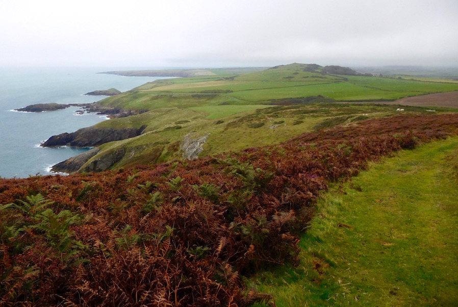
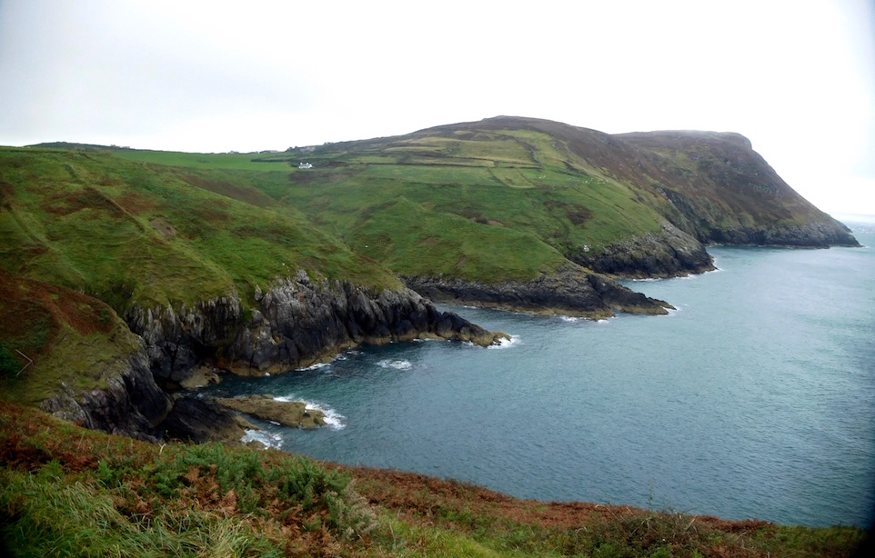
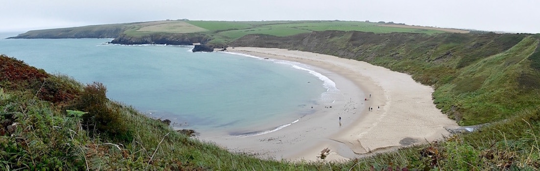
But this particular walk is the absolute end of the Llŷn peninsula - which some people like to refer to as the end of Wales, or even better yet, the end of the world (there's actually a music festival that just happened here at the end of the summer that's called just that). It's not just supposed to be scenic, with potential views all the way from Bardsey to Pembrokeshire, but also remote, exposed to the elements, and at times a bit harrowing.

Thinking I'd prefer not to be involved in any of those things when the weather was particularly horrible, I tried to wait it out.
The Flaw in My Logic
Of course, the flaw in the logic of waiting for decent weather is that I was making the assumption that good weather would be happening anytime soon. Frankly, although the weather for the last 99 (99!!!) days has often bit wet, it's usually been either scattered showers that clear up for brief spells during the day, or total washout days usually followed by semi-ok days.

As I mentioned a few days ago, this didn't seem to be the case by the time I got to Llŷn. First it got really, really cold - in particular at night. And then the grey, overcast rainy weather seemed to just settle in. After the monsoon of two days ago, I saw that it was supposed to rain again yesterday, so decided to see if it would be terrible or something I could deal with. It ended up being something I didn't want to deal with.
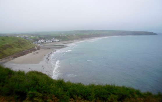
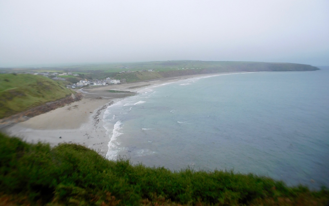
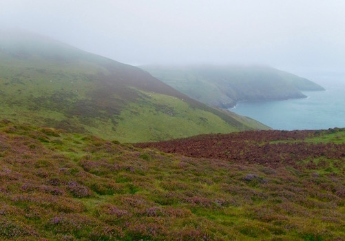
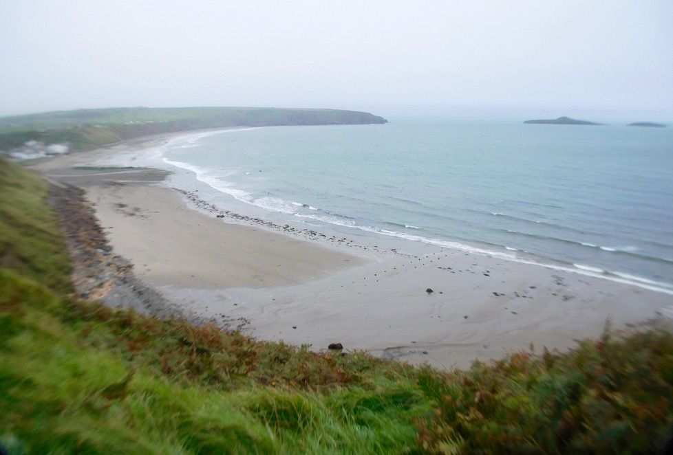
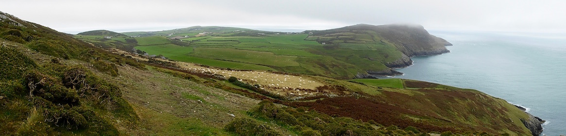
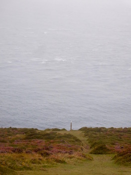
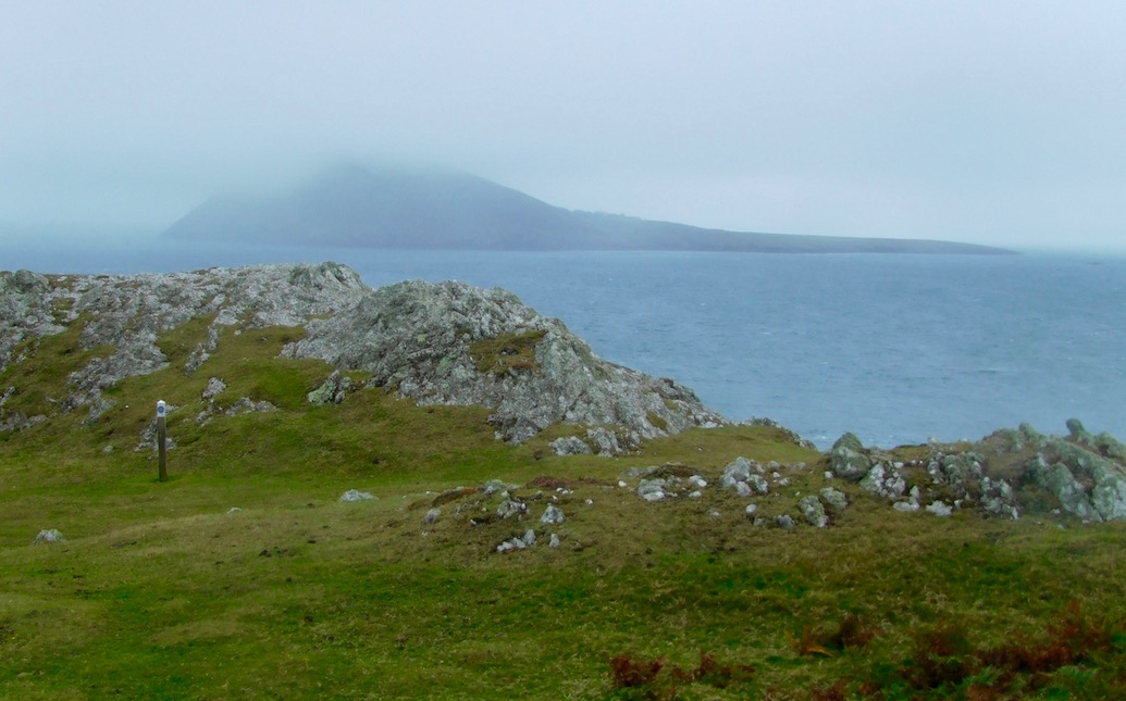
So today, when the forecast was for it to be a full day of low-lying sea fog but not terrifyingly windy and only off and on showers - I decided that really I couldn't delay any longer and should probably get moving. As you might notice from my pictures - it was not actually a great day, in any sense of the word. But just think then, how absolutely horrible the previous two days must have been, because really it seemed fine, although with annoyingly short views, at the time.

I left today from the so-called Whistling Sands of Porthor, and immediately realized that most of today's walk would remain in my imagination, rather than be recorded for posterity by my camera. And that what was recorded would be weirdly distorted like a funhouse mirror by a three lens camera with lenses that weren't quite matching up correctly.
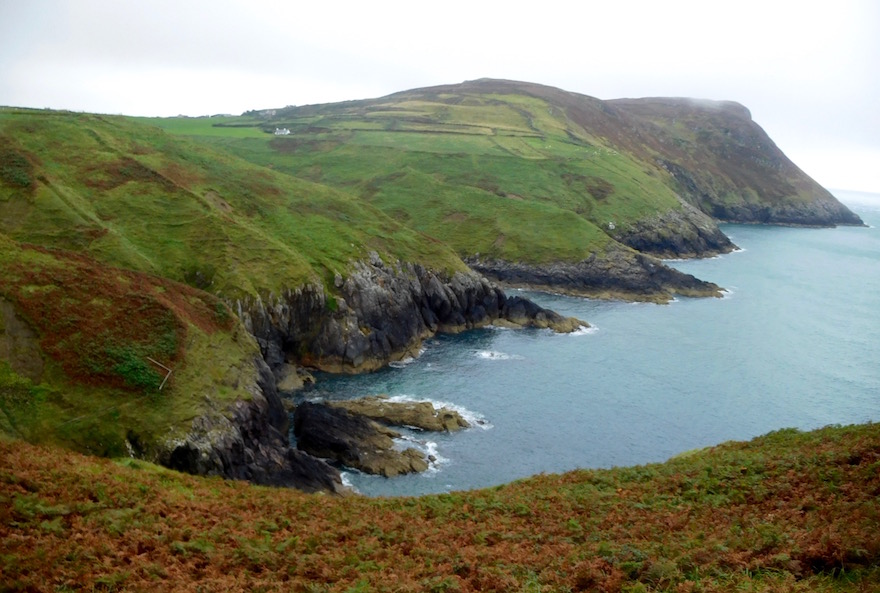
But I very quickly realized that it didn't really matter anyway - because the fog was coming in so thick and strong off the Irish Sea that even with the best camera in the world I wouldn't be getting many pictures anyway. Even so, this was a great walk. It was as challenging as anything I've done on the path - and it actually felt truly remote. In fact, the village of Aberdaron is further away from a train station than anyplace else in Wales or England (it's still closer than most places in the States would be from a rail station, but here they use trains way more).
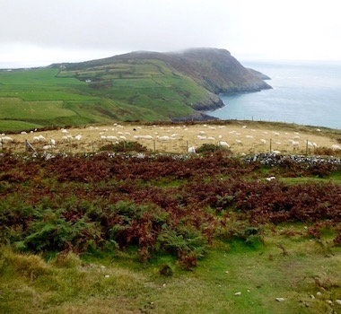

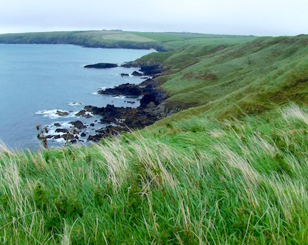
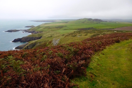
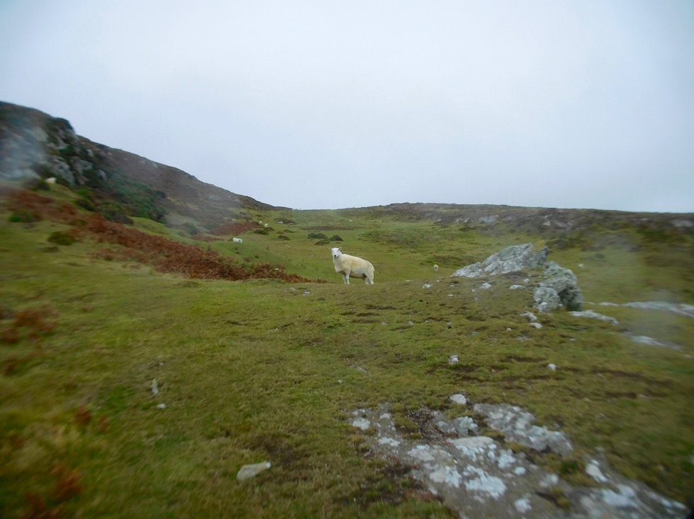
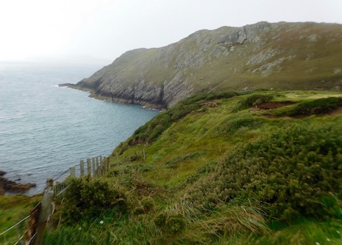
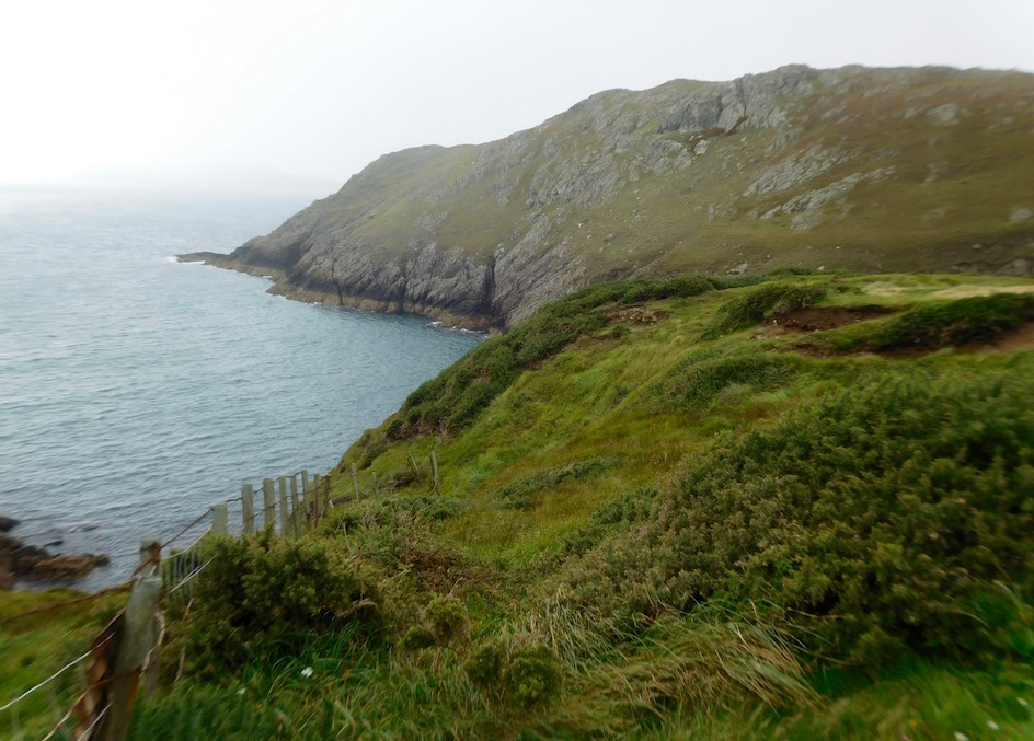
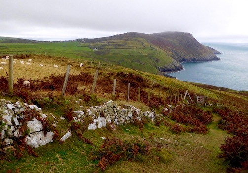
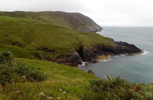
And this walk seemed to go well beyond where roads reached. There were a few spots where you could see a farm nearby, but largely it was up and down cliff or mountain paths covered in gorse and heather, with a sea view far, far below not really giving a sense of direction both because the fog was closing in, and because this walk started out going south west only to U-turn all the way around the end of the peninsula, ultimately ending by going northeast toward Aberdaron.
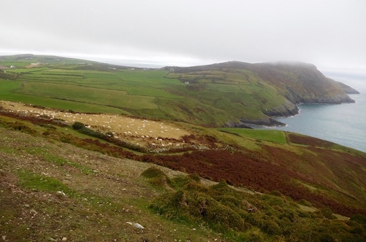
After I got over the final hill on the south west ascent, I passed a small coast watch station that used to be a military installation during WWII. I looked at my map, and it seemed to want me to go at an angle downhill, but I couldn't figure out what way I was facing (despite having a compass and a GPS - I sort of learned my lesson) I couldn't figure it out.
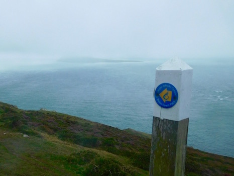
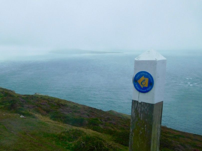
Luckily, the trail was very well signposted here - I could clearly see the next signpost indicating the Wales Coast Path/Llyn Coast Path sign. But the reason I was dithering was that the signpost looked like it was pointing off a cliff. But after I couldn't figure out what I should be doing, I walked up to it anyway, figuring I didn't actually have to follow it off the cliff if I didn't want to.

By the time I got to the marker, I could tell it wasn't a cliff beyond, but just a steeper path. But then the next marker came into view, and it also looked like it was pointing off into an abyss. Now, maybe you'd just keep going without thinking about it. But I've been in this place before, and it didn't end well. In fact, it ended with me lost and walking several miles through Spanish wilderness in a shirt and my underpants, having recently watched most of my hiking trousers float silently into a thousand foot abyss shortly after they'd been torn off my body following my slipping on a too-steep trail and sliding down on my butt across a rock face. Luckily for all concerned, I'd been wearing exceedingly large underpants at the time.
But here, unlike in Spain, I realized what would happen if I just happily traipsed along - like the frog about to be boiled not realizing the water's getting hotter and hotter, I probably wouldn't realize how steep the trail was getting until it was so steep I'd then be liable to do something really stupid. And here from what I could see there wasn't a tree for me to grab onto, again, unlike Spain - slipping would mean smashing on rocks or first into a foaming sea and then being smashed on rocks. Now, some people might think the solution was to find an alternate way or go back. The latter wasn't an option since I needed to keep going, and the former would just get me lost and in potentially even a worse situation.
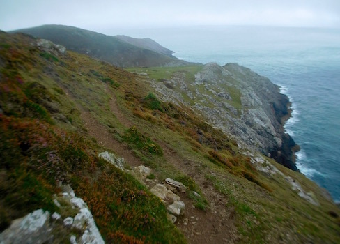
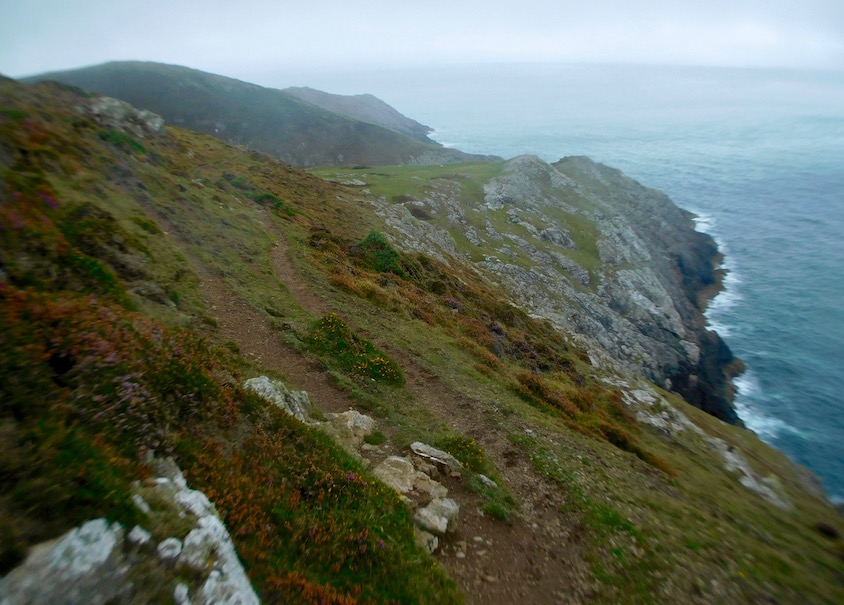
Instead, I decided to just go Ravenous Bug Blatter Beast of Traal on this situation. No, I didn't blindfold myself. But I did consciously decide that if I didn't look all the way down, then all the way down wasn't there. More specifically, if all I did was look very narrowly only at where I was putting my foot down at any given time, and very carefully focused mostly to the left of my foot (as opposed to the nothingness that existed if I shifted my gaze just a few inches to the right), my legs wouldn't turn to jelly because really all I was doing was walking on a perfectly flat sheep trail. I wouldn't look at any pretty views, I wouldn't try to take out my map, and I most definitely wouldn't try to take any pictures.
So that's what I did. And that's how I tricked a jumpy nervous system into just letting us all get around this really steep headland without triggering any vertigo-response nonsense. Do I have any idea what happened? Not really. Were the views nice? Well, my feet looked ok, and the trail was brown and the grass was green. How long did I do this? Absolutely no idea, as I don't keep a watch on my feet.
At Least I Saw Bardsey - Sort Of
But when I finally got off the first part of the sheer part of the trail (there was a second part that skirted another sheer cliff face where I had to do the same thing) I was quite proud of myself. I also questioned whether this was part of the pilgrim trail to Bardsey - because if it was then I now totally understand how those 20,000 people earned their sainthood.
For those who have no idea what I'm talking about - let me explain. When I was blogging about St. Beuno's church a few days ago, I mentioned the information panels describing the pilgrimage that went through there. Like St. David's Bardsey was considered a site holy enough that several pilgrimages (in this case three) were the equivalent of one to Rome.
That's because Bardsey is considered one of the greatest holy sites of the Celtic world. When the Roman Empire collapsed and lawlessness ruled, Christians found safety on the island - I imagine that protected as it was by multiple dangerous sea currents (the Welsh name 'Ynys Enlli' actually means 'island of currents' - and I can attest that just looking at it from the hills I was on, the currents are shockingly obvious), if you made it out there it would be as good a place as any to hide. Eventually St. Cadfan built a monastery here in 516AD, which remained for centuries as one of the last centers of Celtic Christianity in Britain.
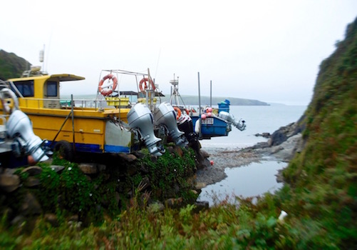
Anyway, thousands upon thousands of early Christians made their way to Bardsey, with churches and places of refuge popping up all along the trail so pilgrims could pray for safe passage across the channel and shelter for the wait - even now Bardsey is still inaccessible for weeks at a time because of the currents (for example, I would have gone out in the last two days, but there was no safe way to get there - when I walked past the cute launching point near Aberdaron later, all the boats were still grounded). Because of the holiness of the island, many Christians actually came here to die so they could be buried on the island. That's why it's called the 'island of 20,000 saints' - as tradition holds that's the number buried here.

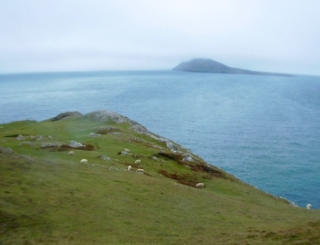
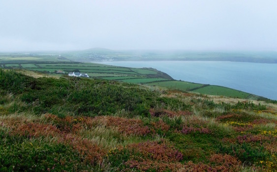
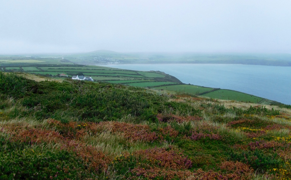
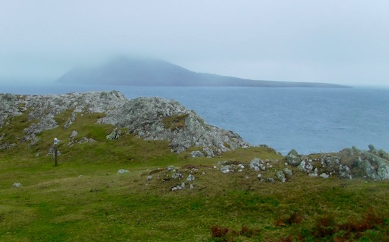
As I was saying though - I'm not sure the pilgrimage trail exactly went through where I'm going or if it just went straight across the point of the peninsula directly to Aberdaron, which was the last stop on the mainland before Bardsey on the trail. All I know is that I'd looked forward to seeing the views of Bardsey - as on super clear days I was able to see it from on Cardigan Bay. . .
And unfortunately, because of the particular positioning of the fog (in that today it had cut off the top half of the giant hillside that sits on one side of Bardsey) the thing that came unbidden to my mind wasn't anything particularly religious. Rather it was that from a distance, Bardsey looked exactly like the island that they found King Kong on in old black and white movies. It was probably called Kong Island. Or Skull Island. Or something equally ridiculous. While I suppose it didn't help that the fog also washed out all the color, so I felt like I was in a black and white movie myself, I really do wish I'd been able to be swept away by the beauty that I'd seen in so many pictures, rather than giggling to myself on a hillside like an idiot.

Anyway, before I totally leave the topic of Bardsey (and since I didn't get to actually go there, there's not going to be another time to talk about it), you should also probably also know these incongruous fun facts. First, Bardsey is home to the world's rarest apple - the aptly named Bardsey Island Apple that comes from a tree unique to the island (though now you can apparently buy seedlings). Second, that Bardsey had (has? I'm not entirely sure, if someone wants to better explain this to me, that would be great) a king. As part of the Newborough Estate in the 19th century, the island was home to a small number of crofting families and fisherman. Since the island could be cut off from the mainland for weeks at a time, the estate holder appointed a king to be in charge. The office came with a crown and everything - though his son didn't want the title and so eventually they started to elect a President. Third, that they used to make beer so strong that the bottles would explode. Or at least that's what Cwrw Llŷn Brewery said about it's Brenin Enlli Legendary Bitter Ale - named, by the way, after the king of Bardsey.
And Finally, on to Aberdaron
Well, regardless of these fun facts, I didn't actually go to Bardsey Island - I just saw it, kind of, from a hillside that I'd reached by pretending Matrix-like that there was no hillside. To be fair though, my GPS seemed to feel the same way, given that when I tried to turn it on to figure out exactly where it was it showed me as being in a vague spot in the Irish Sea.
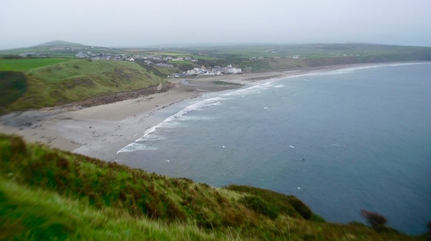
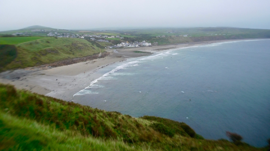
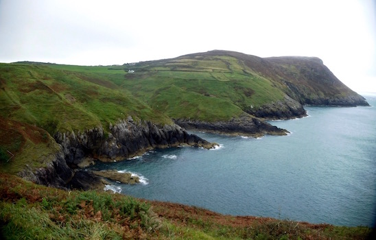
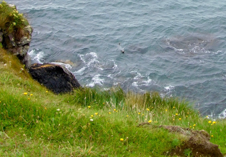
I had to skirt another fairly precipitous headland to get away back around the headland. After pretending this wasn't there as I walked across it, I found a small cove where I looked down, only to spot a seal staring right back up at me. I seriously think he was looking right at me. After a minute of our staring contest he was gone, and then so was I. Eventually the trail went up to a headland that should have had even better views all the way from Aberdaron down the sweep of Cardigan Bay. As it was, I could sort of see Aberdaron a bit.
I hurried along the rest of the way until I got to the end of the day in Aberdaron - replete with its ancient pilgrim wayside inn, its thatch roofed bakery and its surprisingly amazing National Trust spot (with free wifi, nonetheless).
But I'll take that up with tomorrow's walk - as clearly I've spent far too long here describing places I've still never been. . .